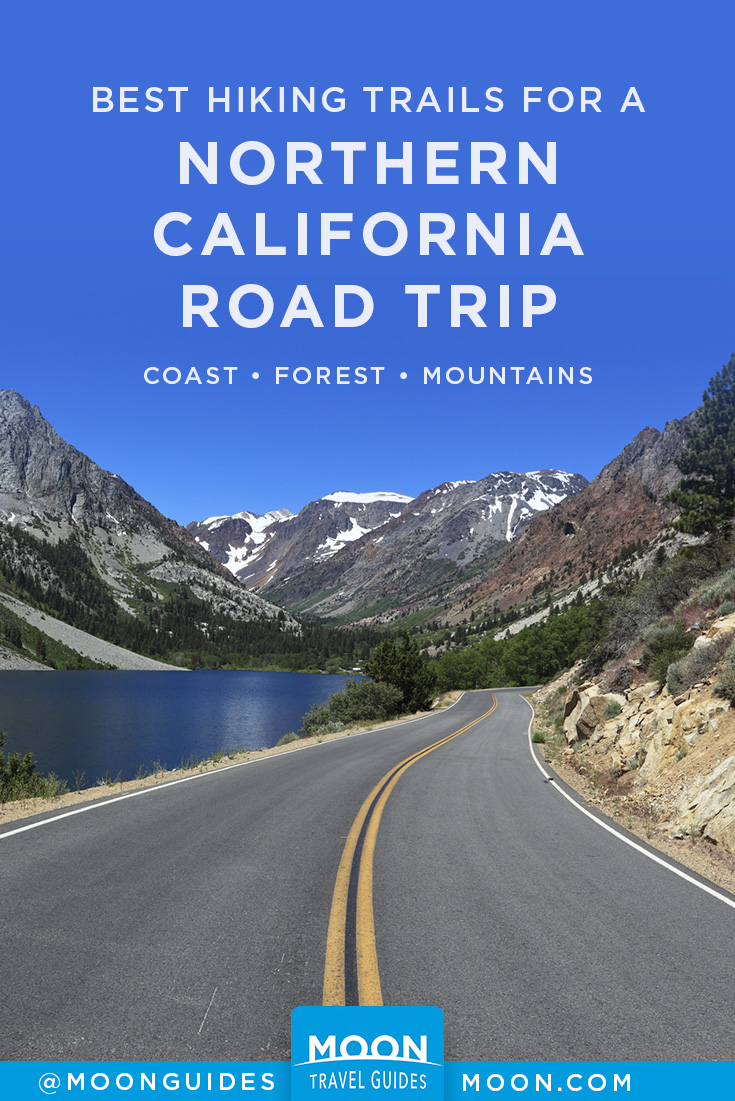
Best Hiking Trails for a Northern California Road Trip
In Northern California, humankind takes a backseat to nature. This is a region dominated by skyscraping redwood trees, forest-cloaked mountains, driftwood-decorated beaches, snow-frosted peaks, naturally occurring hot springs, and lakes as blue as the sky above. Here, adjectives like “largest,” “biggest,” “deepest,” “tallest,” and “highest” frequently precede beaches and bays and falls and forests. This is California at its wildest, its most elemental, its purest. Explore it one hike at a time with these trails that are perfect for road tripping.
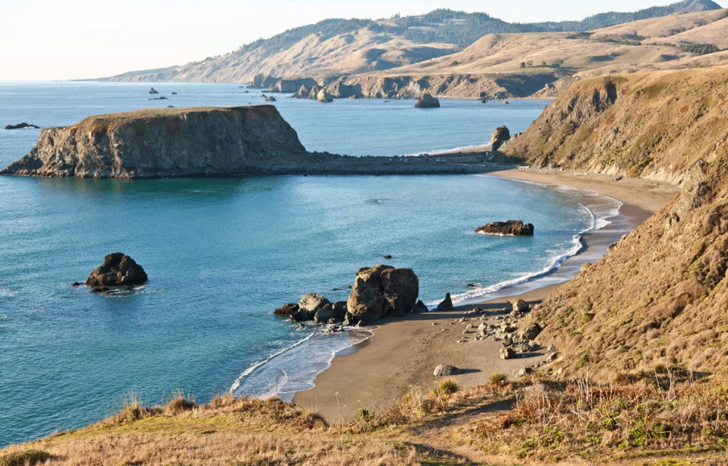
Kortum Trail, Sonoma Coast State Park
3.5 mi/5.6 km one-way, 1.5 hours, easy
The best way to experience the Sonoma coastline is with a walk along the Kortum Trail. The hike atop coastal bluffs parallels the crashing Pacific, with several side paths down to the striking beaches and coves. The path is alternately compacted soil, a raised boardwalk over a marshy section, and a footpath, all allowing for an easy stroll. Pick up the trail from the parking lots at Wright’s Beach, Shell Beach, and Goat Rock.
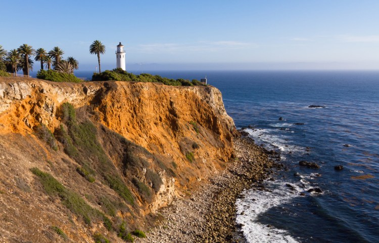
Point Arena Lighthouse, California Coastal National Monument
3.5 miles/5.6 km
The 1,655-acre Point Arena-Stornetta Unit of the California Coastal National Monument (Point Arena Cove north to Manchester State Park, sunrise-sunset daily) is like a greatest-hits compilation of the California coast: vertigo-inducing cliffs, far-ranging ocean views, sea arches, rocky points, and tidepools.
This hike begins with views of Point Arena Cove from the bluffs above and levels out to a walk by the sea with views of sea arches. The area can be explored by miles of trails including the superb hike that starts from behind the Point Arena City Hall and continues 3.5 miles (5.6 km) to Lighthouse Road. Walk another 0.5 mile on the road to visit the Point Arena Lighthouse. Parking is available at Point Arena City Hall and at the pullouts along Lighthouse Road. For a trail map, visit www.mendocinolandtrust.org.
Fern Canyon Trail, Prairie Creek Redwoods State Park
1 mile/1.6 km round-trip, easy
Perhaps the single most famous hiking trail along the redwood coast is the 1-mile (1.6-km) Fern Canyon Trail (Davison Rd.), near Gold Bluffs Beach. The unusual setting was used as a dramatic backdrop in the film The Lost World: Jurassic Park. This hike runs through a narrow canyon carved by Home Creek. Five-fingered ferns, sword ferns, and delicate lady ferns cascade down the steep canyon walls. Droplets from seeping water sources keep the plants alive.
You can extend this hike into a longer loop (6.5 mi/10.5 km round-trip, 3 hours, moderate): When the trail intersects with James Irvine Trail, bear right and follow that spur. Bear right again onto Clintonia Trail and walk to Miners Ridge Trail. Bear right onto Miners Ridge and follow it down to the ocean. Walk 1.5 miles (2.4 km) along Gold Bluffs Beach to complete the loop.
To get to the trailhead, take US-101 for 3 miles (4.8 km) north of the town of Orick. At the Prairie Creek visitors center, turn west onto Davison Road (no trailers allowed) and travel 2 miles (3.2 km). This rough dirt road takes you through the campground and ends at the trailhead in 1.5 miles (2.4 km).
Mill Creek Trail, Jedediah Smith Redwoods State Park
7.5 mi/12.1 km round-trip, 5.5 hours, difficult
This hike passes by ferns, maples, pines, and, most importantly, some of the biggest coast redwoods in the world. (Just off the trail is the Grove of the Titans, said to be the home of the world’s largest coast redwood.) Start at the Summer Footbridge (seasonal) and follow the creek down to the unpaved Howland Hill Road. There’s also a pristine swimming hole with a rope swing near the southeast end of the trail.
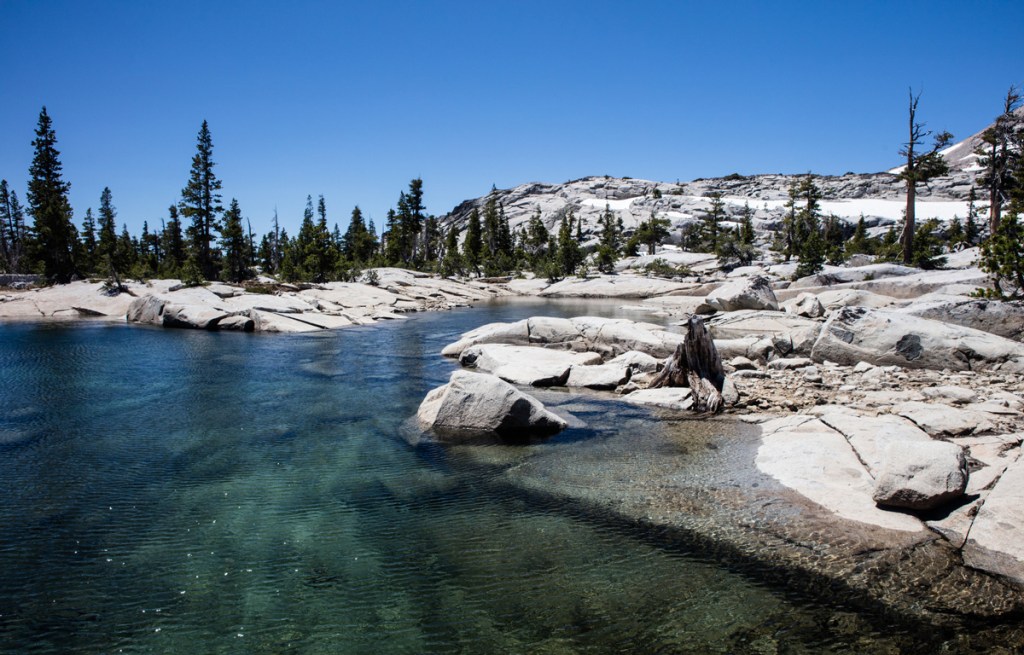
Lake Aloha, Desolation Wilderness
5-12.5 mi/8-20 km round-trip, 8 hours, moderately strenuous
Locals like to say that visiting Lake Aloha, located in the Desolation Wilderness at 8,116 feet (2,474 m) in the Sierra Nevada, is like being on the surface of the moon. Blue waters, granite rock, and petrified trees define this area, with occasional snow in the surrounding mountains.
From the trailhead at Lower Echo Lake (Johnson Pass Rd.), the Echo Lakes Trail hugs the water as you trek past granite rock while slowly gaining elevation, passing a few homes toward Upper Echo Lake. The hike from Lower Echo Lake to Upper Echo Lake is 2.4 miles (3.9 km), but you can shave off this leg of the journey by taking the boat taxi across Lower Echo Lake.
A boat taxi (8:30am-5pm on demand in summer, $14 one-way) drops hikers off at Upper Echo Lake, where the trail continues 1.1 miles, heading west into the backcountry to Tamarack, Lucille, and Margery Lakes. In about a mile, the trail splits; go left to follow the northern shore of Lake in the Woods; stay right to head straight to Lake Aloha.
Lake Aloha is a serene, deep-blue swimming hole dotted with granite. There are some places to enjoy lunch or sunbathe on the rocks. In summer, it’s common to see PCT hikers on the trail or stopping for the night along the shoreline. Bring bug spray, as the mosquitoes tend to come out around sunset as you head back the way you came.
Sacramento River Trail, Redding
11-18 miles/18-29 km, easy
Across the Sacramento River from the Turtle Bay Exploration Park, the Sacramento River Trail (844 Sundial Bridge Dr.) spans 11-18 miles (18-29 km) from the Sundial Bridge to Shasta Dam. To start, head north across the Sundial Bridge, then turn left to walk through the McConnell Arboretum & Gardens (840 Sundial Bridge Dr., 9am-5pm daily, free). This garden is lovely in spring when brightly colored irises and clusters of daisies are in full bloom.
Continue west on the Sacramento River Trail to walk across the concrete Diestelhorst Bridge (2 mi/3.2 km west of the Sundial Bridge). Built in 1914 to permit vehicles to cross the Sacramento River into Redding, this thruway was in use until 1997, when it was replaced by the Lake Redding Bridge. The wide paved Diestelhorst remains open to pedestrians, cyclists, and skateboarders and parallels a patina-covered train track.
Subway Cave, Old Station
0.75 mile, easy
Subway Cave (Hwy. 89, Apr.-Oct., free) is almost 30 miles (48 km) south of Burney Falls. About 30,000 years ago, molten lava spewed forth and rivers of hot liquid covered Hat Creek Valley. As the top layer hardened, the lava continued to flow until it eventually dried up, leaving this wide-open lava tube called Subway Cave.
A short and easy loop hike (0.75 mile) offers a good place to stretch your legs and cool down. This self-guided trail leads to the top of the tube. Then hike down into the dark 1,300-foot abyss using a headlamp or flashlight to navigate cave features with names like Stubtoe Hall, Wind Tunnel, The Sanctum, Lavacircle Lane, and Partial Collapse. It can be a little spooky in the heart of the cave, but there’s only one place to end up—a lighted tunnel at the end.
Lundy Canyon Trail, Hoover Wilderness
8 mi/13 km round-trip, 4-6 hours, moderately strenuous
The out-and-back Lundy Canyon Trail follows the side of Lundy Lake and is beautiful in autumn. The trail gains more than 2,000 feet (600 m) of elevation as it crosses Mill Creek for 1 mile (1.6 km) above Lundy Lake. From the lake, continue 3 miles (4.8 km) along Mill Creek, hiking through brush, granite, and past the waterfall before dropping down into a meadow to reach Oneida Lake (4 mi/6.4 km). Near the end of the trail, look for the remains of the May Lundy Mine; you may also find remnants of railroad ties on the rocky edge.
The trailhead is at the end of Lundy Lake Road. From Bridgeport, drive 18 miles (29 km) south on US-395 and turn right onto Lundy Lake Road. Continue 6.7 miles (10.8 km) to the trailhead at the end of the road.

Ridge Trail and Panorama Trail Loop, Andrew Molera State Park
8 mi/12.9 km round-trip, 5 hours, moderate
Ridge Trail and Panorama Trail Loop is one of the best coastal hikes in Big Sur. Start at the parking lot on the Creamery Meadow Beach Trail, then make a left onto the long and fairly steep Ridge Trail to get a sense of the local ecosystem. Then turn right onto the Panorama Trail, which has sweeping views of the coast, including Molera Point and Point Sur, as it runs down to the coastal scrublands.
Take the small Spring Trail (0.2 mile round-trip, easy) down a driftwood-littered gully to a scenic stretch of beach. Hike back out and take a left connecting to the Bluffs Trail, which takes you back to Creamery Meadow along the top of a marine terrace.
Explore More of California

Pin it for Later