Best Visible Trail Ruts on the Oregon Trail
Historians estimate that about 300 of the original 2,000 miles (480 of 3,200 km) of the Oregon Trail remain untouched. The rest of it has been lost to time or development—in many places, roads and highways were built directly over the popular route, such as Oregon’s stretch of U.S. 26 along the Barlow Road route. However, many ruts—impressions of the wagon wheels that traversed the land two centuries ago—remain intact. In some places these are known as swales, slight sunken depressions that have been overgrown with grass. In most places you can walk or hike along them, but be respectful and never drive on them.
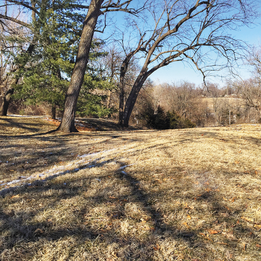
85th and Minor Park/Blue River Crossing, Missouri:
Leaving Independence, travelers can follow a faint and unique route of ruts left in the urban landscape; the best can be found at Minor Park and the small neighborhood corner of 85th and Manchester. At 85th and Manchester, on the corner of a lot, are some of the state’s best ruts, deep and easy to see, dramatically cutting into the ground. The NPS signs direct you here, and a small interpretive panel offers some history on the Oregon, California, and Santa Fe Trails.
Alcove Springs, Kansas:
Springs at this site made a lovely resting spot for pioneers, and short trails take you around them as well as the distinct swales in the grass. Alcove Springs is easily the best Oregon Trail sight in Kansas Well known to Native Americans and then fur trappers of the region, the spring was given its name by Edwin Bryant, a member of the notorious Donner Party; they stopped to rest here in 1846 while waiting to ford the Big Blue River. Party member George McKinstry carved the new name, Alcove Springs, into the rocks, and J. R. Reed carved his signature; these and other carvings can still be seen today.
Newsletter Signup
By clicking ‘Sign Up,’ I acknowledge that I have read and agree to Hachette Book Group’s Privacy Policy and Terms of Use
Ash Hollow, Nebraska:
At the Windlass Hill site, you’ll find a sod house, a giant metal wagon with informational kiosks, and a paved trail that takes you up the hill to see ruts. The 0.5-mile (0.8-km) loop takes 30 minutes to hike and offers excellent views of the hilly terrain that wagons conquered on their way down into the valley—deep ruts and gorges are visible along the trail, and a stone monument at the top marks where the Oregon Trail passes.
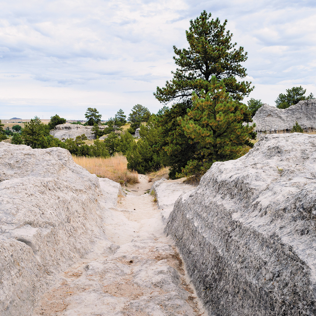
Guernsey Ruts, Wyoming:
The Guernsey Ruts are, hands down, the most striking of the entire trail, the result of thousands of wagons forced to roll through a section of soft sandstone, creating deeper and deeper ruts that are up to four feet deep in places; the sandstone was worn down by earlier wagon parties, and it was too difficult to pull wagon wheels out of the ruts—so emigrants continued following the same grooves. From the parking lot, head up the paved trail to see the ruts; you’ll know them when you see them. The easy, 0.4-mile (0.6-km) loop continues past more ruts and back to the parking lot. The site also offers a picnic shelter, restrooms, and informational kiosks that describe the history of the area.
Emigrant Trail, Idaho:
Perfectly preserved inside the Hagerman Fossil Beds National Monument, this strenuous trail takes 3-4 hours to hike but rewards with close-ups of deep ruts that cut through the grass. Hiking past the empty hills might give you a sense of what the pioneers may have experienced; many emigrants walked alongside their wagons. You can hike in either direction, but if you start from the Snake River Overlook, you’ll gain 900 feet (274 m) in elevation as you scale the big hill to the Oregon Trail Overlook; from the other direction, the elevation gain is 600 feet (183 m).
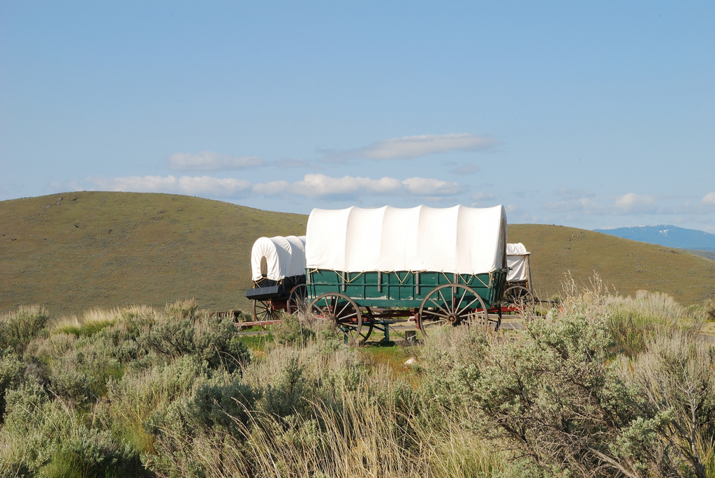
National Historic Oregon Trail Interpretive Center, Oregon:
Just outside Baker City, this museum has a long set of ruts left in the high desert hills. Here, you’ll find 4 miles (6.4 km) of hiking trails to explore the sagebrush landscape and wagon ruts carved into the prairie, as well as remnants of an old gold mine. Hike the 0.75-mile (1.2-km) trail to Panorama Point atop Flagstaff Hill to look over the valley on the same perch where pioneers once stood, taking in views of the imposing Blue Mountains and Wallowa Mountains. Continue on over the hill to access the striking wagon ruts marking the prairie, traveling from east to west.
If you want to see the wagon ruts without visiting the center or going on a hike, pull over on Highway 86 just before the center; you’ll see a historical marker on the side of the highway with a few parking spots. You can walk a short distance to view the deep ruts.

Get the guidebook and plan your adventure!

What to read next…


Pin it for later