Route 66 Painted Desert & Petrified Forest Driving Tour
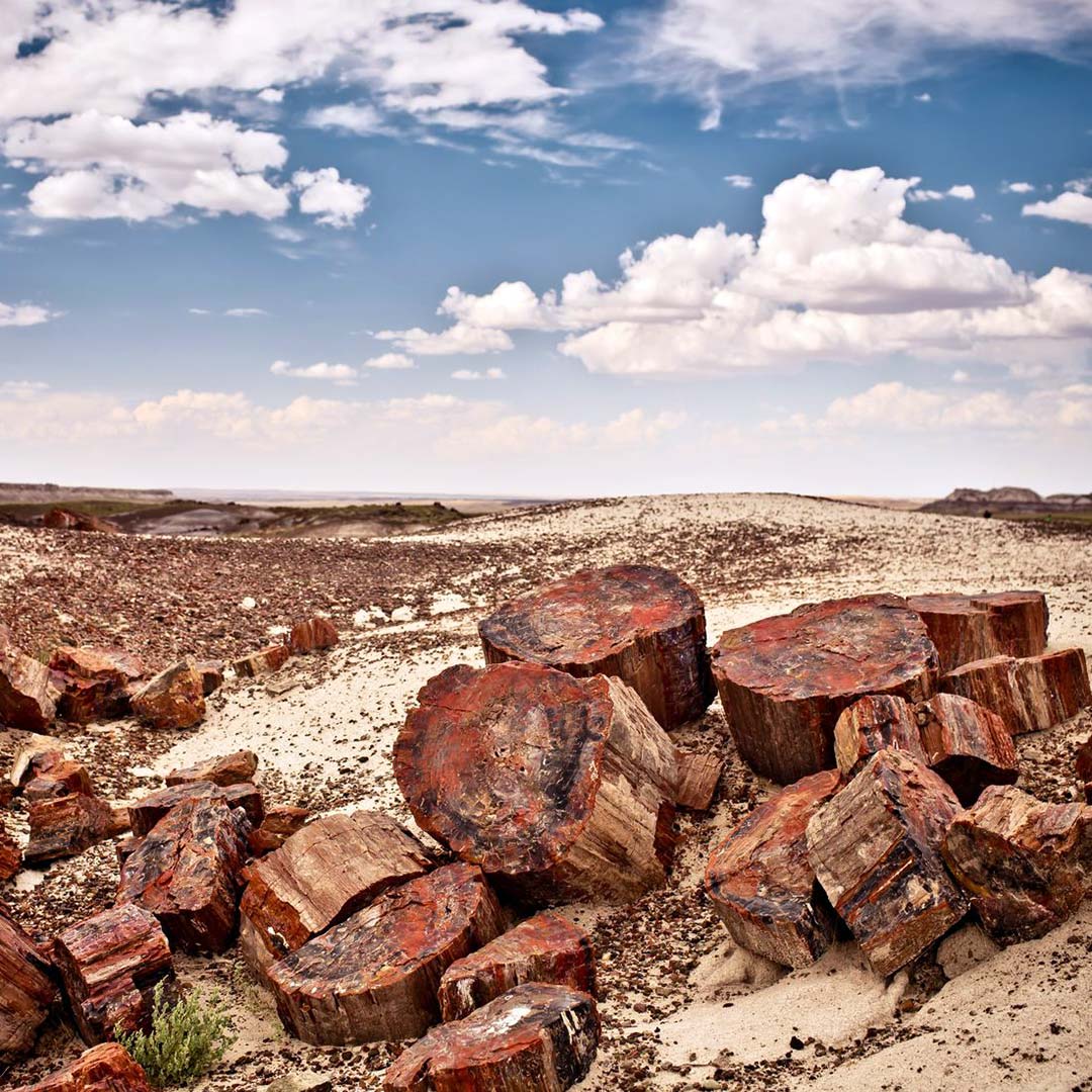
The Painted Desert and Petrified Forest National Park has the world’s largest and most colorful collection of petrified wood. It is also the only national park in the United States that protects a portion of Route 66.
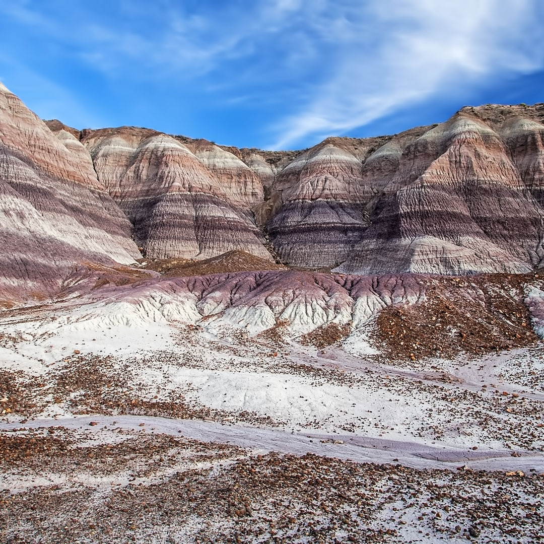
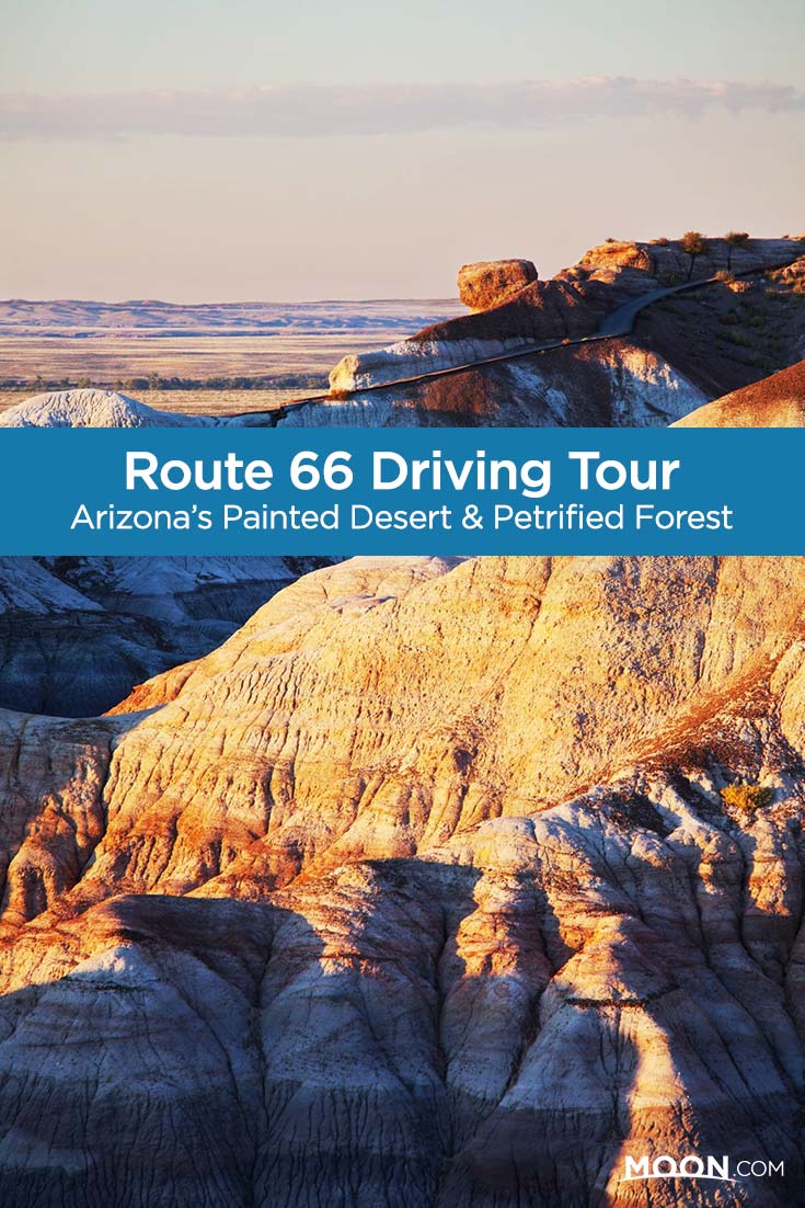
The northern section of the park encompasses the Painted Desert—approximately 146 square miles (378 sq km) of badlands and multihued mesas of stratified layers of mudstone, shale, and siltstone pigmented by iron and magnesium deposits. The southern section of the park contains the Petrified Forest with historic structures, archaeological sites, and fossils that date back more than 200 million years.
It takes at least 45 minutes to drive the 28-mile (45-km) road through the park, but to truly experience it try to allow at least a couple of hours to drive Blue Mesa Road, take a hike, and stop at the spectacular viewpoints along the way. Tiponi, Tawa, and Kachina Points feature overlooks with panoramic views, all located less than 2 miles (3.2 km) north of the Painted Desert Visitor Center. There are no camping facilities or overnight parking allowed in the park.
Driving Tour
Painted Desert Visitor Center
Less than 0.5 mile (0.8 km) from the I-40 exit is the Painted Desert Visitor Center (8am-5pm daily), which houses a bookstore, hands-on petrified wood exhibits, and park information and services. A free film about the park is shown continuously throughout the day. The visitors center is adjacent to a restaurant, gift shop, and gas station; restrooms are available.
Painted Desert Rim Trail
The Painted Desert Rim Trail has remarkable views of the Painted Desert. Approximately 1 mile (1.6 km) after the northern park entrance is the pull-off for Tawa Point, where the Painted Desert Rim Trail begins. The trail travels along the canyon rim and includes several information panels about the wildlife, geology, and ancient people of the region. In 0.5 mile (0.8 km), you’ll reach the Painted Desert Inn and then Kachina Point with its panoramic views of the red, orange, pink, and purple rocks. From Kachina Point, the trail enters a 5- to 8-million-year-old volcanic area. Once you reach Kachina Point, turn around and head back to the Tawa Point parking lot.
Painted Desert Inn
The restored 1924 Painted Desert Inn is 2 miles (3.2 km) north on the park road. The inn was built with wood and stone in the Pueblo Revival style. Think flagstone terraces and thick, earth-textured walls. In 1940, the Fred Harvey Company managed the inn to serve passengers traveling the Santa Fe Railway before the inn closed in 1942.
In 1947, architect Mary Jane Colter renovated the inn with a new color scheme and glass windows to display the surrounding landscape—a pioneering style of architecture (now popular throughout much of Arizona) that brought the outdoors in. The interior lunchroom, where the Harvey Girls served hungry train passengers, features murals painted by Hopi artist Fred Kabotie. The inn closed again in 1963 and was scheduled for demolition in 1976. The National Park Service saved it by listing it on the National Register of Historic Places. In 1987, the secretary of the interior designated the inn a National Historic Landmark.
The Painted Desert Inn reopened in 2006. Though it no longer operates as a hotel and restaurant, the museum and bookstore feature extraordinary architectural details, such as hammered-tin chandeliers, local pottery, and a vivid mountain lion petroglyph, one of the finest in the region.
Newsletter Signup
By clicking ‘Sign Up,’ I acknowledge that I have read and agree to Hachette Book Group’s Privacy Policy and Terms of Use
Route 66 Studebaker
The park road circles back toward I-40 heading south; however, you cannot access the interstate at this point. Right before you approach I-40, park in a pull-out that marks an old Route 66 alignment, complete with big views, historical telephone poles, and a rusted 1932 Studebaker (Stop Number 4).
Newspaper Rock
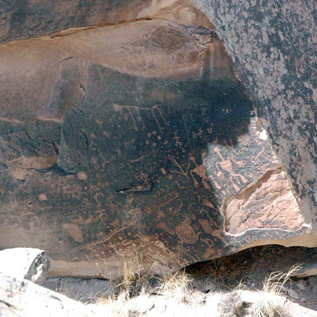
Heading south on the park road, you will reach Newspaper Rock (Stop Number 6) on the west (right) side of the road. Newspaper Rock contains more than 650 petroglyphs etched into its boulders and offers a glimpse of the people who lived here in the Puerco River Valley close to 2,000 years ago.
Blue Mesa Trail
The Blue Mesa Trail (Stop Number 7) is a moderately strenuous paved and gravel 1-mile (1.6-km) hike among bluish-bentonite clay badlands and petrified wood. The trailhead starts at the Blue Mesa sun shelter just past Newspaper Rock.
Rainbow Forest Museum
At the south end of the park is the Rainbow Forest Museum (off Hwy. 180, 8am-5pm daily). Museum exhibits include prehistoric animals and petrified wood. Catch a free film about the park and the creation of petrified wood is screened every half hour. A gift shop and snack bar are nearby; restrooms are available.
Back on 66 towards Holbrook
Drive 28 miles (45 km) south through the park and exit from the south entrance. Take U.S. 180 for 19 miles (31 km) north to rejoin I-40/Route 66 at Holbrook.
Stewart’s Petrified Wood Shop
It’s a big no-no to take any petrified wood from the park, you can get some at Stewart’s Petrified Wood Shop, 13 miles (20.9 km) east of Holbrook. It’s part trading post, part yard sale, part folk art sculpture garden. They sell meteorites, dinosaur bones, tree stumps, bookends, and jewelry made from petrified wood. Meet the ostriches (their eggs are for sale) and see sun-blasted vintage cars and bizarre dinosaur sculptures like a T. rex with a mannequin hanging out of its mouth. Have your camera ready and cash on hand; even if you don’t buy something, you’ll want to snap a pic of this place.
Get your kicks
What to read next…
More travel guides for your adventure

Pin it for later
