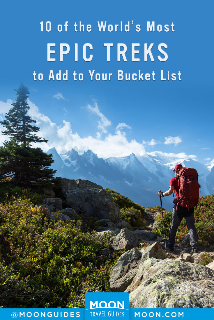
10 Best Long-Distance Hikes in the World
The trek: There is an art to this particular kind of traveling, exploring the unknown on foot. To go on a trek is to discover new landscapes, new cultures. More than your endurance or speed, it’s your path that matters. Whether you’re a beginner or a seasoned adventurer, here are some unexpected and breathtaking routes to take you to the four corners of the earth. But be sure you’re well equipped, physically fit, and conscientious about the weather! From Nepal to the Moroccan Atlas and from the Inca Trail to the Great Wall of China, it’s time to explore the most beautiful treks on the planet.
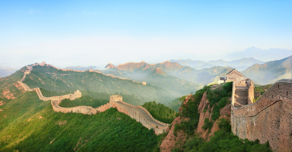
China: Great Wall of China
Distance: Several treks ranging 2–10 days
Starting point: Easily accessible from Beijing
Climb the largest structure built by human hands (4,200 miles/6,700 km long) and make one of the most unusual treks in the world on a “road” 20 to 23 feet (6 to 7 m) high and 13 to 16 feet (4 to 5 m) wide! The Great Wall is easy to get to from Beijing at Badaling, Mutianyu, Huanghuacheng, and Jinshanling, the latter two being the least visited. Several options are available, from two to ten days, depending on what you want to do, though it’s impossible to walk the entire Wall. Be conscientious when choosing your route—consider the proximity of restaurants, inns, and hotels, which can allow you to travel light. In most places, the wall is composed of a succession of stairs that go up and down, sometimes at very steep inclines. As some sections are not passable, you may have to take detours or do some climbing. You should plan ahead and talk to a travel agency before preparing for a long trek. If you want to sleep on the wall, you have to go through an agency. It can be very cold at night, so pack accordingly. Choosing the right route for your abilities is essential, but you must also choose the right season: namely, avoid summer, when the temperature is around 104°F (40°C), and winter, when it is frigid. Even with its challenges, this trek is well worth the effort, and you can walk proudly on a piece of UNESCO World Heritage.
Peru: Inca Trail
Distance: 28 miles (45 km), 4 days
Highest point: 13,780 feet (4,200 m) (Warmiwanusqa)
Starting point: Kilometer 82 (accessible by bus from Cusco)
Change in elevation: 5,577 feet (1,700 m)
Would you like to explore the Inca empire? In two to four days, you can make a circuit through a small but extremely rich territory. Be warned: the extraordinary hiking trail is, in places, quite difficult. In short, you have to be fit and motivated! The Inca Trail is the most popular hiking route not only in Peru but on the entire South American continent—a route through beautiful landscapes that allows you to visit the Inca ruins throughout the Andean forest, with an unobstructed view of Machu Picchu when you get there. The trail (25 miles/40 km) consists of stone paths, stairs, tunnels, and bridges that cross rivers, valleys, and cold altitudes. The highlight is the Dead Woman’s Pass at 13,780 feet (4,200 m) elevation. Note: advance reservations are required. You should book six months ahead of time if you want to go during the peak season, as passage is limited to five hundred hikers a day. Plan to pay anywhere from $600 to $1,500 per person for permits and guides, because you are no longer allowed to make the journey without them. It’s best to go in the dry season (April–October). If you have not booked in advance, you can reach Machu Picchu on some unrestricted routes: Salkantay, which is less traveled, can also take you there, but be advised that access to Machu Picchu is itself limited to 2,500 daily visitors.
France-Italy-Switzerland: Tour du Mont Blanc
Distance: 110 miles (170 km), 7–10 days
Highest point: 8,743 feet (2,665 m) (Col des Fours in France and Arpette window in Switzerland)
Starting point: Les Houches
Change in elevation: 32,800 feet (10,000 m) over 11 passes
The Tour du Mont Blanc (or TMB for the those in the know) is probably the most famous trek in Europe. As its name indicates, it circles the highest peak in western Europe, covering a distance of about 110 miles (170 km) and more than 32,800 feet (10,000 m) of climbing. It offers spectacular views of the Alps: peaks, glaciers, moraines, and pastures. The trail passes through three countries (France, Switzerland, Italy) and seven valleys: the Arve Valley (or Chamonix), Val Montjoie, Glacier Valley, the Italian Val Veny, and the Swiss Val Ferret, Val d’Arpette, and the Trient Valley. Traditionally, TMB trekkers depart from Les Houches in France, then go through Les Contamines-Montjoie, Courmayeur, La Fouly, Champex, Le Tour, and Chamonix-Mont-Blanc. But nothing forces you to do it this way, and there are alternate routes available for less experienced and/or less intrepid hikers. Although TMB peaks are only 8,743 feet (2,665 m), you still need to be physically fit enough for mountain trekking. The full route takes around ten days, and the season runs from June to October. Watch out for sudden changes in the weather!
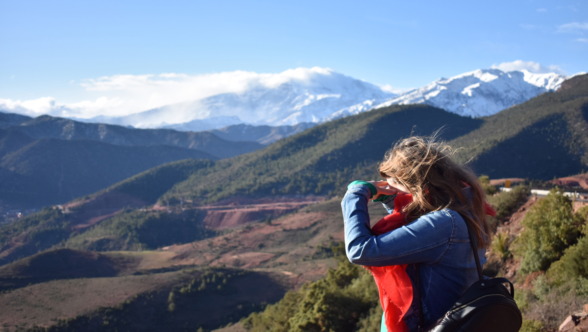
Morocco: Atlas Mountains
Distance: 155 miles (250 km) for the complete crossing (3 weeks) but many shorter trails are available
Highest Point: 13,671 feet (4,167 m) (Mount Toubkal)
Starting point: Marrakech
Are you a beginner looking to explore different terrains? Then the treks available in the High Atlas in Morocco are for you. There are lots of easy, marked trails that take two to eight days to cover, though a guide is recommended. The High Atlas is less than an hour from Marrakech. Also called the “roof of Morocco,” it is a mountain range where novices are welcome but the more athletic can plenty of high-elevation challenges that combine adrenaline with the beauty of the landscapes. Routes are usually hikeable from May to October. Easy to get to from Marrakech, the Ourika valley offers many trekking options from Setti-Fatma: the Timenkar Plateau (two days), the ascent of Mount Tougroudadane (10,900 feet/3,320 m; three days), or Mount Toubkal (13,671 feet/4,167 m; eight days), via Tachdirt, Imlil and the refuge of Tazaghart (for the very experienced). To climb Jebel Toubkal (the highest peak of the Maghreb), the easiest way is to get there is through Imlil. The trek takes two days, and a guide is recommended because the climb is dangerous in places. Overall, however, the trek is not too difficult and offers exceptional panoramas of the High Atlas.
Nepal: Annapurna Circuit
Distance: 120 miles (200 km), about 12 days
Highest point: 17,769 feet (5,416 m) (Thorong La)
Starting point: Besisahar
Change in elevation: 2,625 feet (800 m)
The Annapurna massif, which is more than 26,000 feet (8,000 m) high, is very popular in the trekking world. It is one of the great classics for hikers, not to mention one of the most famous, taking travelers through a great diversity of surroundings: tropical valleys, desert landscapes, waterfalls, mountains, and more. Since a road for vehicles opened, it is no longer possible to walk the entire thing. The journey from Besisahar to Muktinath takes ten to twelve days, and then the second leg, from Muktinath to Pokhara, is done by vehicle. The highest pass is the Thorong La Pass at 17,769 feet (5,416 m), which requires hikers to be in top physical condition. The advantage of this trek: hotels, bivouac shelters, restaurants, and inns line the journey. There are no great obstacles, and the elevation changes are gradual. You must have a Nepalese visa. And watch out for altitude sickness!
Newsletter Signup
By clicking ‘Sign Up,’ I acknowledge that I have read and agree to Hachette Book Group’s Privacy Policy and Terms of Use
France: Corsica GR 20
Distance: 110 miles (180 km), 16 days
Elevation max: 8,553 feet (2,607 m) (Scuds Peak)
Starting point: Calenzana (north) or Conca (south)
Change in elevation: 43,000 feet (13,000 m)
The Isle of Beauty is aptly nicknamed! For an unforgettable trek, tackle the GR 20, which goes through northern Corsica by way of the mountains in the center of the island. The route, nearly 120 miles (200 km) long, is not easy, since it covers an elevation range of about 43,000 feet (13,000 m). You will need a good two weeks to complete it at a rate of about six to seven hours of walking a day. However, you can also choose to follow only part of the GR 20 and stop in one of the villages between Ajaccio and Bastia. If you want to complete the route in its entirety, you need to be well prepared and trained to hike in the mountains—only about half of visitors choose to do this. The GR 20 is traditionally traveled from north to south, from Calenzana to Conca, passing by Vizzavona. The hardest part is between Calenzana and Vizzavona, where you can expect some rather steep climbs and descents. On the way, you can sleep in shelters (even these need reservations in July and August) or camp. Note: the GR 20 crosses the regional park of Corsica, where you cannot pitch your tent! Also famous, but less difficult, the Mare e Monti and Mare a Mare are two other very worthwhile treks in Corsica.
Turkey: Lycian Way
Distance: 310 miles (500 km), 1 month
Starting point: Fethiye or Antalya
A trek by the sea? Beloved by rowers, this trek can combine sport and relaxation. The Lycian Way runs for a little more than 310 miles (500 km), from Fethiye to Antalya. Plan for a good month of walking to cover the whole route—but, of course, there’s nothing stopping you from doing only one section. Beautiful beaches at the beginning, mountains at the end, canyons, caves, and archaeological sites in between, none of it far from the Mediterranean…. The route was marked by the passionate English trekker Kate Clow, who published a book, The Lycian Way. The signage is not always consistent, and some stretches can be dangerous, so it is better not to do this trek alone. You can, however, travel light if you go in spring or autumn to avoid the hot weather in summer and use the inns, hotels, and restaurants that are easily spotted from the route. If you prefer to rough it, though, pack up your tent and take the route that goes north past Kale. The marked paths can be the guiding thread of a much longer stay with several stages to enjoy the different beaches with elusive views of turquoise waters. Beginner hikers may want to combine part of this trek with a boat cruise of three to four days.
Tanzania: Kilimanjaro
Distance: Between 25 miles (40 km) and 40 miles (65 km), 6–10 days
Highest point: 19,331 feet (5,892 m) (Uhuru Peak at Kibo volcano)
Starting point: Arusha
Change in elevation: 13,000 feet (4,100 m)
A challenging trek for the physically fit…but in a responsible way. It is open to all, provided you are in good physical and respiratory condition. And for good reason: The peak of Africa rises to 19,331 feet (5,892 m) from a starting altitude of 5,900 feet (1,800 m). The sublime panorama from the summit will be the reward for all your efforts. There are five main routes leading up the mountain, including the Marangu route (the easiest and busiest), the Machame route (a bit more difficult, but more beautiful), the Umbwe route (uncrowded and wild), the Mweka Way (steep and quick), and the Shira Plateau Way (which is gorgeous but doesn’t reach the summit). There is an entrance fee for Kilimanjaro Park and a guide and a porter are essential companions; training is mandatory. Budget about $980 per person for six days all-inclusive— not to mention adequate equipment—to accomplish this feat. July, August, and September are the busiest months, but we suggest January and February for dry weather and fewer people. Wet months are not recommended. The pace is quite intense: It takes six days of walking four to seven hours per day to reach the summit of this impressive Tanzanian volcano (80 x 50 km) that is visible all the way from Kenya.
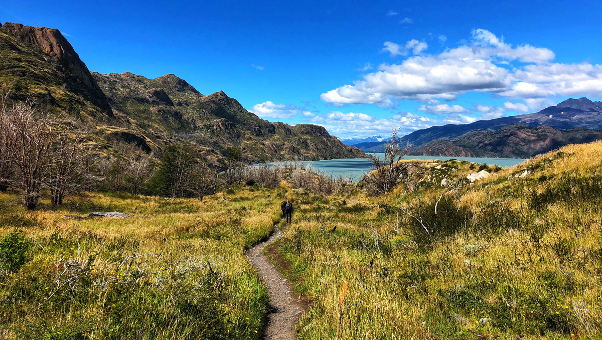
Argentina-Chile: Patagonia (Trek W)
Distance: 47 miles (76 km), 5 days
Starting point: Puerto Natales
Change in elevation: 2,600 feet (800 m)
A region of outstanding hikes with surprises at every turn. From the Tropic of Capricorn to the icy expanses, Patagonia is immense, yet it’s one of the least populated areas in the world. This makes for peaceful hikes where you won’t disturb any locals. The most beautiful sights are close to the Andean Cordillera, with mountains, lakes, glaciers—a feast for the eyes! The most popular destinations are Nahuel Huapi Park near Bariloche, Los Glaciares National Park, Mount Fitz Roy in the El Chaltén region of Argentina, and Torres del Paine National Park in Chile with its world-famous Trek W. The route, named for its shape, generally takes 4 to 5 days and runs along lakes. There are campsites and shelters all along the route. Note: climate conditions are harsh in this region, and changes in weather can happen quickly. Don’t go alone, and make sure you’re well equipped (solid tent, warm sleeping bag, waterproof clothing, hiking shoes, provisions), because the sites are very isolated. Once you’ve crossed the desert and the wild regions, the lakes and the fjords, Tierra del Fuego, the southernmost city in the world, is before you. You can’t trek any farther than this!
USA: Continental Divide Trail
Distance: 3,000 miles (5,000 km), 6 months
Highest point: 14,268 feet (4,349 m) (Grays Peak)
Starting point: Antelope Wells, New Mexico, or Glacier National Park, Montana.
Conquer the peaks of the Rocky Mountains! This trek, a succession of virtually uninterrupted trails, bisects the United States from Mexico to Canada along the spine of the continent. Known as the Continental Divide Trail, this trek follows the watershed between the Atlantic and Pacific; the rivers flow on the west side toward the Pacific, on the east side toward the Atlantic. This route crosses New Mexico, Colorado, Wyoming, Idaho, and Montana. Note that you can keep going into Canada to Jasper National Park via the Great Divide Trail. Obviously, doing the entire route is only recommended for the most experienced trekkers who have a lot of time—it takes about six months! In fact, just a handful of hikers even attempt the adventure each year. Only about three-quarters of the route is marked, and some sections are very difficult. Mountain-climbers favor the Colorado segment (200 miles/320 km), which follows another famous trek, the Colorado Trail, and the Montana (86 miles/138 km) portion, which crosses part of Glacier National Park. In any case, you must be particularly well prepared for this athletic trek, which will take you “into the wild.”


Newsletter Signup
By clicking ‘Sign Up,’ I acknowledge that I have read and agree to Hachette Book Group’s Privacy Policy and Terms of Use
Pin it for Later