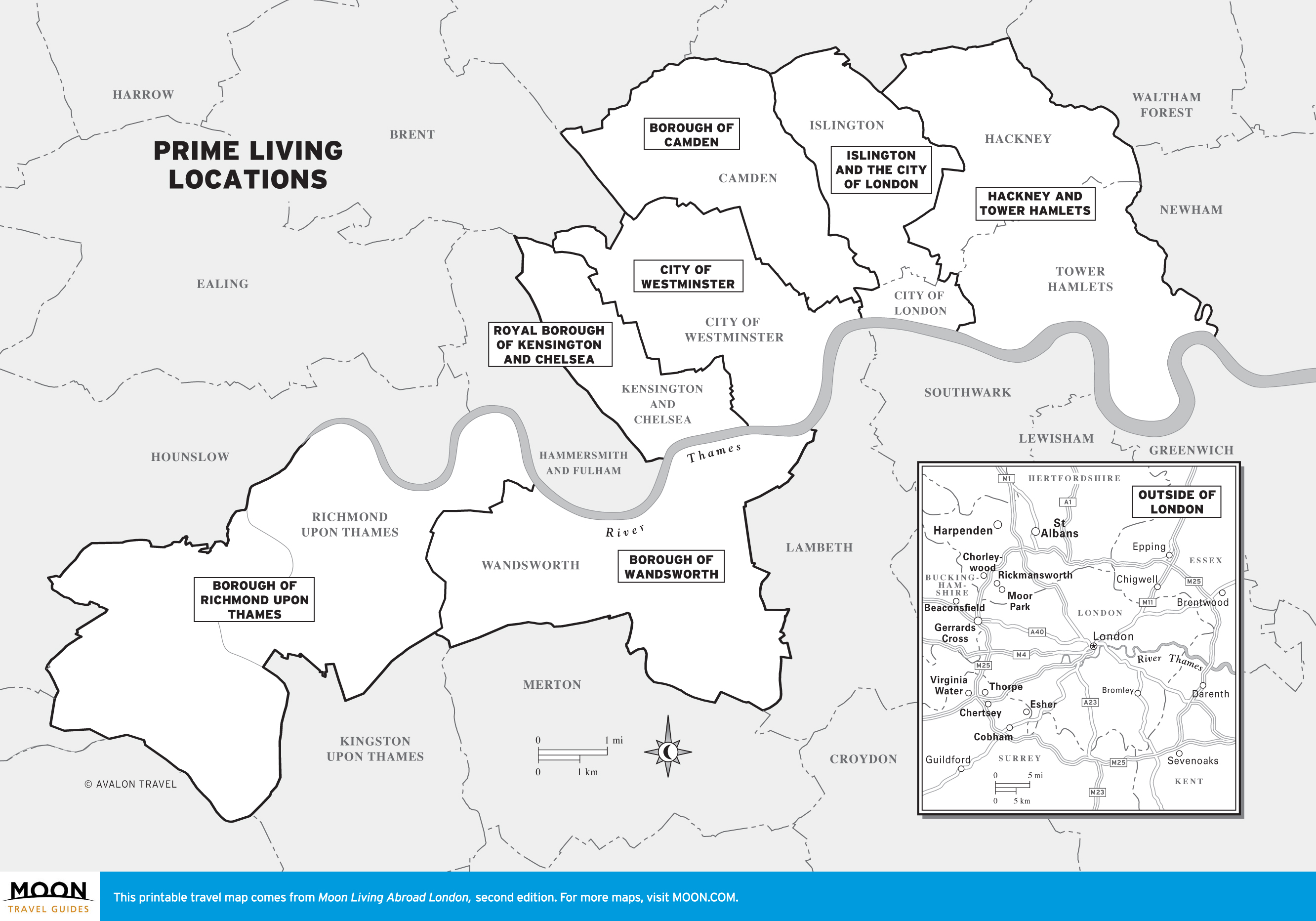
London, UK
These free, printable travel maps of London are divided into neighborhoods:
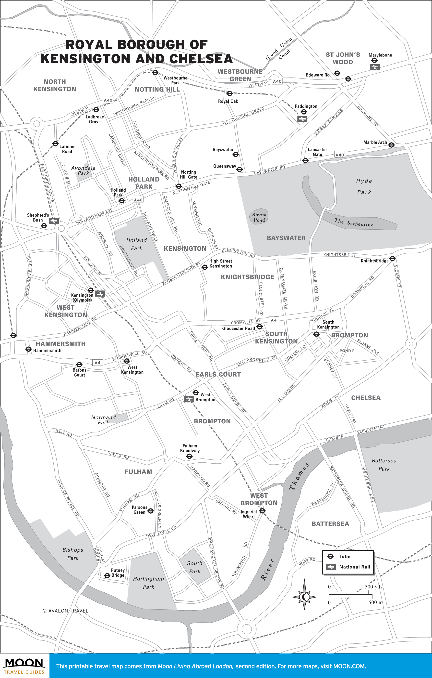
- Kensington & Chelsea
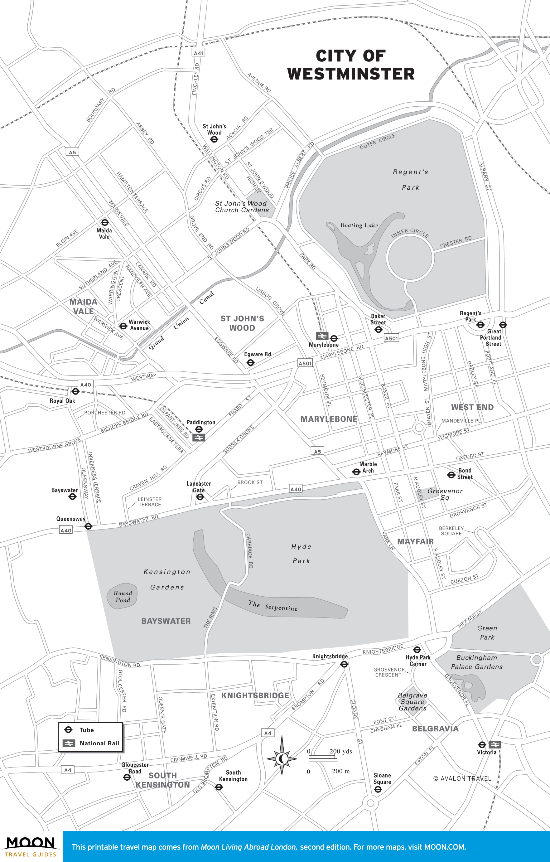
- City of Westminster
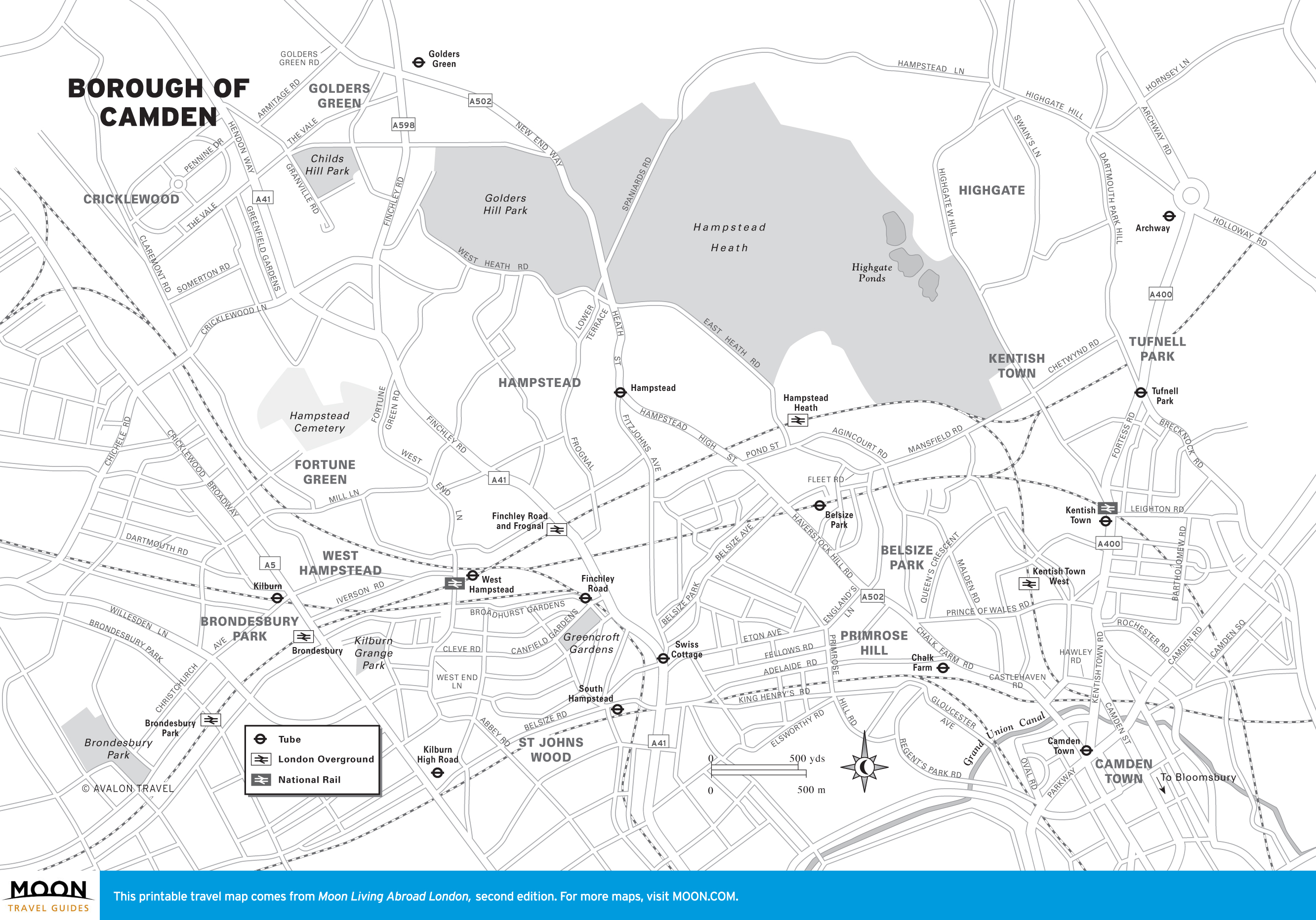
- Camden
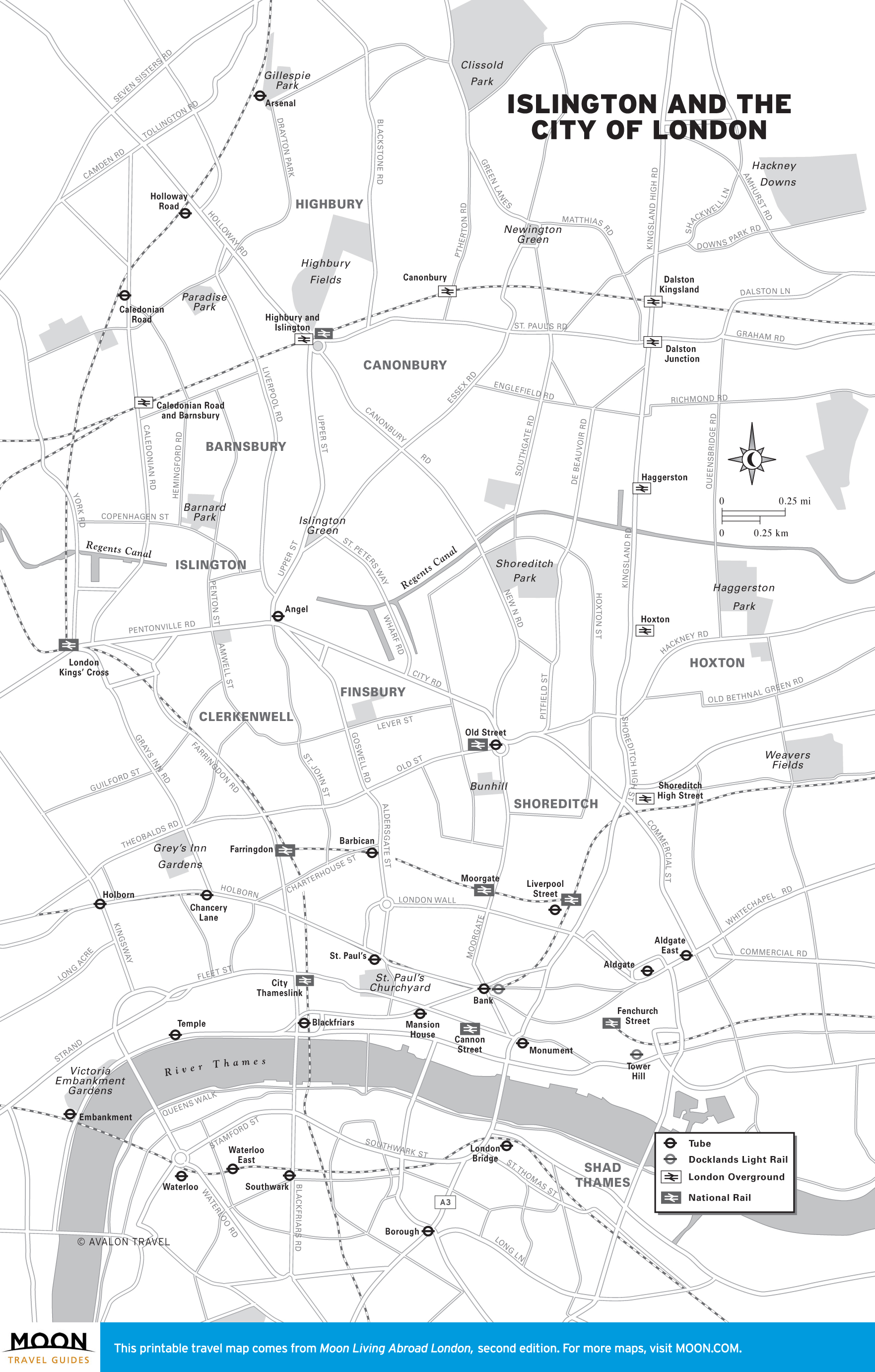
- Islington & City of London
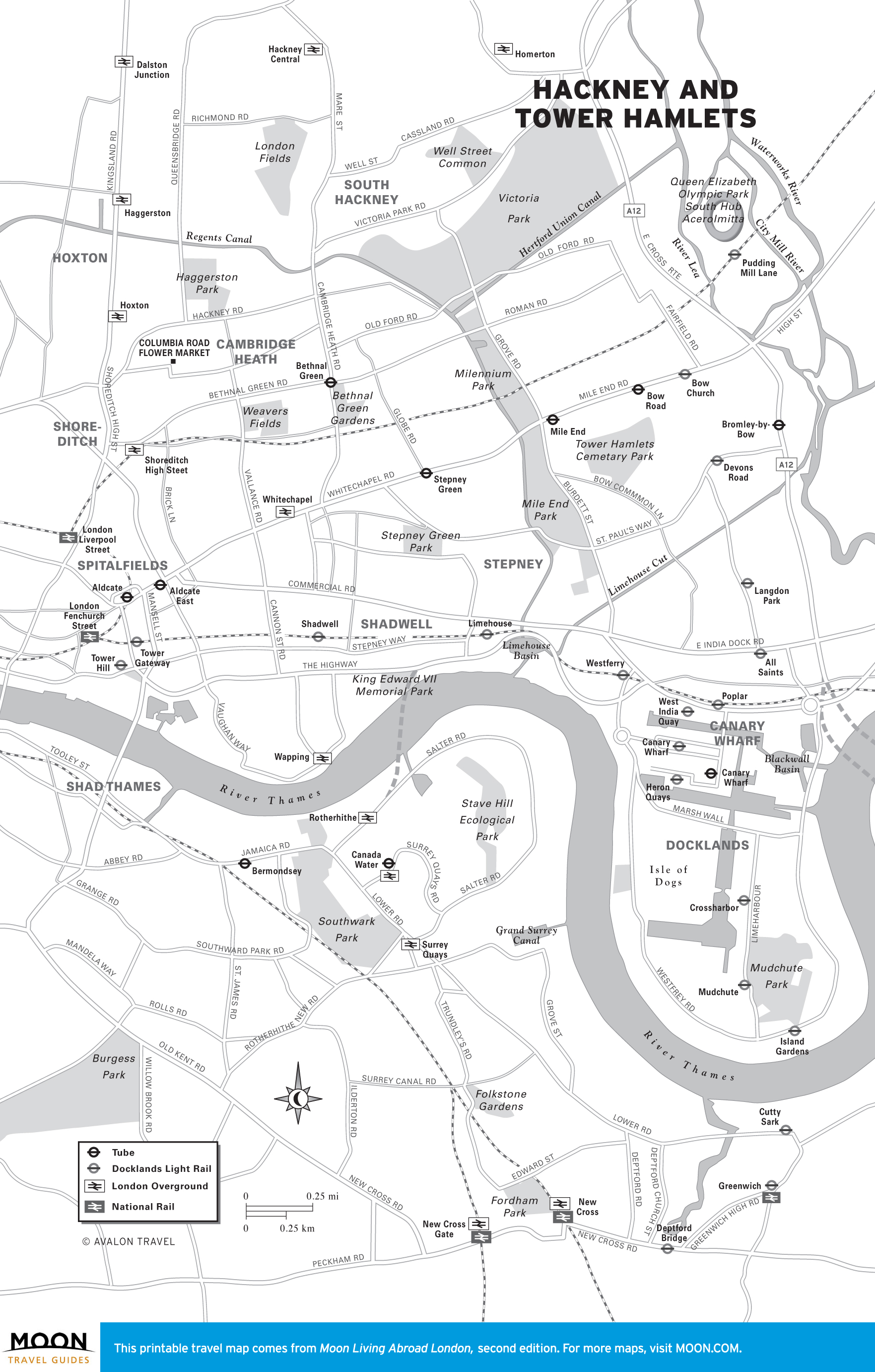
- Hackney & Tower Hamlets
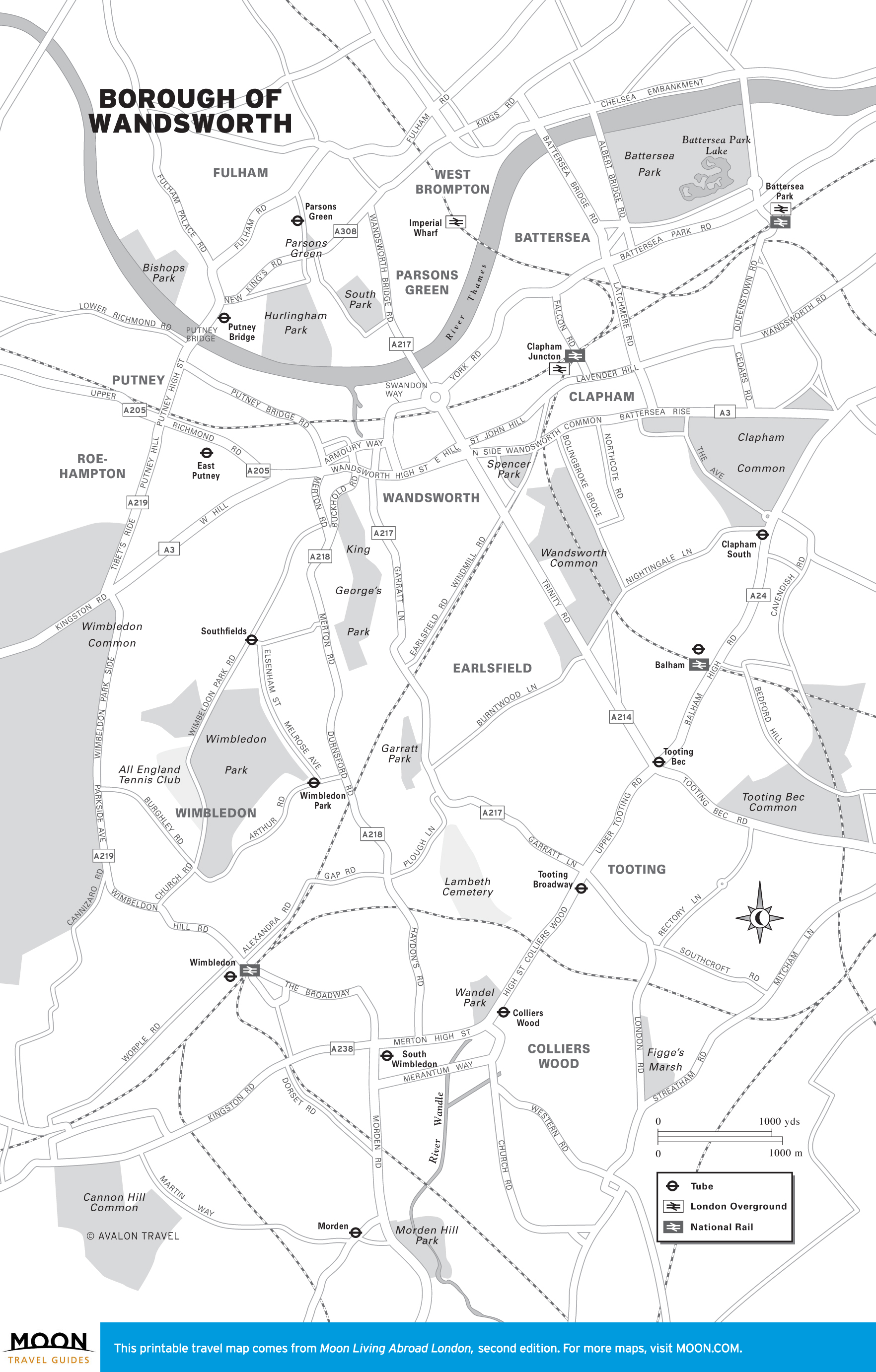
- Wandsworth
- Richmond upon Thames
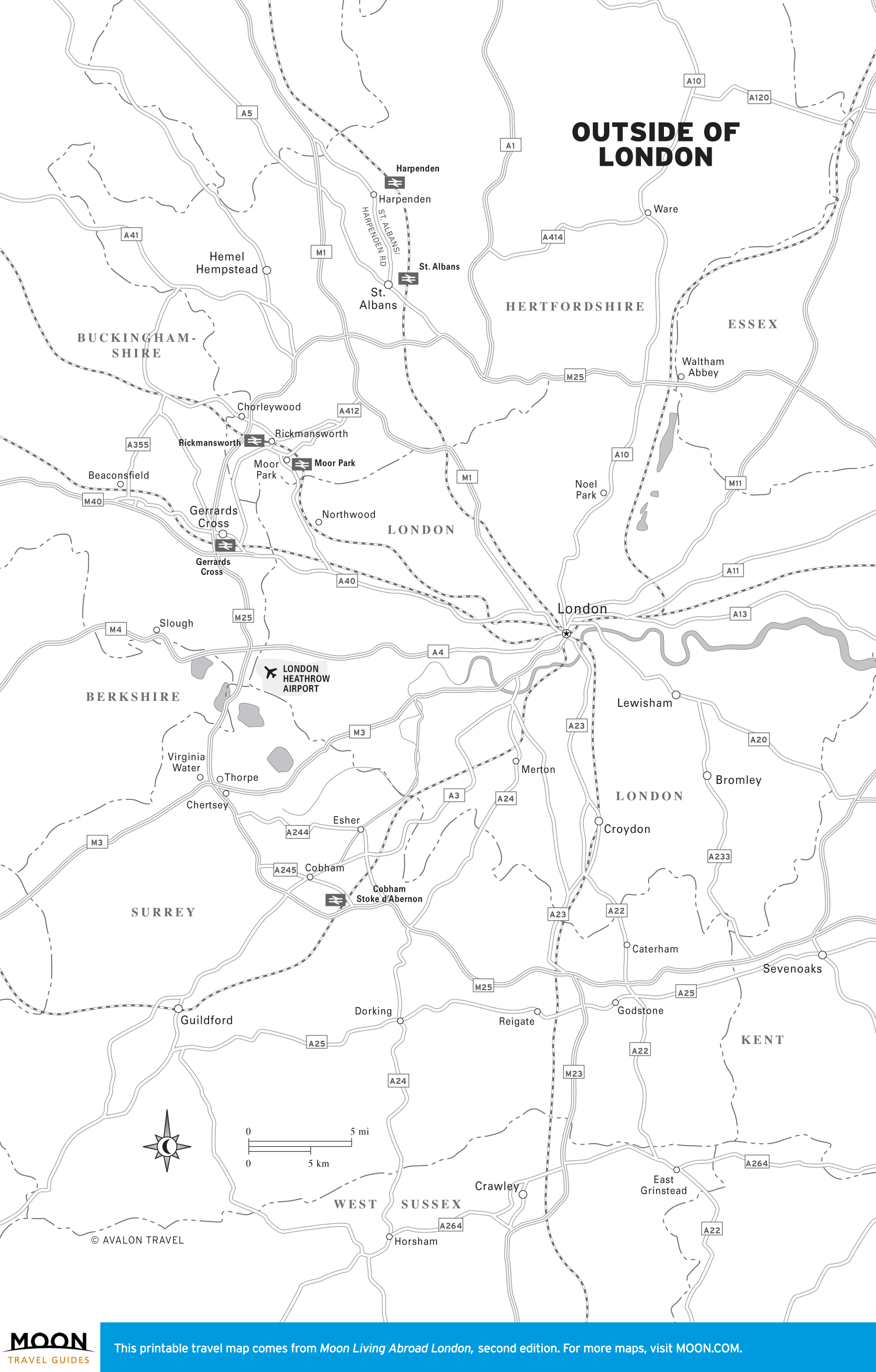
- Outside of London
Explore London or plan to move abroad with these helpful travel maps from Moon Living Abroad in London.
London Neighborhoods