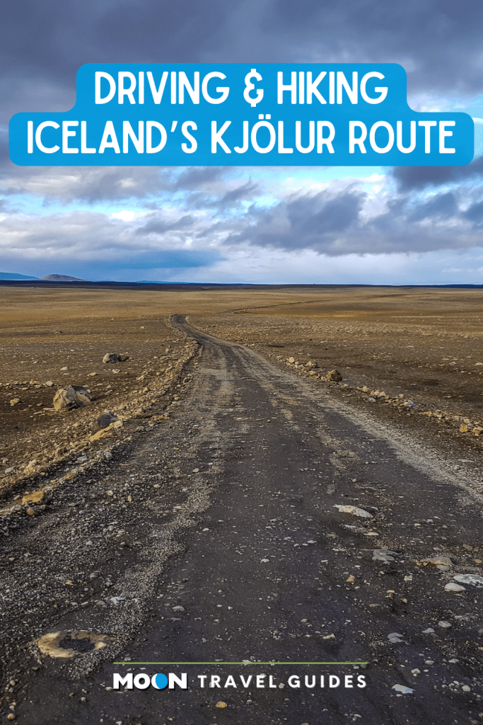
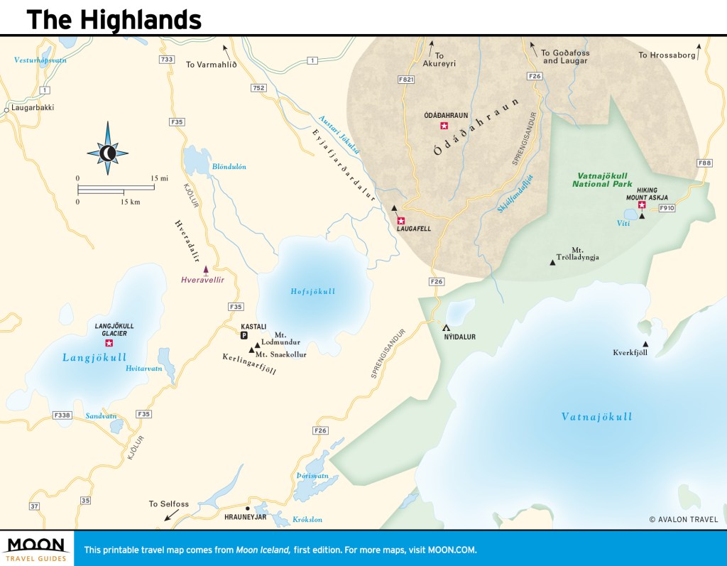
Driving and Hiking the Kjölur Route Through Iceland’s Highlands
For a less treacherous route to Iceland’s highlands, Route F35–also known as the Kjölur route–is your best bet. The allure of the highlands is its stark, rugged landscape and wide-open spaces. It’s easy to feel alone in this part of Iceland, as the region does not attract crowds, but those that make the effort to get here find it worthwhile. You will find a vast landscape of flatlands punctuated by mountains and glaciers. If you are after remoteness and tranquility, this is the place.
Sights along the Kjölur Route
Langjökull Glacier
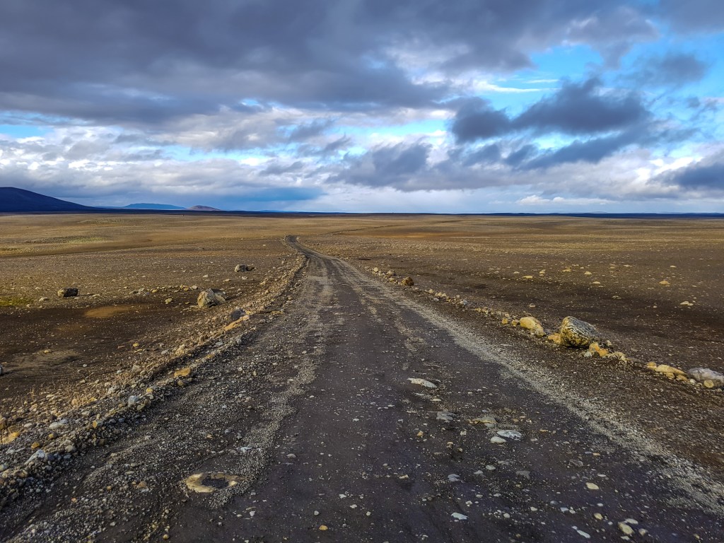
Route F35
At 952 sq km (368 sq mi), Langjökull (Long Glacier) is the second-largest ice cap in Iceland after Vatnajökull. The ice is quite thick, up to 580 m (1,900 ft) deep. The highest point of the ice cap is about 1,450 m (4,760 ft) above sea level. The rocky terrain and snowy patches are vast and haunting.
Route F35 runs along the east side of Langjökull, between it and Hofsjökull. From Reykjavík, head east on Route 1. Before you reach the town of Selfoss, turn left on F35 and continue past Gullfoss for about 37 km (23 mi).
Hveravellir Nature Reserve
Route F35; tel. 354/452-3200; www.hveravellir.is
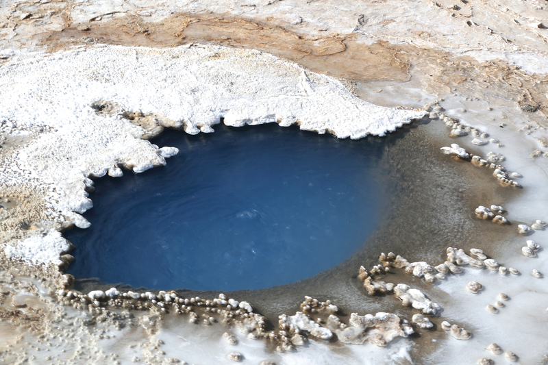
Situated in the western highlands, the Hveravellir Nature Reserve is one of the last great wilderness spots in Europe. It’s about 90 km (56 mi) north of Gullfoss on Route F35. Hveravellir is a natural geothermal hot spot with smoking fumaroles and bubbling water holes, and it’s a special experience to see geothermal energy at work. It’s also a popular place to hike.
There are private rooms in one of two huts, called the New Hut (28,800ISK, linens and breakfast included), as well as dormitories (8,000ISK pp), and a campsite (1,900ISK pp) available within the reserve. One bathing-friendly waist-deep pool is situated close to the mountain huts, and it’s a safe place to take a dip.
Kerlingarfjöll
Route F35, GPS coordinates N 64.6834, W 19.2999; tel. 354-664-7000; www.kerlingarfjoll.is
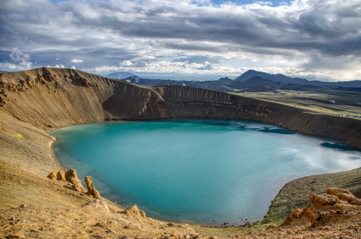
The mountain range Kerlingarfjöll (Women’s Mountains) shows all the characteristics of a matured caldera, including volcanic formations and geothermal hot spots. In short, this is a geology buff’s dream. The towering peaks were created by eruptions from a large caldera lying under the mountains; while the caldera is still considered active, it has been silent for tens of thousands of years. Visitors will see steep slopes and pointy peaks dotted with ice, leading into a hotbed of geothermal activity. While the earth steams below, aboveground it’s quiet and desolate.
Kerlingarfjöll Highland Base
tel. 354/571-1200; www.kerlingarfjoll.is
The recently opened Kerlingarfjöll Highland Base includes a luxury hotel with 26 rooms, 2 suites and 6 private cabins (from 72,000ISK), a 20-room hostel with shared and private rooms (42,000ISK), and a campsite (3,000ISK). The hotel is a mixture of cozy and modern, with soft hues, lots of wood accents, and large windows overlooking the stark highland scenery. The restaurant is open year-round and serves three meals a day, along with packed lunches for those embarking on outdoor activities or tours. A dinner buffet (11,900ISK pp, children 5,950ISK) features fresh fish, local lamb, an assortment of hot and cold dishes, vegan options, and delicious desserts. Meanwhile, the main event for many is the hot baths nestled among the mountainous landscape. Entrance is included for hotel guests, and you will find hot sediment pools, a sauna, a cold tub, and pleasant changing facilities on the premises.
To get to Kerlingarfjöll from Gullfoss, drive north on F35. For 15 km (9 mi) the road is asphalt, and the remaining 38-km (24-mi) section is gravel.
Hofsjökull Glacier
GPS coordinates N 64.8167, W 18.8167, east of Vatnajokull, between Vididalur and Hofsdalur
Hofsjökull (Temple Glacier) is the third-largest glacier in Iceland after Vatnajökull and Langjökull. It is situated in the western highlands, north of the mountain range Kerlingarfjöll. The glacier covers an area of 925 sq km, reaching 1,765 m (5,791 ft) at the top. It’s vast and can be quite windy. Visitors have to be careful of huge crevasses in the ice.
Hiking Iceland’s Highlands
Hikers have many choices for roaming the interior. These popular options vary in scenery and degree of difficulty.
Hveradalir
GPS coordinates N 64.6453, W 19.2825
Hiking the geothermal area of Hveradalir (Hot Springs Valley) is wildly popular, and for good reason. The valley offers views of mountains, vast expanses of desert-like earth marked by steam vents (reminding visitors that the land is very much alive), and hot springs. Hveradalir is accessible off Route 1.
Neðri-Hveradalir Hike
Distance: 3-km (1.9-mi) loop; Hiking Time: 3 hours; Information and Maps: www.visiticeland.is; Trailhead: Neðri-Hveradalir car park
A moderate hike begins at the car park by Neðri-Hveradalir (Lower Hveradalir) and takes you through the geothermal area of Hveradalir, where ice and fire meet. The route is a 3-km (1.9-mi) loop that takes about three hours. Hikers will view the stark white glacial landscape and see the steam rise out of the ground near the numerous hot springs. Muted colors of brown and black in a desert-like landscape give way to pockets of stark white snow in some regions and lush green vegetation in others. Every few meters you’ll want to stop and take in the views, and everything seems to warrant a photo.
Ásgarðsá River Hike
Distance: 11.2-km (7-mi) loop; Hiking Time: 5 hours; Information and Maps: www.visiticeland.is; Trailhead: Keis car park
For a longer, more demanding hike, start at the car park called Keis, toward the bottom of Hveradalir, where you follow the Ásgarðsá River for 4.5 km (2.8 mi). The hike is an 11.2-km (7-mi) loop. Being so close to the river, you will see vegetation, which is a rare sight in much of the highlands. During the hike, there will be points where you have to ford water, so dress accordingly. Hikers will pass hills and geothermal hot spots as the river twists and turns. Overall, it’s a five-hour hike and moderately difficult.
Kerlingarfjöll
Distance: 7-km (4.3-mi) loop; Hiking Time: 6 hours; Information and Maps: www.visiticeland.is; Trailhead: Kastali car park
For a more difficult walk, start at the car park called Kastali and continue to 1,432-m (4,698-ft) Mount Lodmundur, then to the highest peak of Kerlingarfjöll, Mount Snækollur, at 1,460 m (4,790 ft). The trail is rocky and there are quite a few slopes, but the payoff is the gorgeous views of the barren landscape below and mountains in the distance. It’s one of the best overviews of the highlands. This is a 7-km (4.3-mi) loop hike, which takes about six hours.
Getting To and Around the Kjölur Route
By F-Road-Approved 4WD Vehicle
The 200-km (124-mi) Kjölur route (Route F35) begins near the picturesque waterfall Gullfoss in the south and extends to Blönduós in the northwest. This route is not a year-round destination: The road typically opens in mid-June, but it could be later if the winter was harsh. The road closes in September, but how early in September depends on the weather. The majority of the route is flat and can be accessible until then (depending on the weather, of course). As elsewhere in the highlands, an F-road-approved 4WD vehicle is required. Be safe, monitor weather reports, and be aware of road conditions.
Be sure to gas up before you head to the highlands, as there are no gas stations in the region. It’s best to get supplies in Reykjavík or a large town in the south. Depending on the duration of your trip, it might be necessary to bring gas cans.
Plan your trip:
Newsletter Signup
By clicking ‘Sign Up,’ I acknowledge that I have read and agree to Hachette Book Group’s Privacy Policy and Terms of Use
Exploring more of Iceland’s highlands?
Featured Post
Pin It for Later