Hiking Maui: Polipoli Spring State Recreation Area
For a place to escape and commune with the serenity of nature, channel your inner Emerson or Thoreau, and meditate up in the mists, get a 4WD vehicle and head to Polipoli Spring State Recreation Area, an out-of-the-way forested spot with some of the island’s best hiking. Trails pass through old-growth redwoods, eucalyptus, ash, and pines. Be sure to wear bright colors, since hunters are frequently in the area.
After ascending the switchbacking pasture-lined road that continues up from the lavender farm, the first hike is the Waiakoa Loop Trail, which begins by the hunters check-in station. The trailhead technically doesn’t begin for 0.75 mile down the hunting access road, but if you don’t have a 4WD vehicle, it’s better to park at the hunters station and walk to the trailhead. Once you’re here, a three-mile loop with a moderate elevation change of 400 feet passes through lowland brush and pines.

Farther up the road, just past the cattle guard where the road eventually turns to dirt, you’ll find the trailhead for the Boundary Trail, a 4.4-mile one-way trail that descends to the lower fence line. This trail offers sweeping views of South Maui, and since it’s 1,000 vertical feet lower than other trails, it won’t leave you as winded. It can either be done as an out-and-back hike or combined with other trails as a loop. The shortest loop is up the Lower Waiohuli Trail, which intersects the Boundary Trail at the 2.6-mile mark. Turning left on the Lower Waiohuli Trail, it’s 1.4 miles back uphill to the main road, then a 2.5-mile trek back along the dirt road to your car.
If seven miles seems too far, most of the shorter walks in Polipoli begin and end at the campground. While some are only a mile long, the best hike in the park for first-time visitors is the 5.3-mile loop trail formed by connecting the Haleakala Ridge Trail, Polipoli Trail, Redwood Trail, and Plum Trail. Driving all the way to the campground requires a 4WD vehicle.
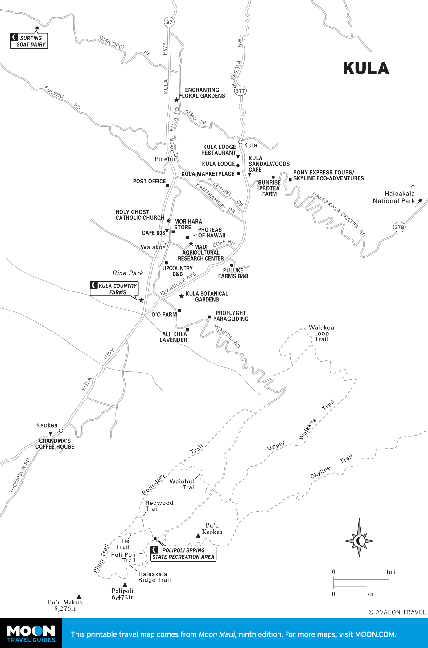
It’s possible to hike all the way from Polipoli to the summit of Haleakala. Follow the 6.8-mile dirt road, known as Skyline Drive, a “back entrance” to Haleakala National Park. If it has snowed recently atop Haleakala and the rangers have closed the road, this is an alternative way to hike into the park and be the only person there.
Even on regular days, however, Skyline is a strenuous hike providing panoramic views down the mountain’s southwest rift zone. Though Haleakala has been dormant for more than 220 years, volcanologists claim that when the mountain erupts again, magma will cover the barren landscape that’s visible from this trail. To reach the trailhead for Skyline Drive, turn left at the fork that leads down to the campground from the main dirt road. From here, the road continues climbing and begins to double back toward the north, along the way passing the trailhead for the 1.8-mile Mamane Trail. Eventually you’ll reach a locked gate at an area known as the Ballpark (7,000 feet). From here it’s a 3,000-vertical-foot switchbacking trail to the summit. Pack plenty of water and warm clothing, and be aware of the challenges of hiking at altitude.
Related Travel Guide
