Best Hikes Along the Blue Ridge Parkway
Hundred-mile views, hidden coves, and private waterfalls await. From short trails to full-day treks, here are the best hikes to check out on your Blue Ridge road trip.
Hikes Along Skyline Drive
Mary’s Rock Trail
The hike to the top of Mary’s Rock is well worth it for the 360-degree views of Shenandoah National Park. There are a couple of ways to reach Mary’s Rock; this route has less elevation gain by around 400 feet and is nearly a mile shorter than the alternative. Immediately the trail ascends, then levels and ascends again. You’ll pass the remains of a huge stone chimney, all that remains of a Potomac Appalachian Trail Club cabin built in the 1930s (it burned down in 1946), at 0.4 mile in. Keep climbing through this typical hardwood forest. You’ll reach the Appalachian Trail and a cement signpost at 0.6 mile in. Turn right here and follow the Appalachian Trail as it ascends, then descends. You’ll reach a second post in another 0.6 mile. Turn left onto the spur trail that will lead you to the summit of Mary’s Rock.

Dark Hollow Falls
Dark Hollow Falls is one of the most popular waterfall hikes in Shenandoah National Park, and for good reason: the short hike and excellent view. Moss and ferns cling to the cliff around the falls, and at the base, there are several great opportunities for photographers to shoot leaf-littered rocks and small cascades, especially in autumn. This short hike takes you to one of the most popular and easily accessible waterfalls. Take “easily accessible” with a grain of salt, though, as the trail is all downhill on the way to the 70-foot Dark Hollow Falls and a 440-foot elevation gain on the way back up. It’s a thigh-burner, for sure. From the parking area, the trail descends and follows Hog-camp Branch. You’ll reach your first overlook of Dark Hollow Falls at 0.6 mile. Continue on the trail to the base of the falls at 0.7 mile. Climb back up to get to your car. Along the way, you’ll notice a rail to help you with your footing and keep you on the path. Don’t be foolish and go past the rail and fences, which not only prevent trail erosion but also keep you safe.
Blue Ridge Parkway Hikes
Linville Falls Trail
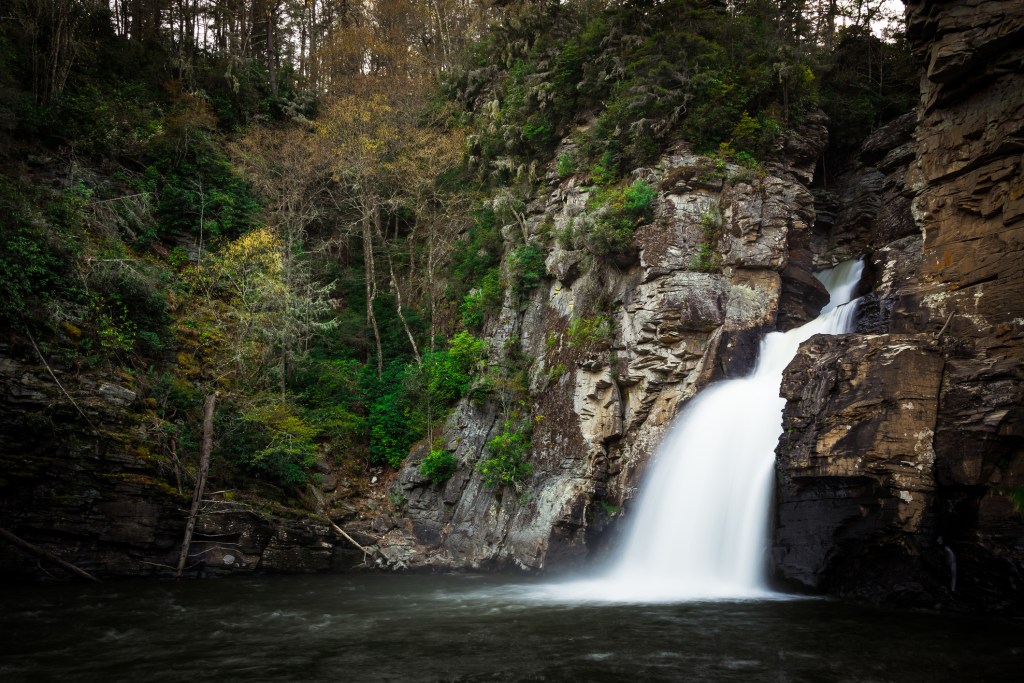
Linville Falls is one of the most-photographed places in North Carolina, a spectacular series of cataracts that fall crashing into Linville Gorge. It can be seen from several short trails that depart from the Linville Falls Visitor Center, including the recommended Linville Falls Trail.
Craggy Gardens Trail
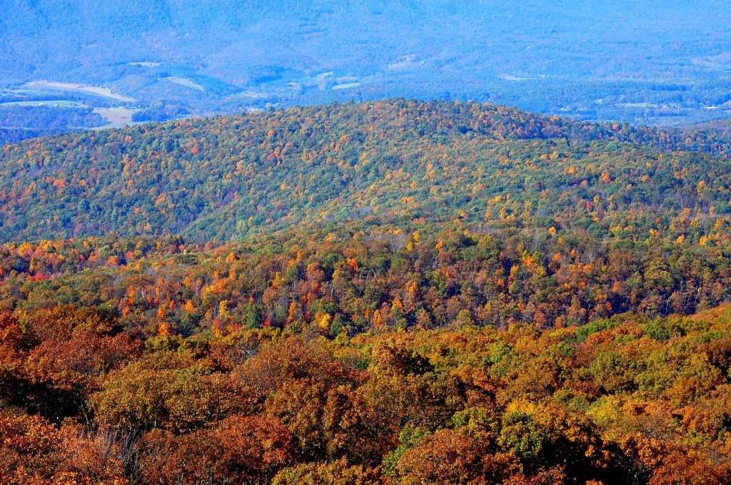
You can take NC-128 right to the top of Mount Mitchell, some 6,684-feet above sea level, and this hike puts you in the parking lot where a very short, paved path leads to the observation tower at the summit. Park in the lot, walk up the ramp, enjoy the view; it’s that easy. The view from the top is nothing short of spectacular. Given the elevation and weather in the mountains, you can watch the Blue Ridge disappear as a tsunami of clouds engulfs the ridges and valleys below. Or you can see for nearly 100 miles in any direction, watching the foothills give way to the Piedmont far to the south and east, and the mountains southwest grow bigger and bolder. One of the best times to visit is sunset, when the shadow of the summit stretches to the horizon and disappears into the coming night. This hike is easy to access from the Parkway, easy to do, and undeniably beautiful, but if you want a challenge that serves up this summit as a reward, try the challenging Mount Mitchell Trail that leads through the state park to the peak.
Hikes in Great Smoky Mountains National Park
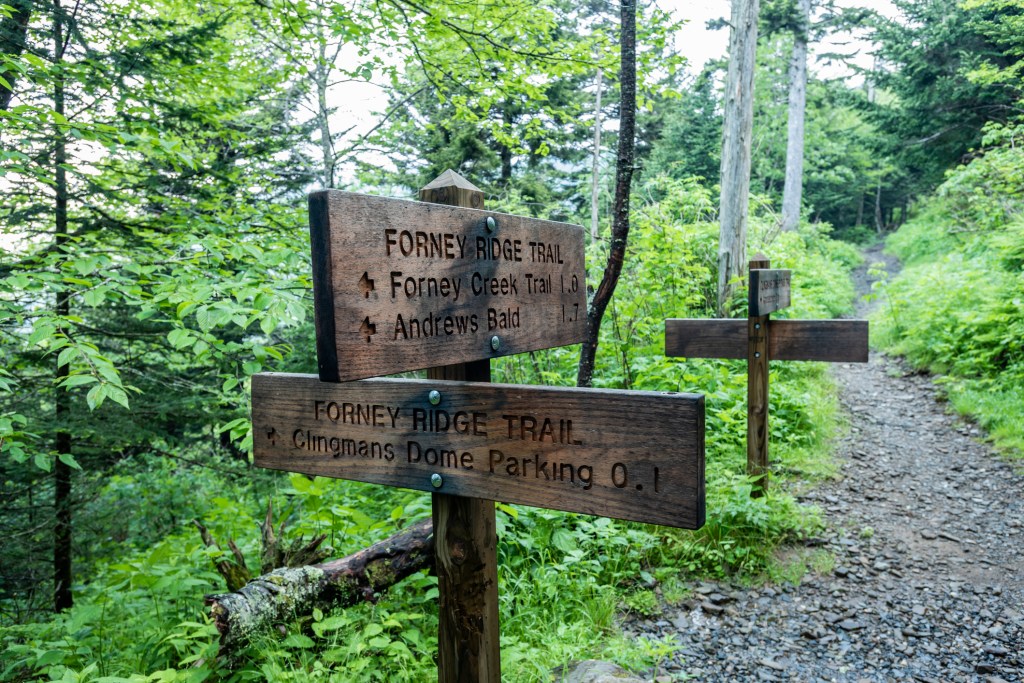
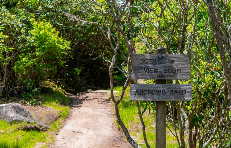
Andrews Bald
The highest grassy bald in Great Smoky Mountains National Park, Andrews Bald is a beautiful sight at the end of a nearly two-mile hike from Clingmans Dome. Balds are meadows found higher up on mountains, and this one is absolutely lousy with flame azalea and rhododendron blooms in the summer. Note that Clingmans Dome Road is closed in the winter.
Before recent trail renovations, the Andrews Bald hike had some of the most rugged sections of rocky trails in the park. Thanks to the Trails Forever program, work crews fixed drainage issues, rebuilt parts of the trail, and even built a few stairways from native rocks and trees. Now the hike is easier and safer and leads to a spectacular view of the Smoky Mountains. A bonus: The hike is just long enough to discourage some potential hikers, but it’s still short enough to be doable by everyone in your party.
The Forney Ridge Trail starts in a spruce-fir forest that was once beautiful but unfortunately now is dead or dying. That’s because the forest has been ravaged by a tiny bug—the balsam woolly adelgid—which devours Fraser firs. However, there is a certain beauty in the white bones of the tree trunks jutting up from the land. Don’t worry, though, the views get considerably better in a short time. Around 1.6 miles into the hike you’ll reach the edge of Andrews Bald, where the forest opens up into a fantastic panorama. In spring and summer, there is a proliferation of wildflowers, flame azaleas, and rhododendrons.
Alum Cave Bluff to Mount LeConte
As one of the most popular hikes in the park, this trail receives a lot of wear-and tear, but repair work completed in 2016 has left it in fantastic condition. Hikers will find sturdy handholds along the stone stairs and narrow exposed sections at the upper end of the trail.
Most hikers turn around at Alum Cave Bluffs, but if you’re pushing on to Mount LeConte, the path steepens and grows more challenging as you gain elevation. The trail narrows to a set of rock ledges where steel cables have been bolted into the mountain for use as a handhold. The drop may be precipitous, but the views are fantastic. Soon, the trail intersects with Rainbow Falls Trail, leading you to the summit of Mount LeConte in short order.
If you plan on hiking to Mount LeConte and back in a day, or spending the night at the lodge, it’s in your best interest to arrive early so you can get a parking space.
Hen Wallow Falls Trail
From the outset, Gabes Mountain Trail is a steady climb on a path that’s at times rugged. Follow this trail until you see a sign for the side trail leading to the waterfall (2.1 miles into the hike). The 0.1-mile side trail is a little steep, but not problematically so.
Hen Wallow Falls tumbles 90 feet into a small pool below, where there are plenty of salamanders to see. The falls themselves are only 2 feet wide at the top, but fan out to 20 feet at the bottom; during dry months, the falls are still pretty, but less wow-inducing. To get back to the trailhead, just retrace your steps.
By clicking ‘Sign Up,’ I acknowledge that I have read and agree to Hachette Book Group’s Privacy Policy and Terms of Use
want more blue ridge?
Pin it for Later