Atlantic Canada
These free, printable travel maps of Atlantic Canada are divided into four regions:
Explore Atlantic Canada with these helpful travel maps. Ensure you have the newest travel maps from Moon by ordering the most recent edition of our travel guides to the Eastern provinces.
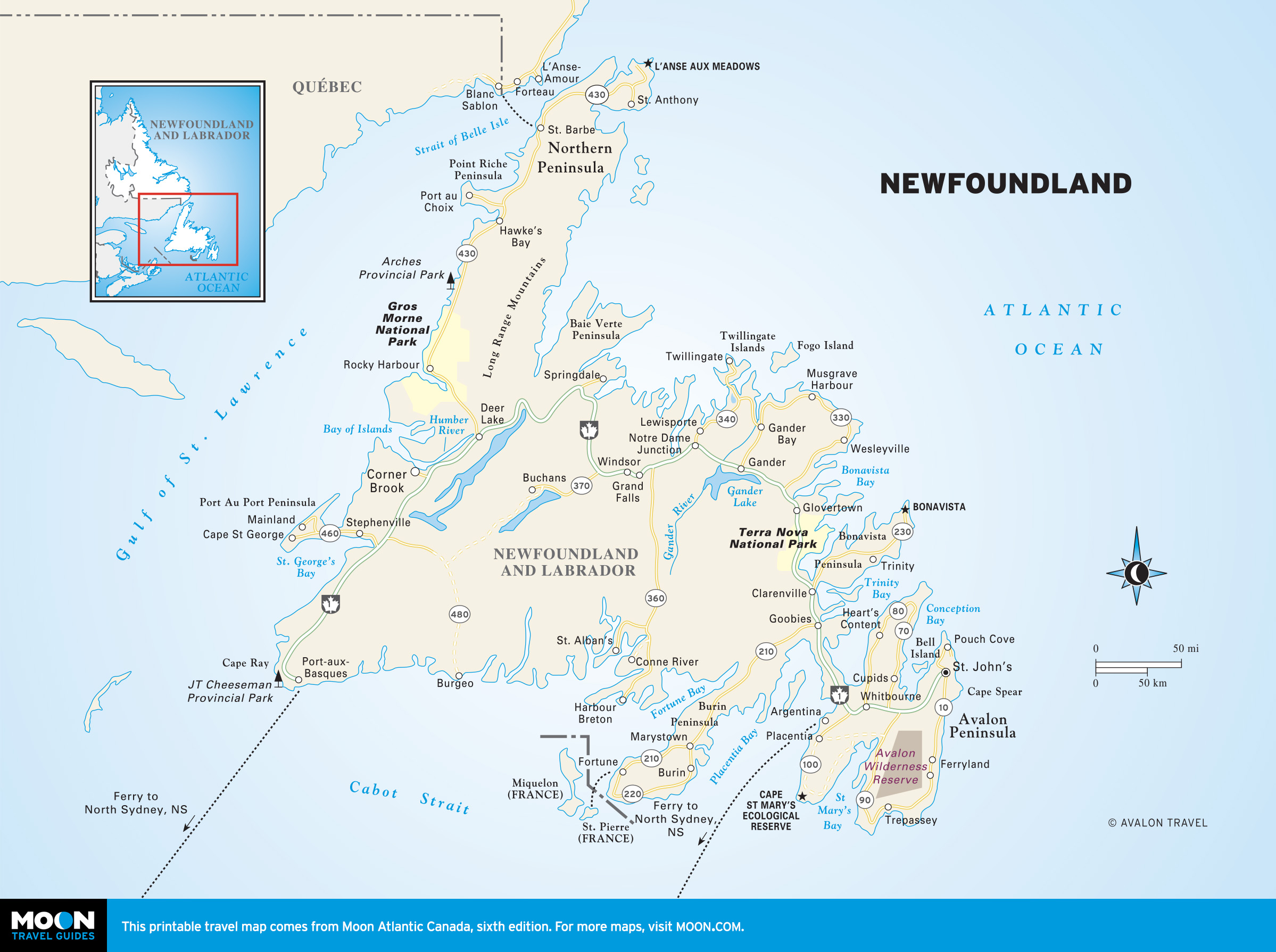
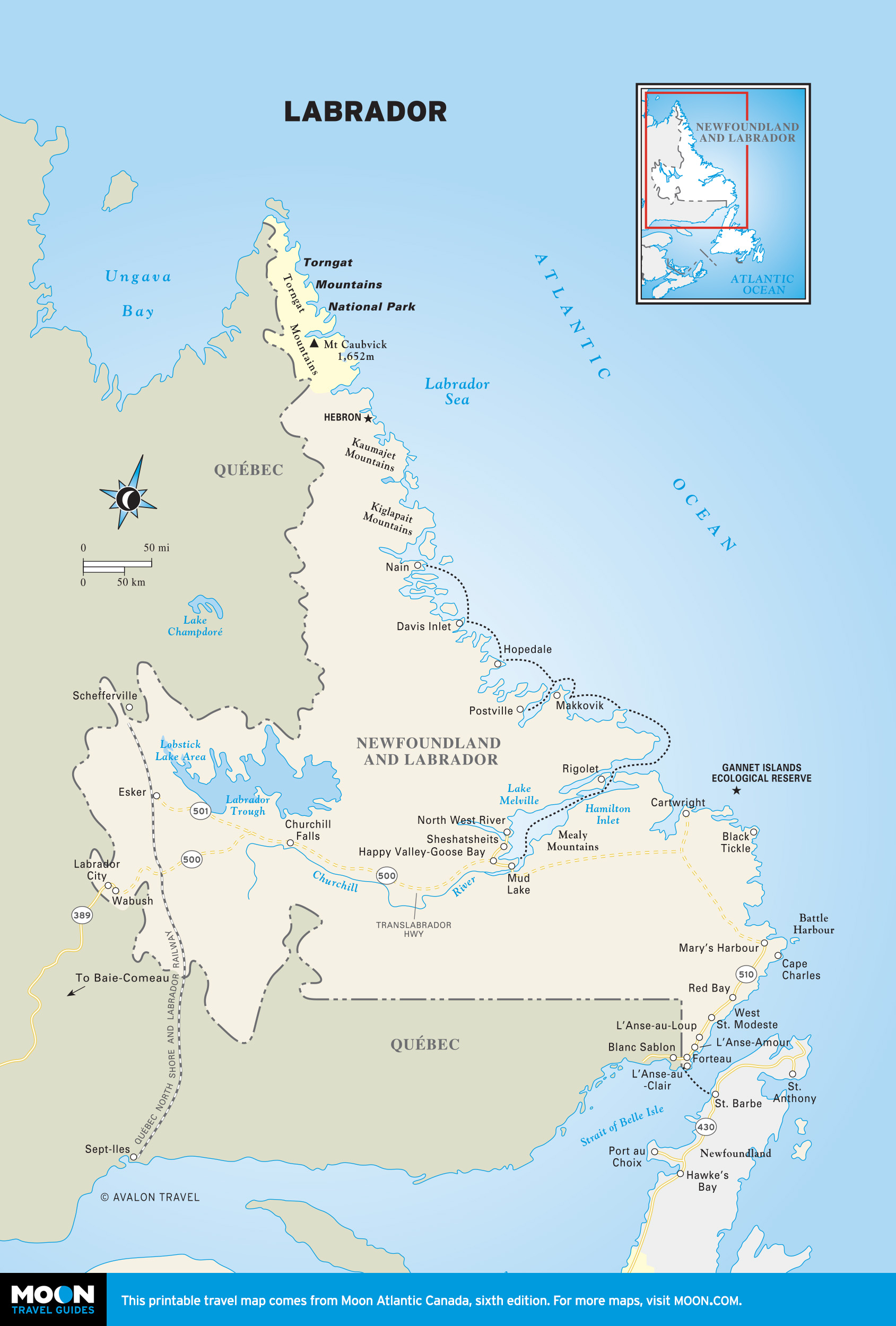
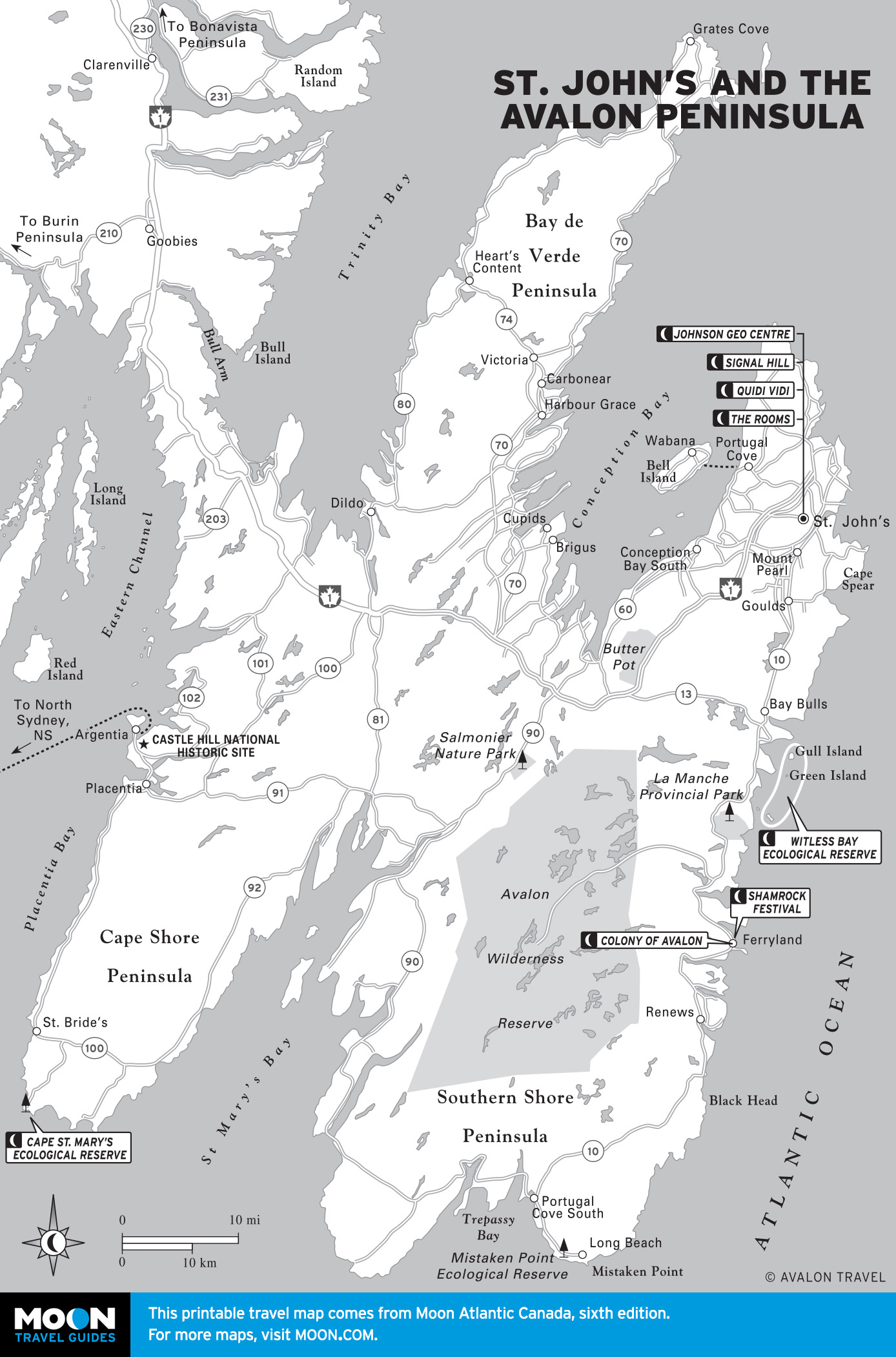
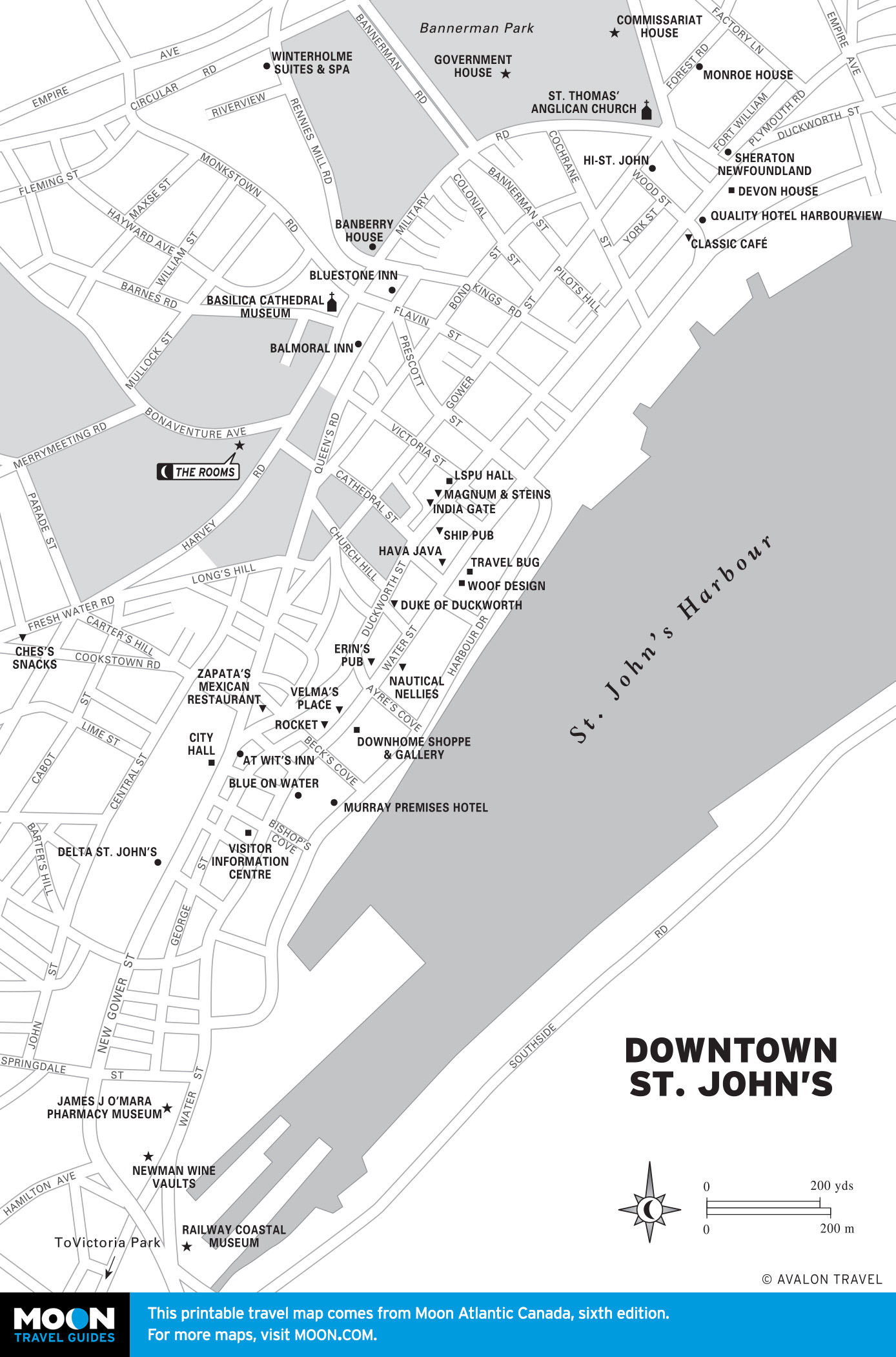
Newfoundland & Labrador
Three times the size of the Maritimes put together, this province redefines the region as Atlantic Canada. It comprises the island of Newfoundland as well as Labrador on the mainland. The Maritimes share a kindred climate, history, and lineage, but Newfoundland is different. About half of the island is boreal forest, while much of the rest is rocky, barren, or boggy. The people, many of whom live in the capital, St. John’s, in some ways seem more akin to their Irish or English forebears than culturally blended or archetypically Canadian.


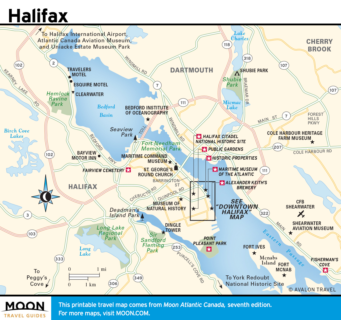
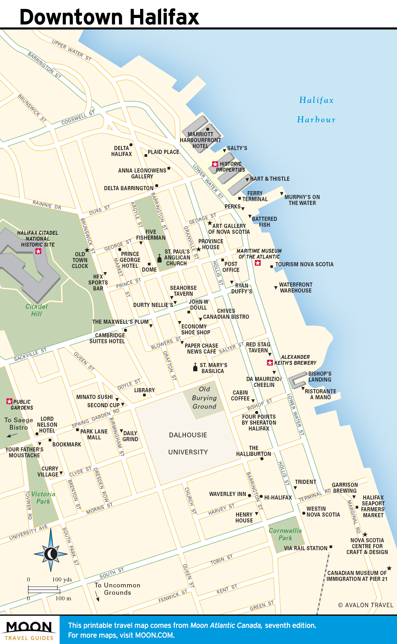
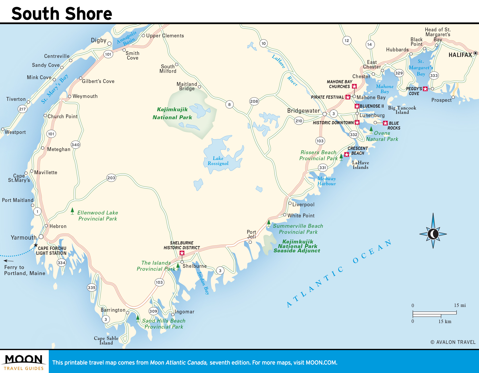
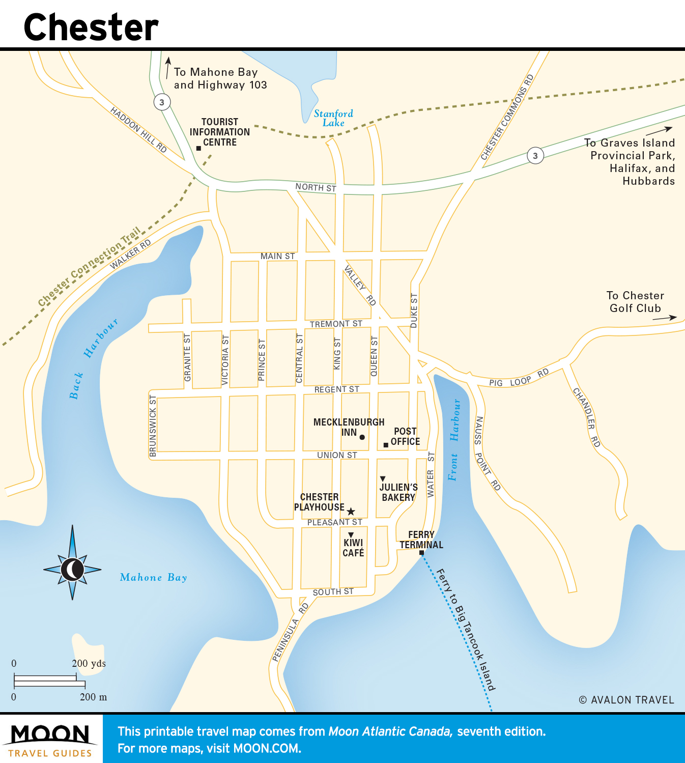
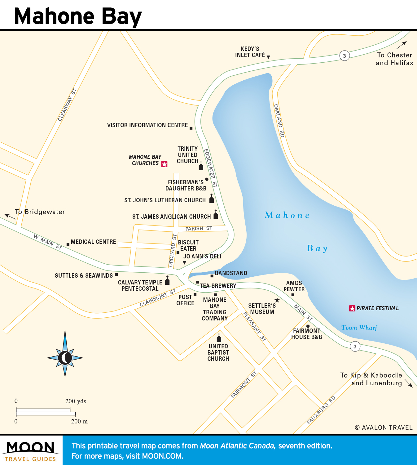
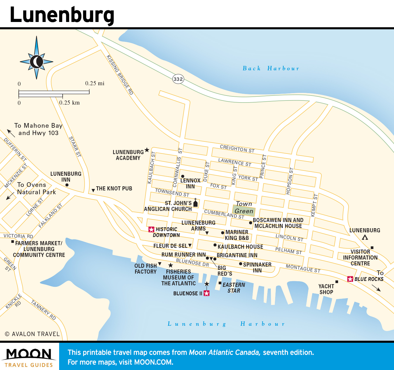
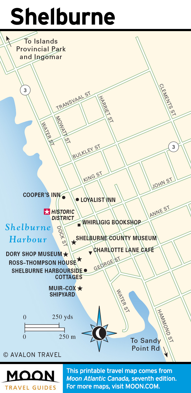
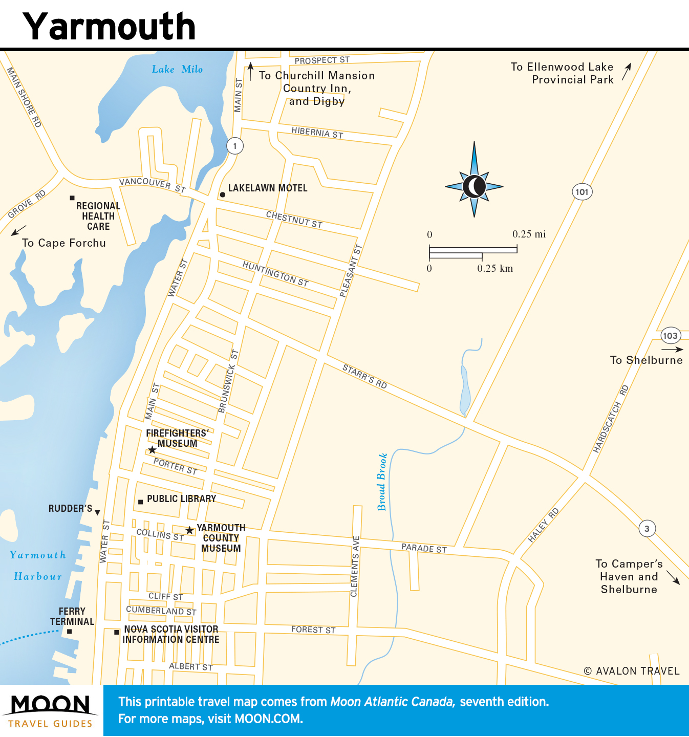
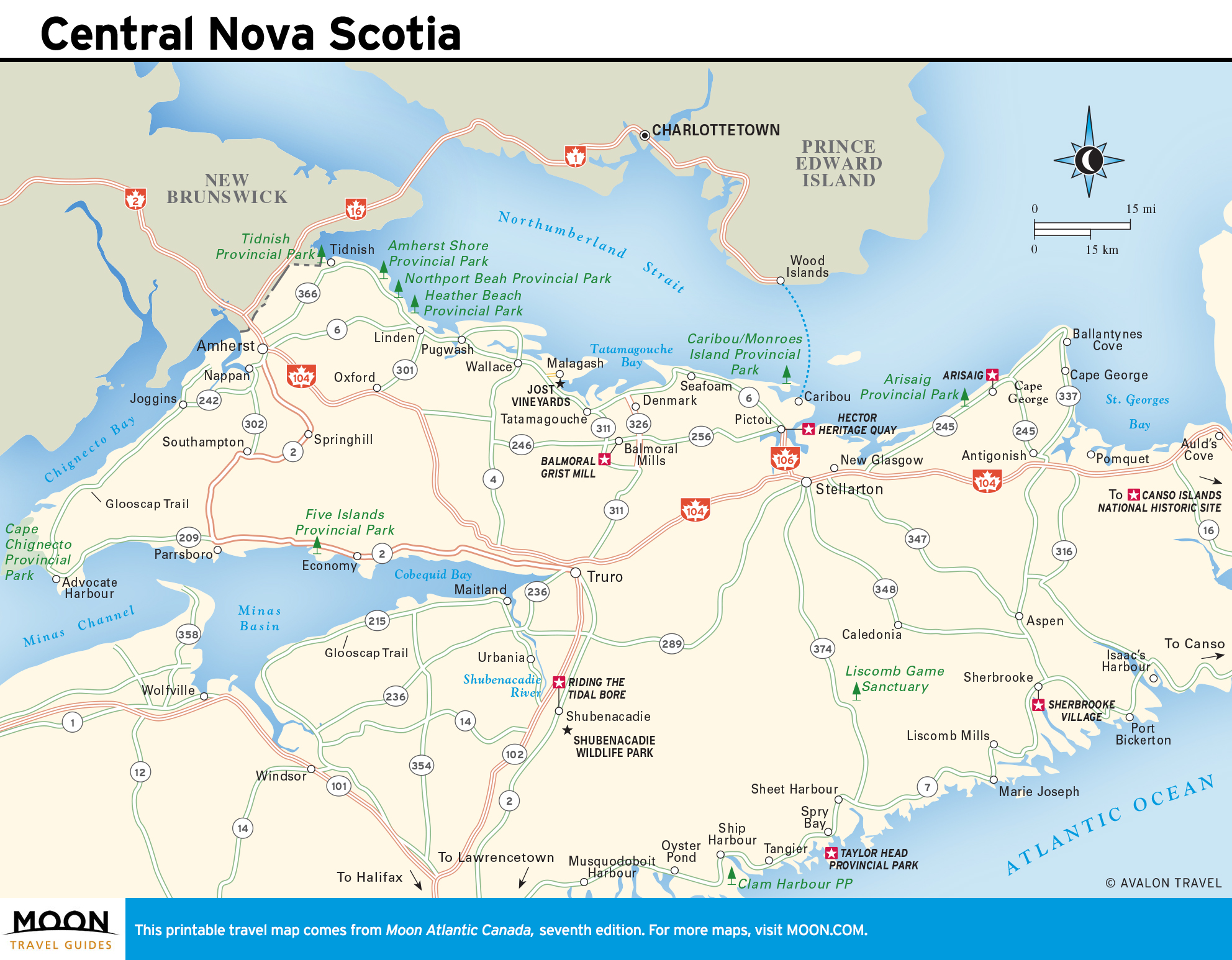
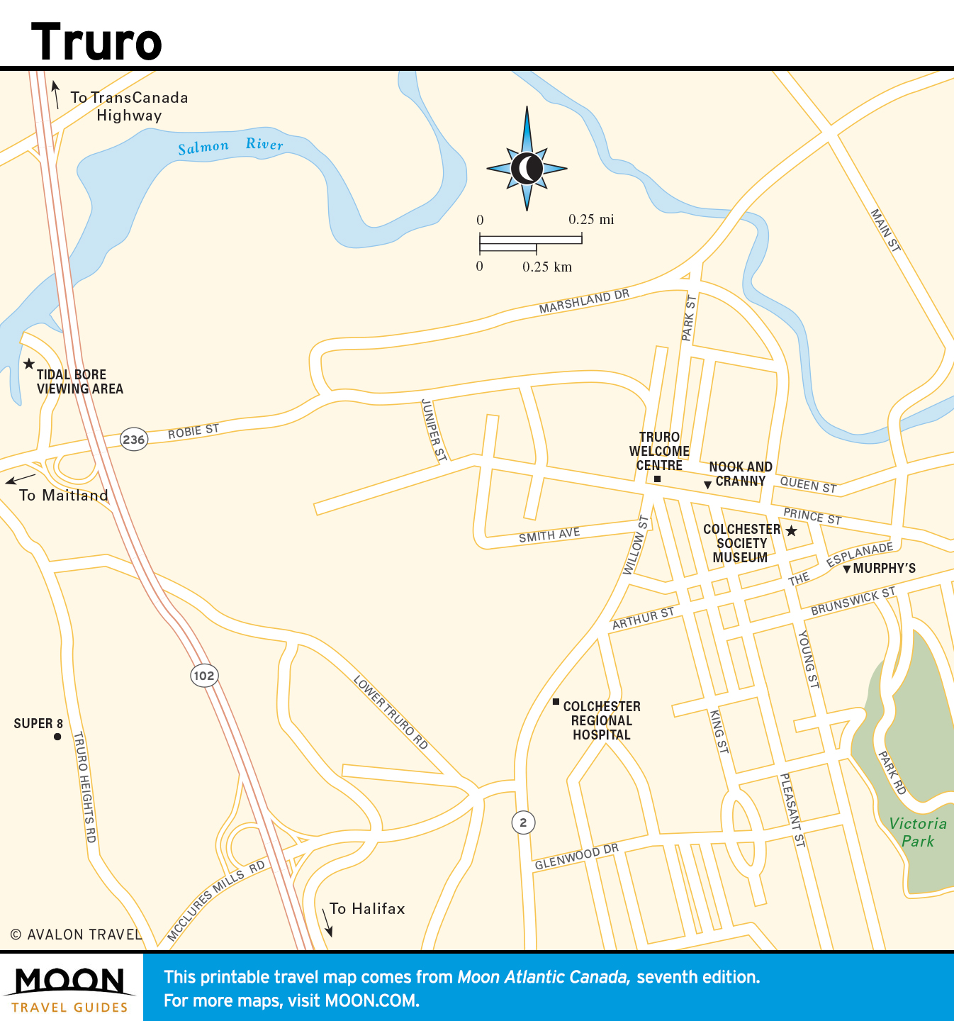
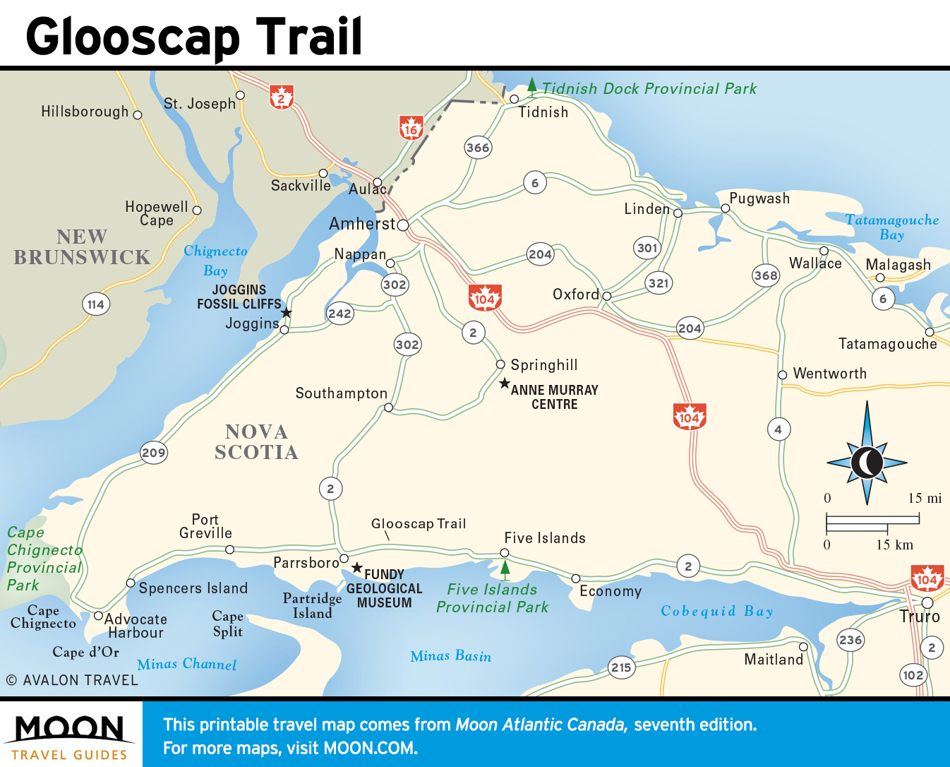
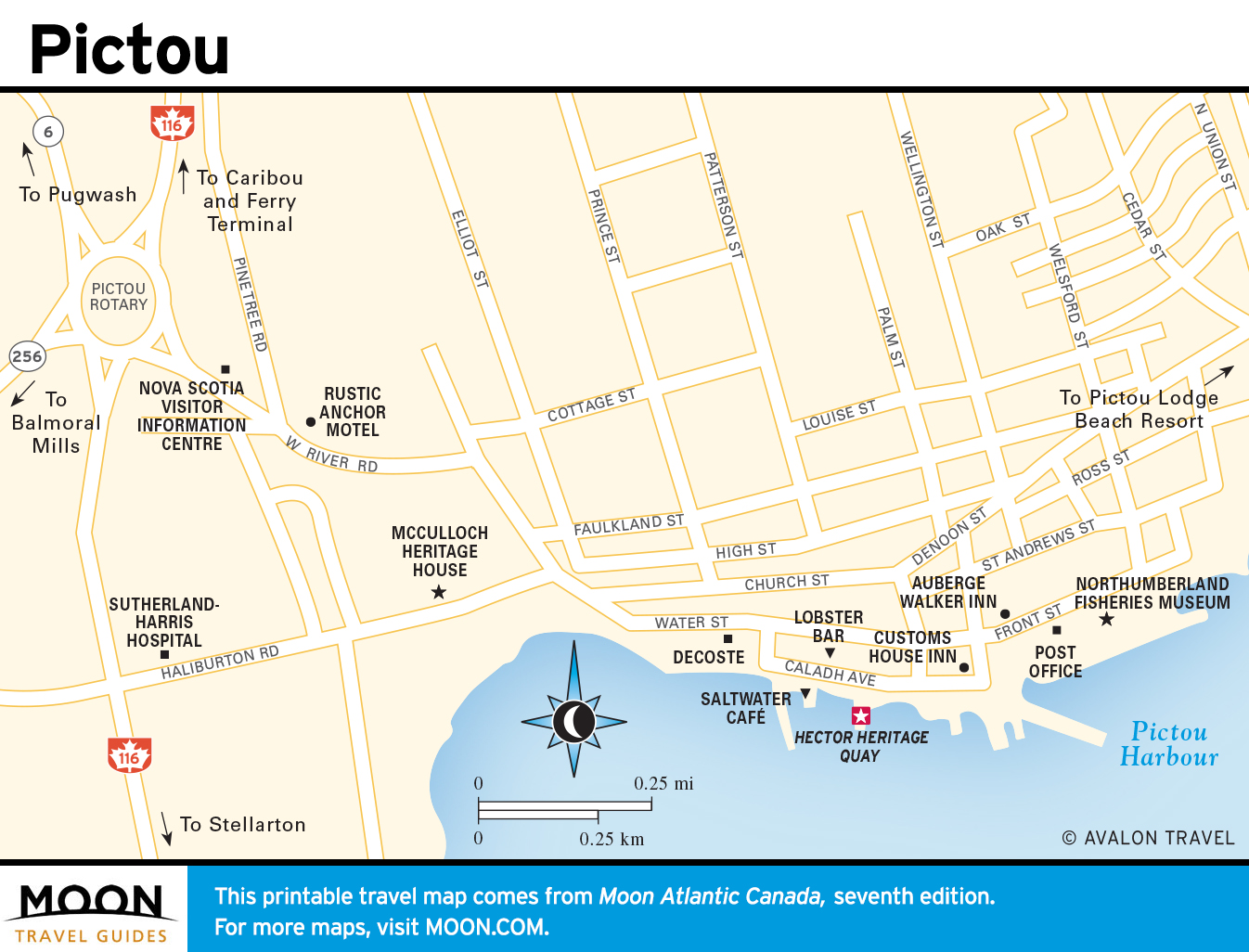
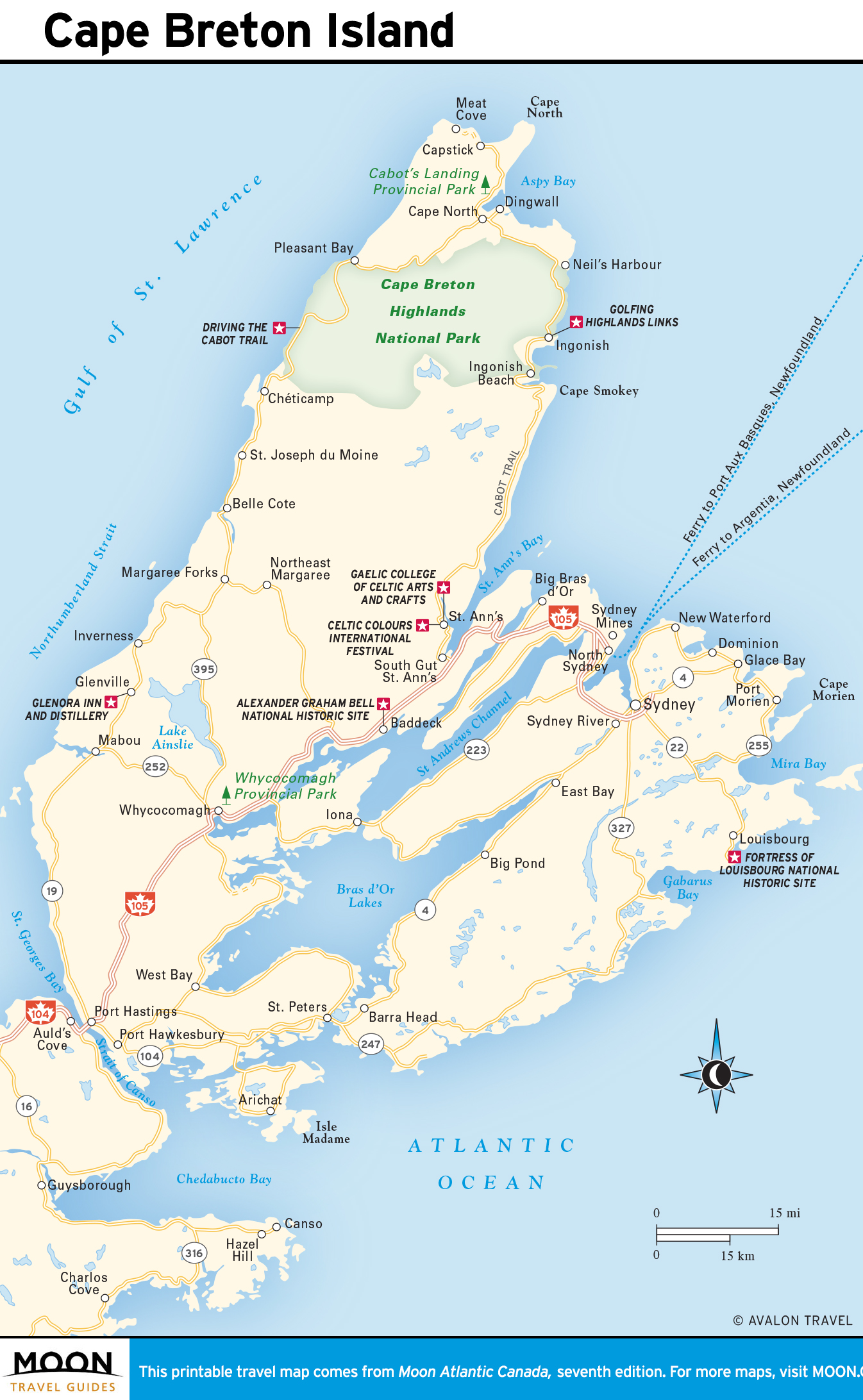
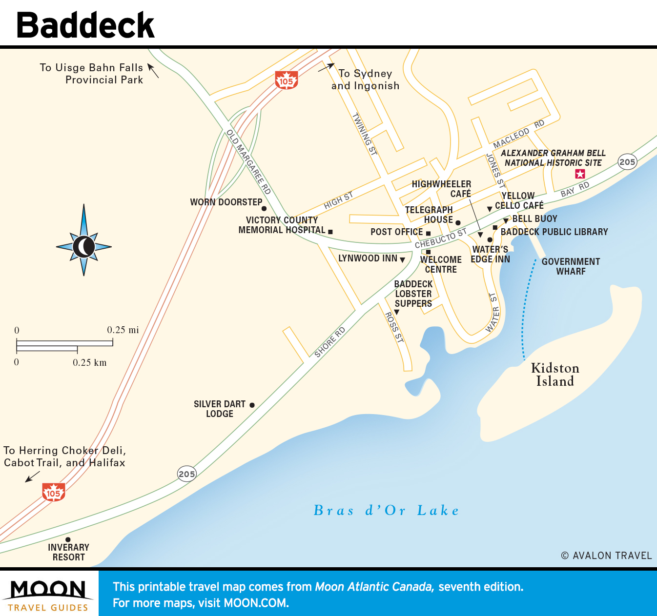
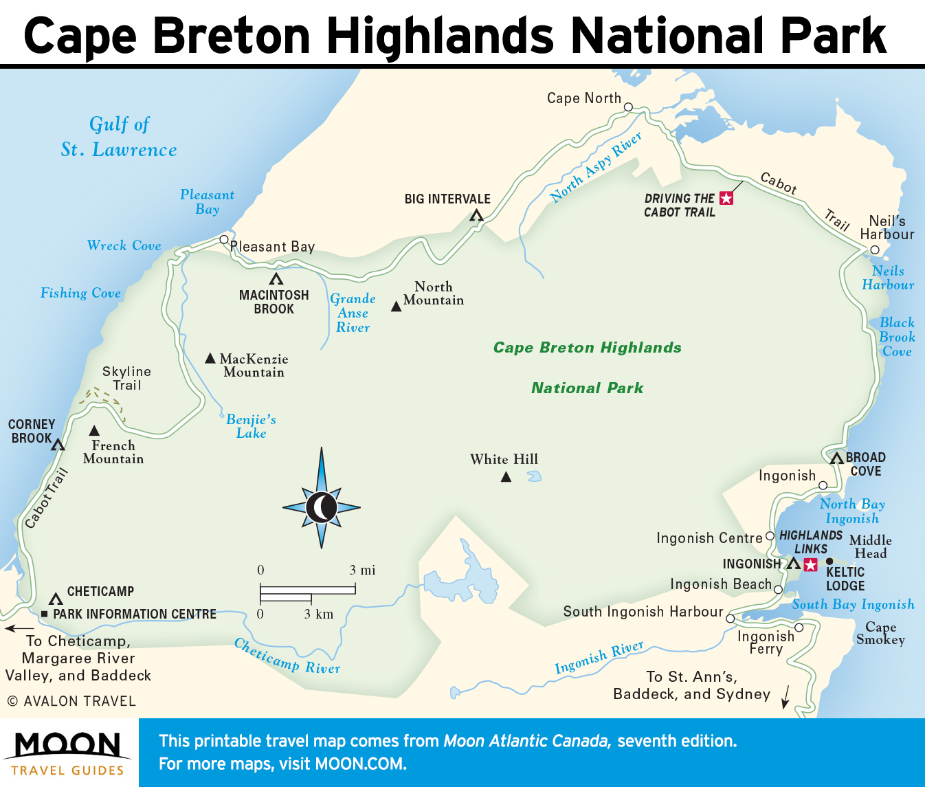
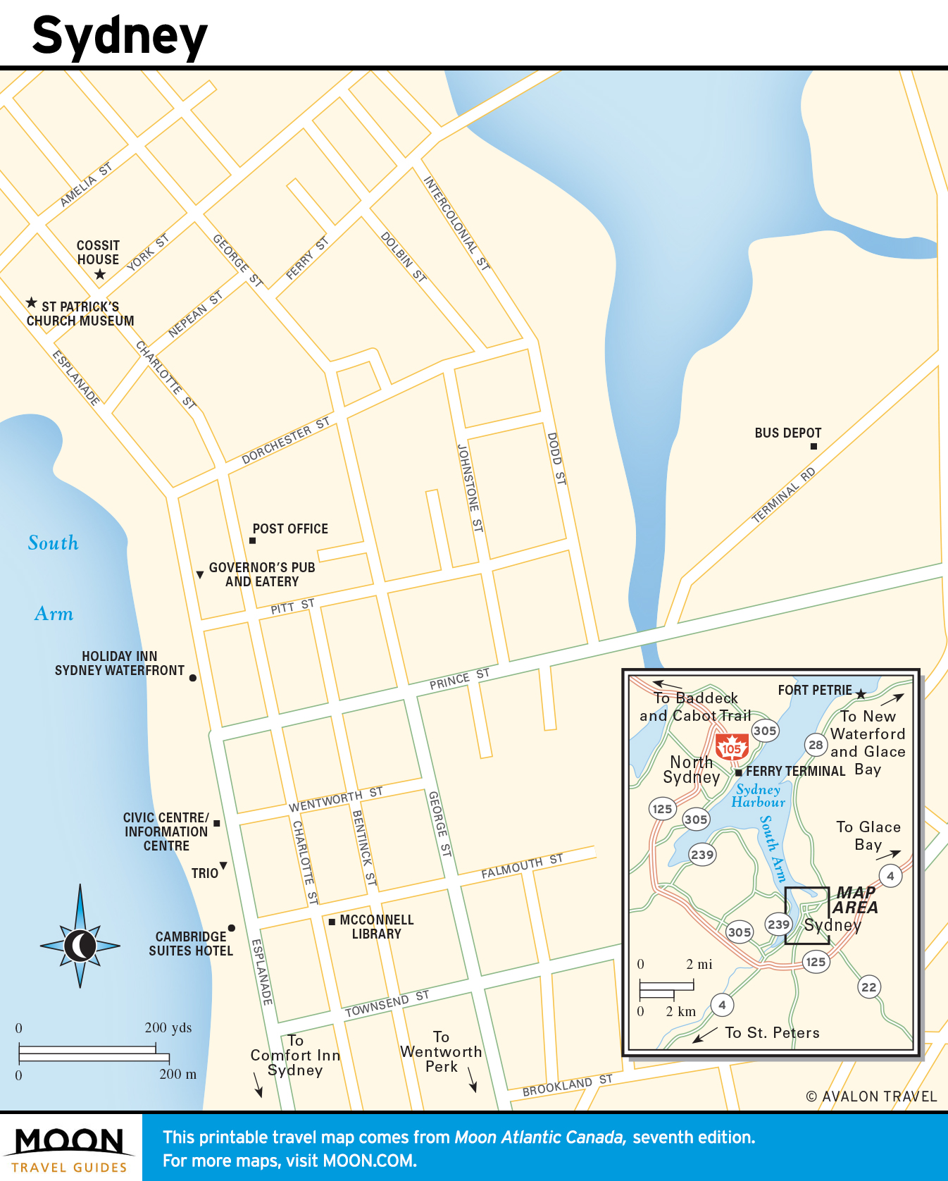
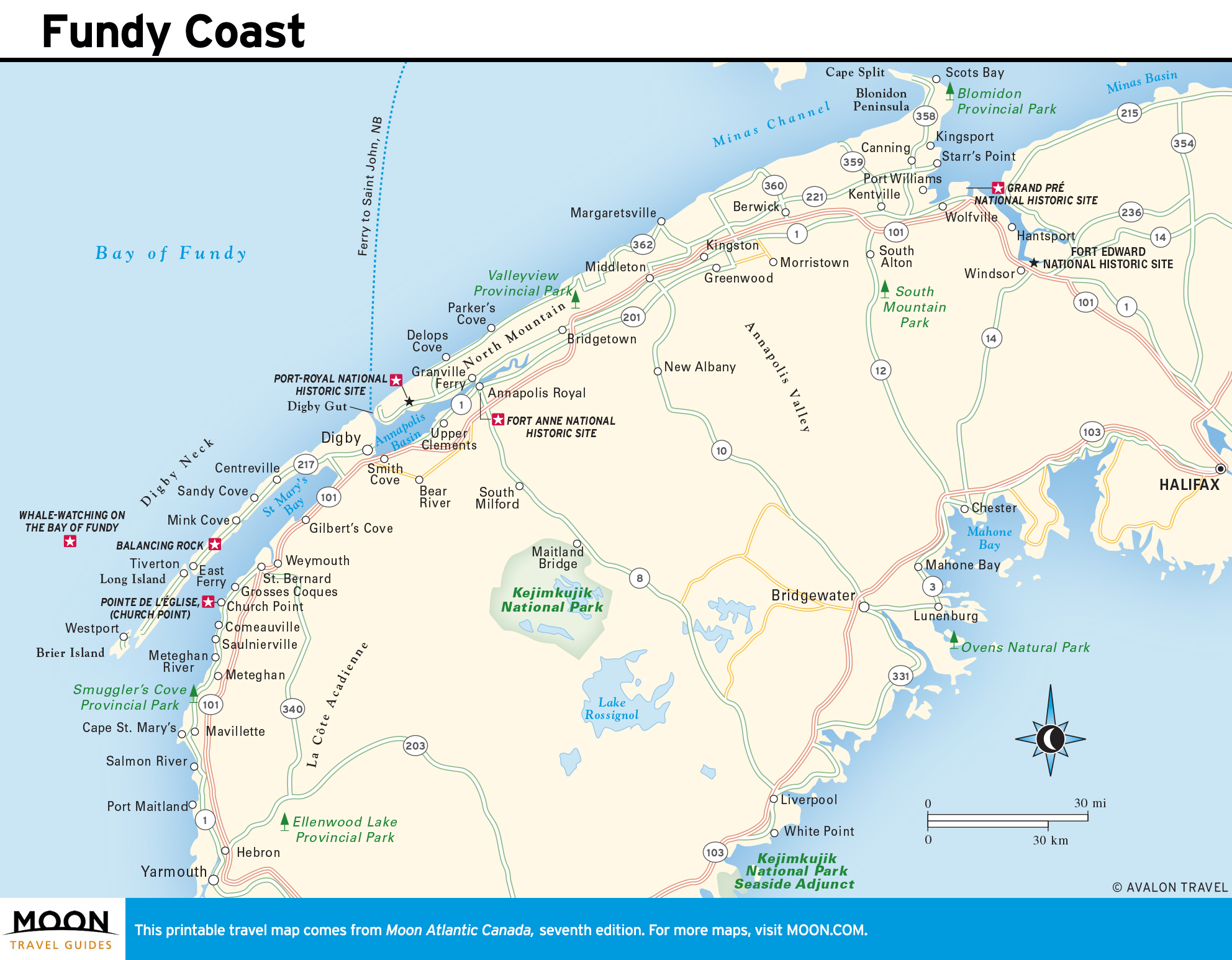
Nova Scotia
Nova Scotia typifies Atlantic Canada, with a dramatic, 7,459-kilometer-long coastline notched with innumerable coves and bays holding scores of picturesque fishing villages. It would be easy to spend an entire vacation exploring Nova Scotia, yet still leave feeling you hadn’t seen everything.
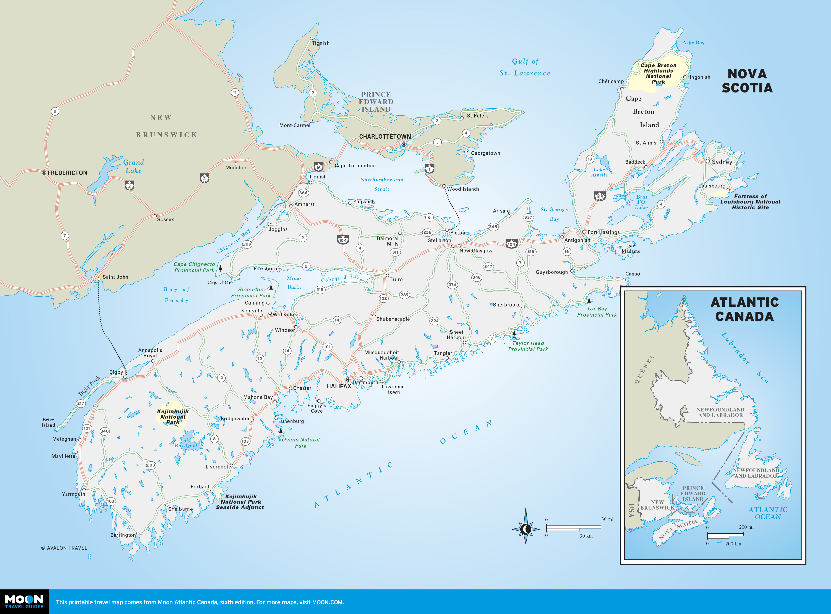

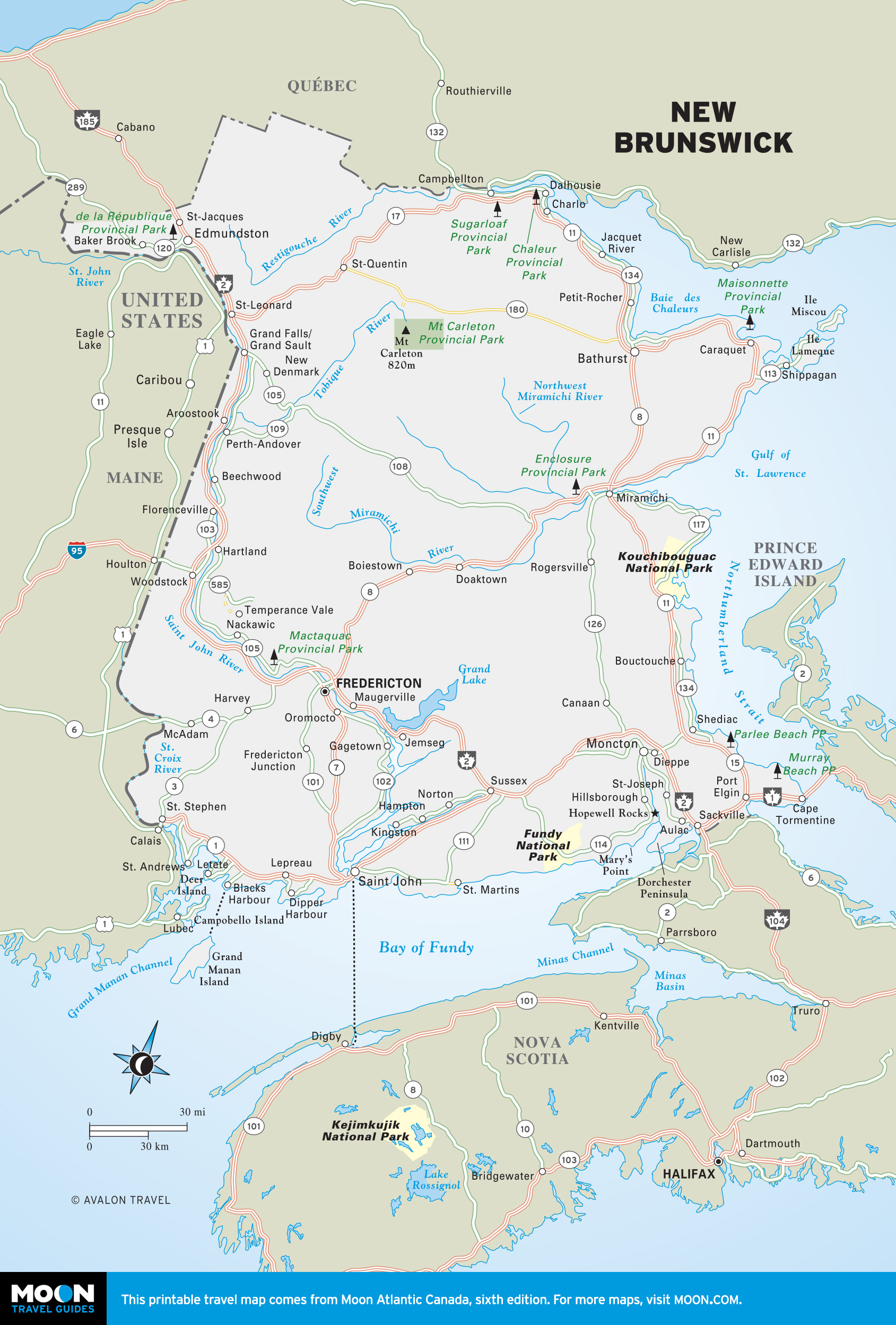
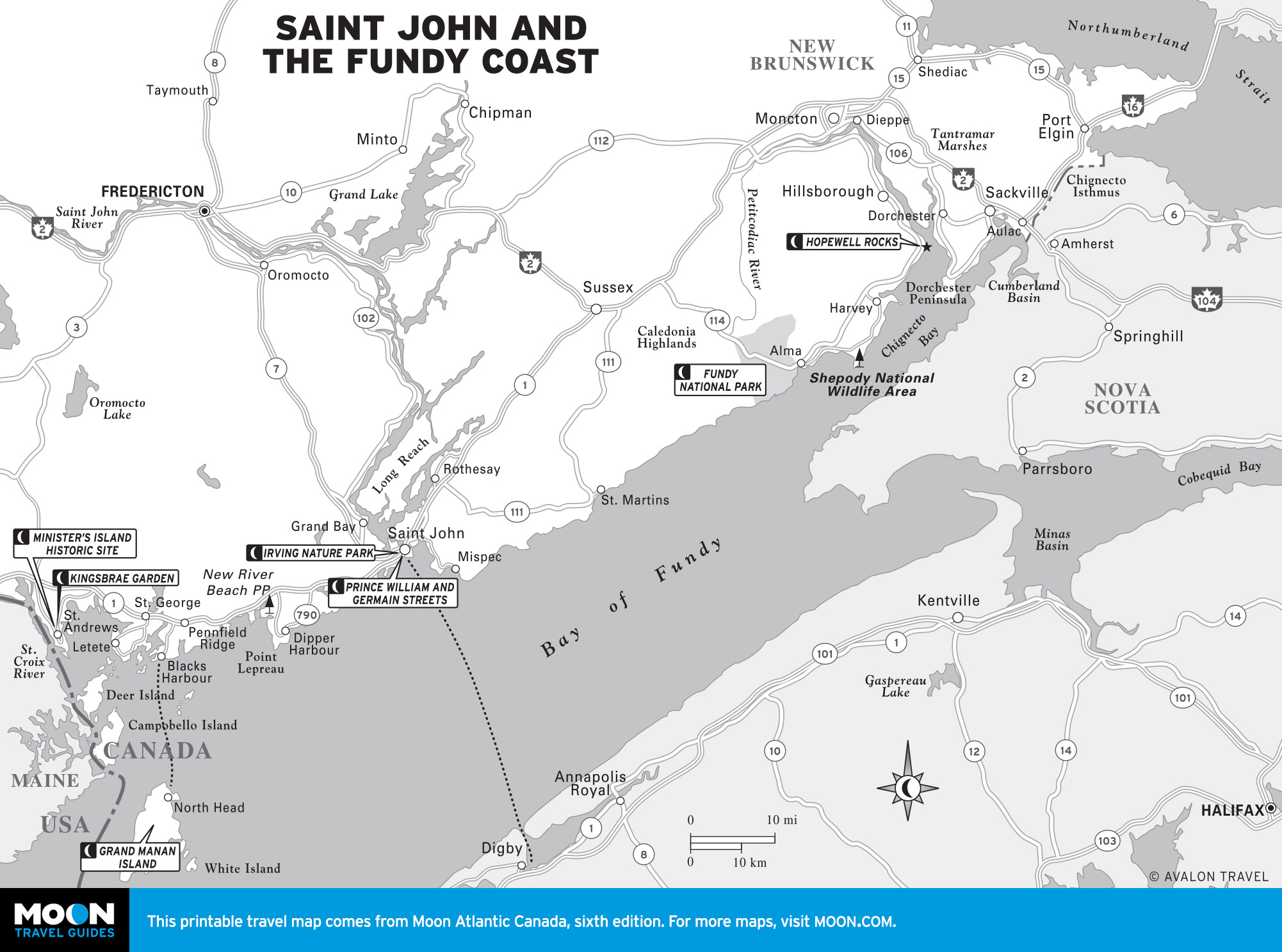
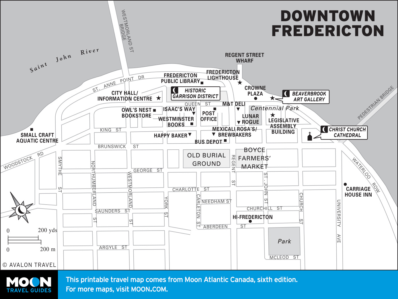
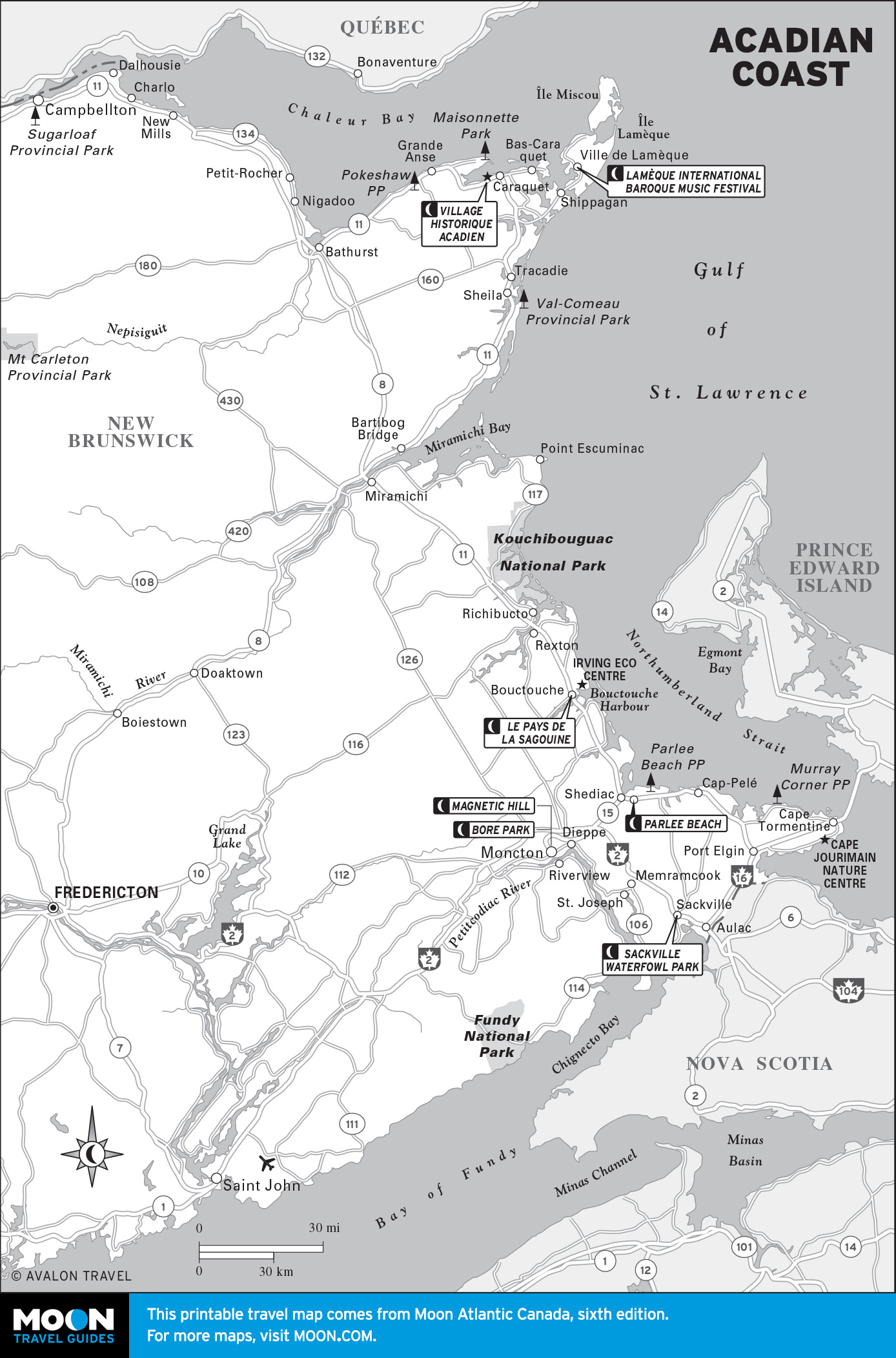
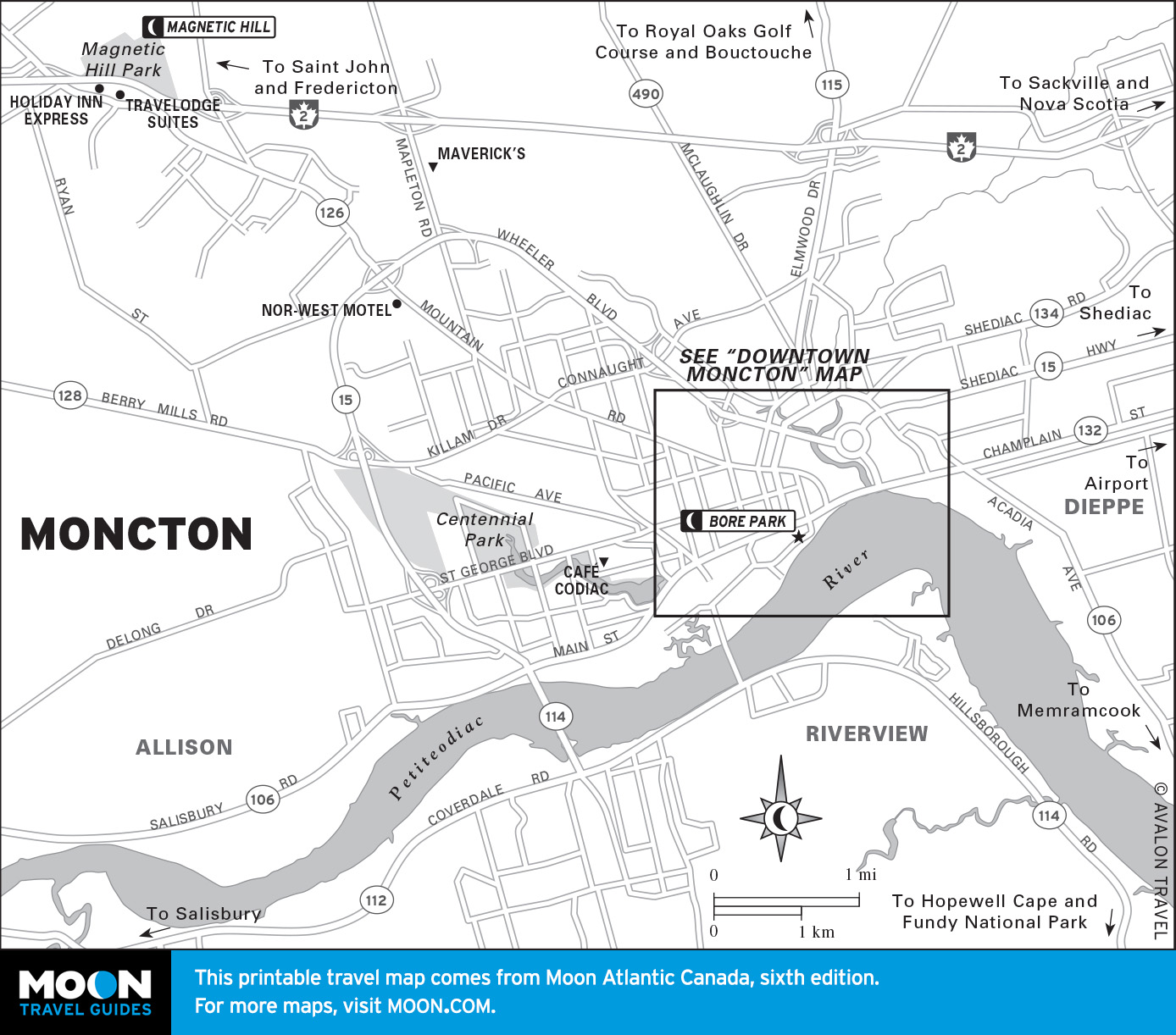
New Brunswick
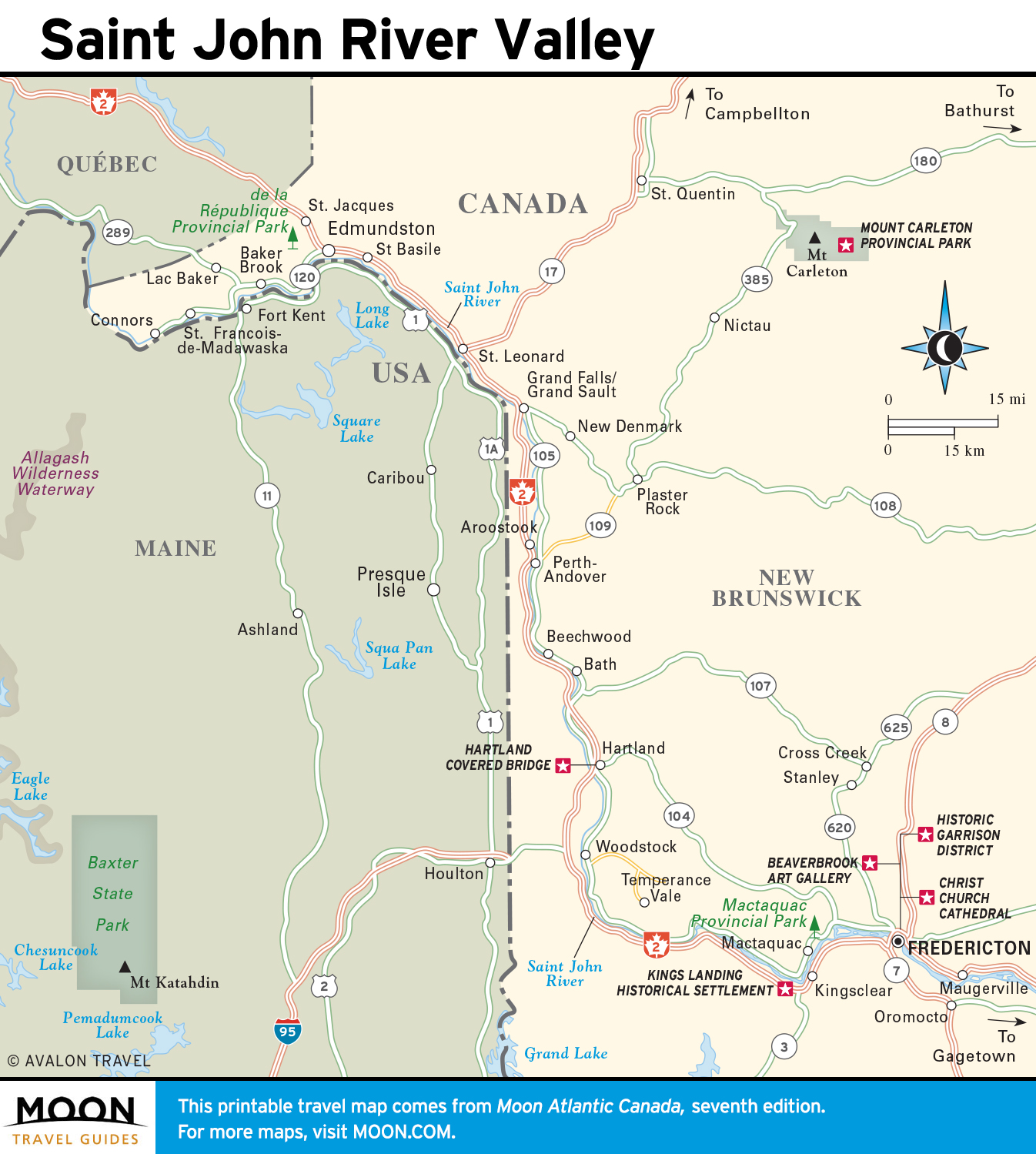
New Brunswick is the largest of the Maritime provinces, but is the least known to outsiders. Although the province is mostly forested, it is its coastline and fertile Saint John River valley that attract the most attention.

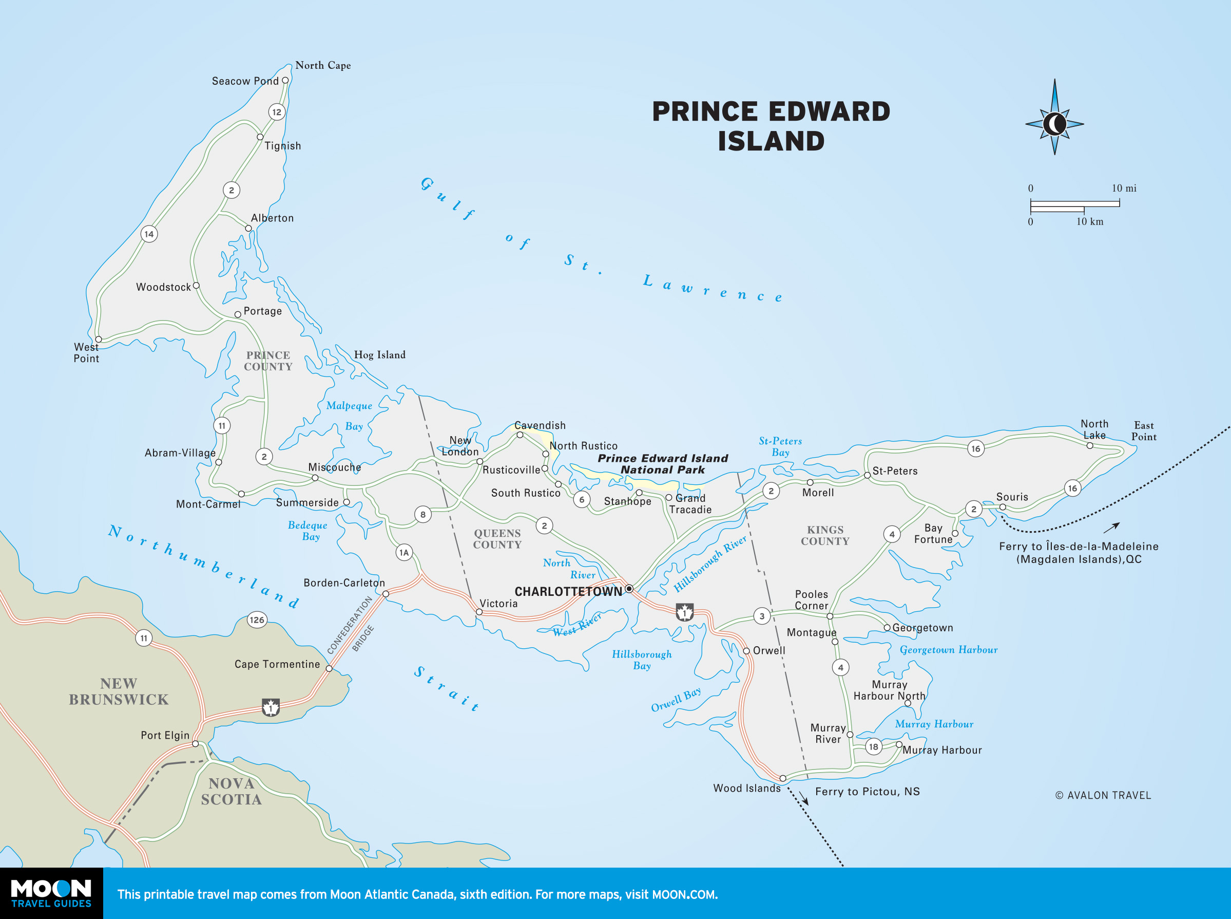
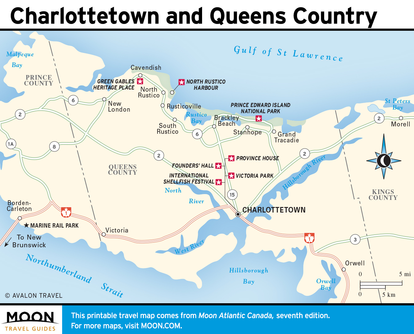
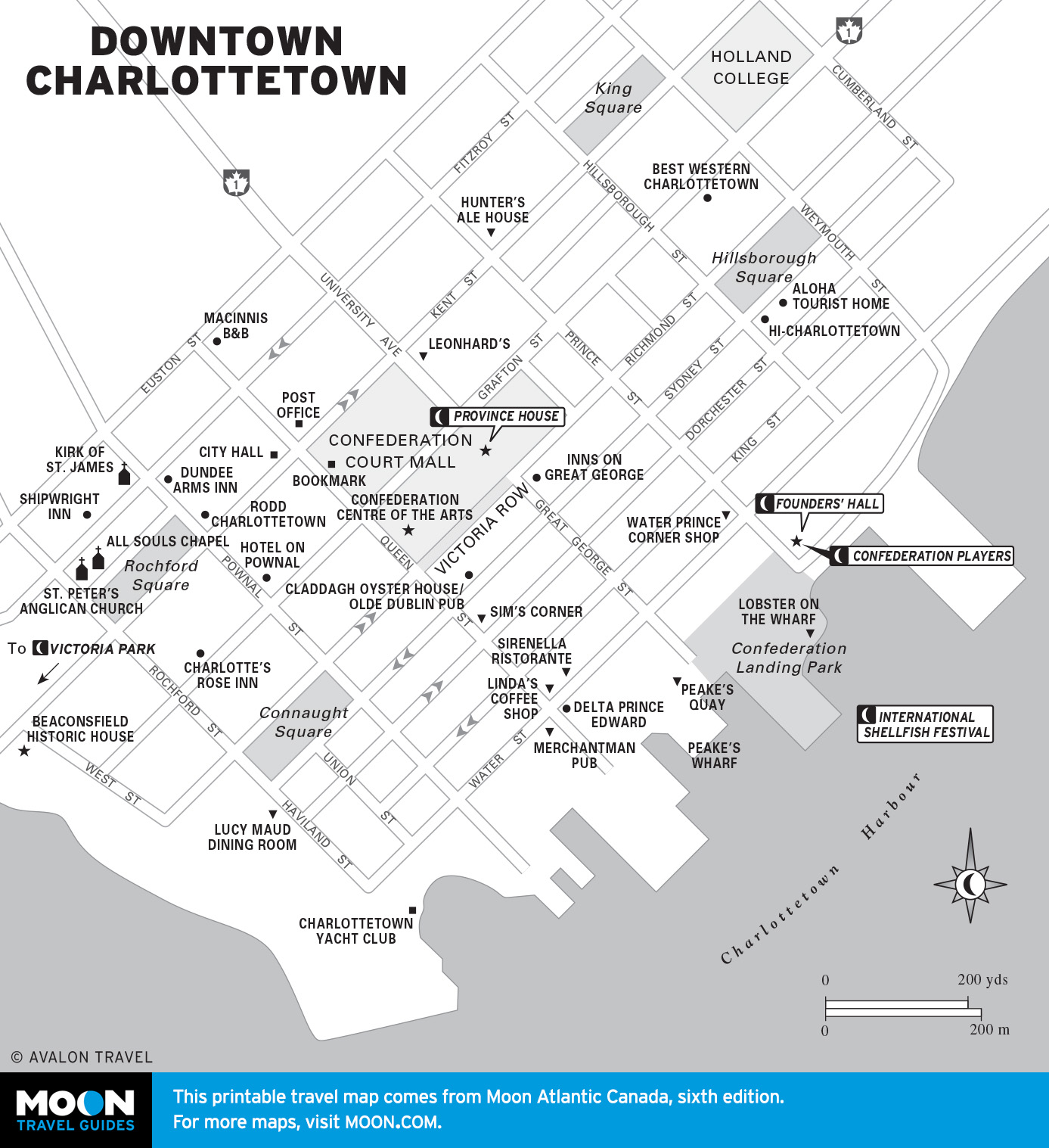
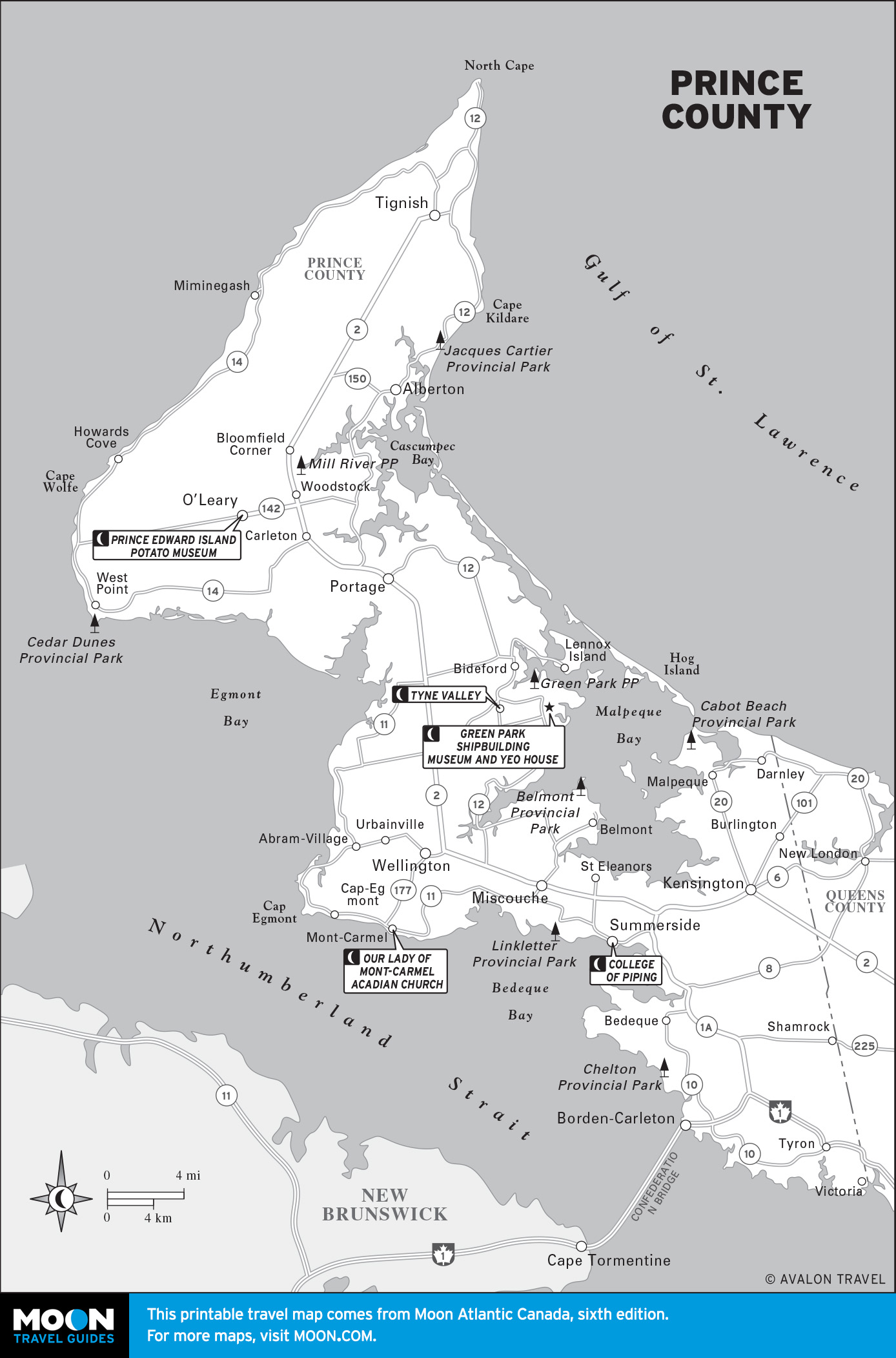
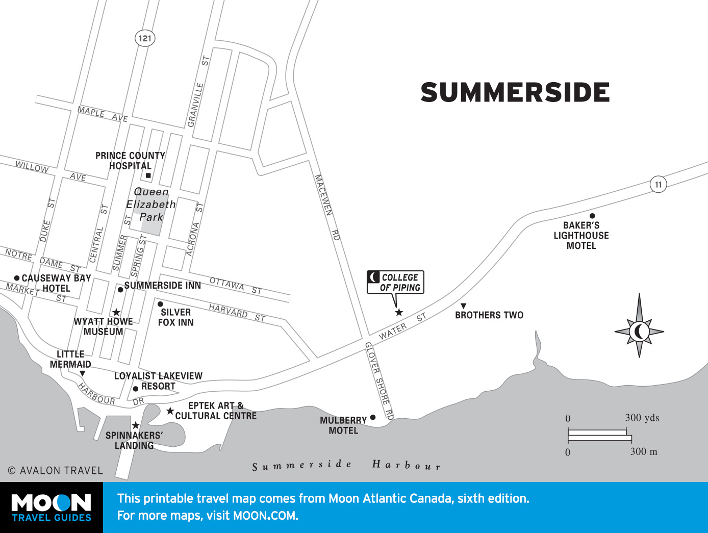
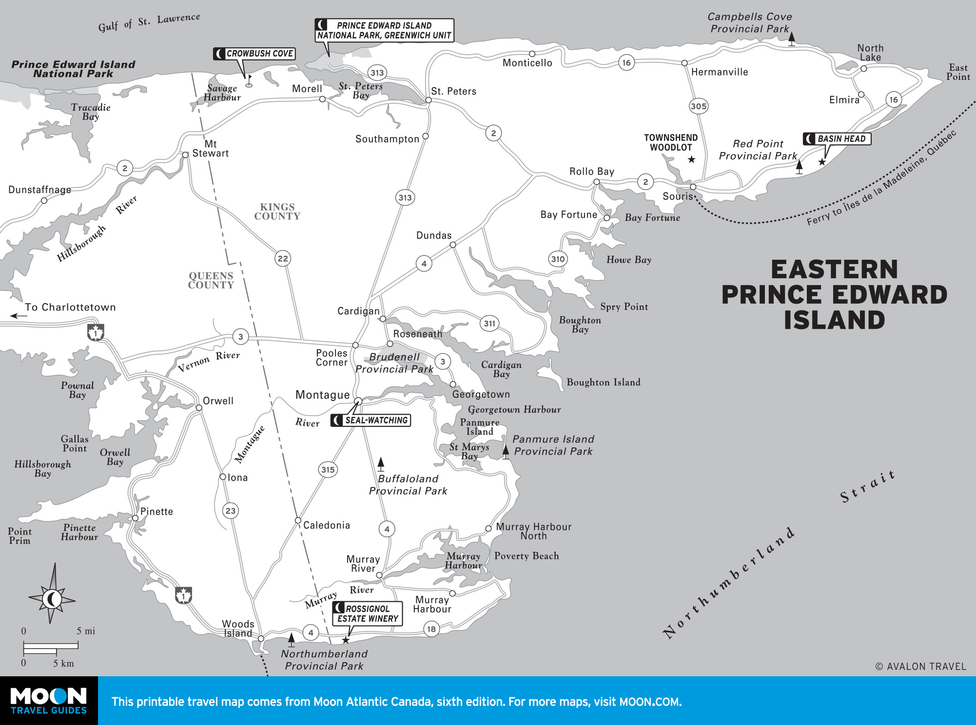
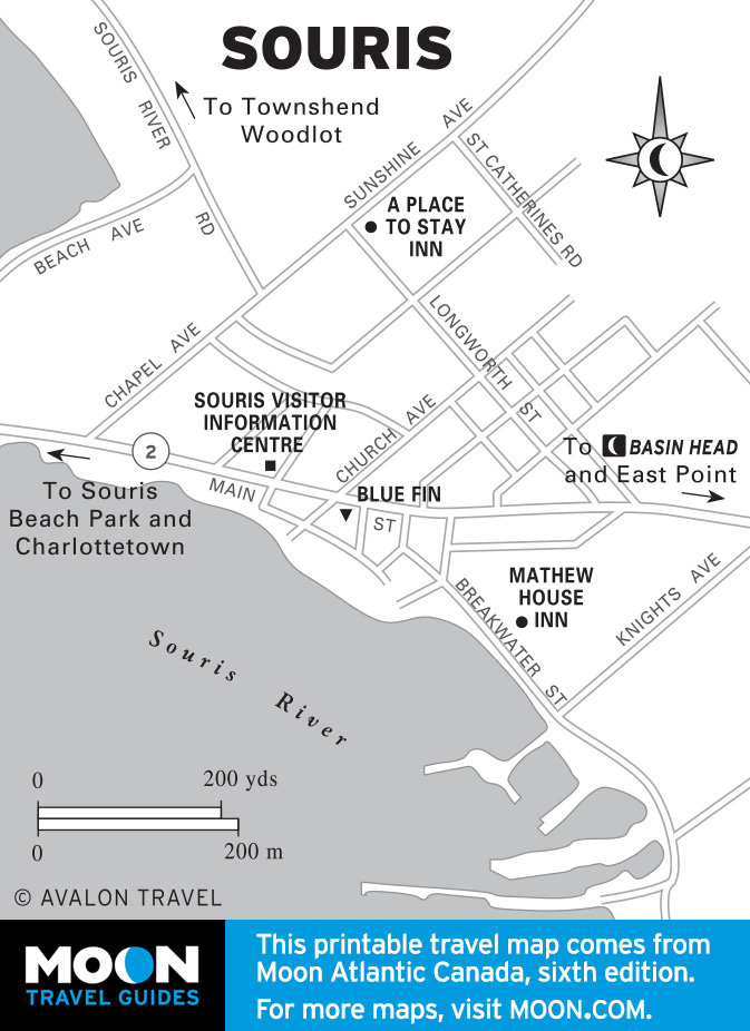
Prince Edward Island
Little PEI ranks as Canada’s smallest province, as well as its most densely populated, most cultivated, most ribboned with roads, and most bereft of original wilderness. PEI also has the country’s smallest provincial capital— Charlottetown, with a population of just 33,000. Tourism revolves around Cavendish, but the island’s low-key charm is found elsewhere, along rural roads that end at the ocean and drift through neat villages that have changed little over