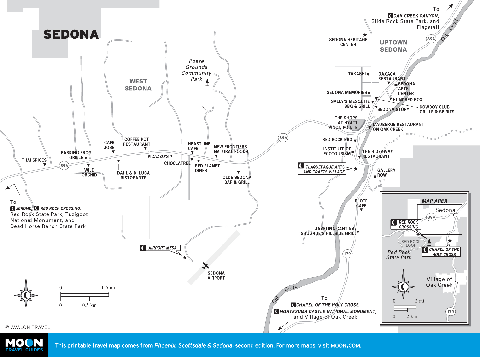
Arizona & the Grand Canyon

These free, printable travel maps of Arizona and the Grand Canyon are divided into three regions:

Explore Arizona and its vibrant cities with these helpful travel maps. Ensure you have the newest travel maps from Moon by ordering the most recent edition of our travel guides to Arizona and the Grand Canyon.


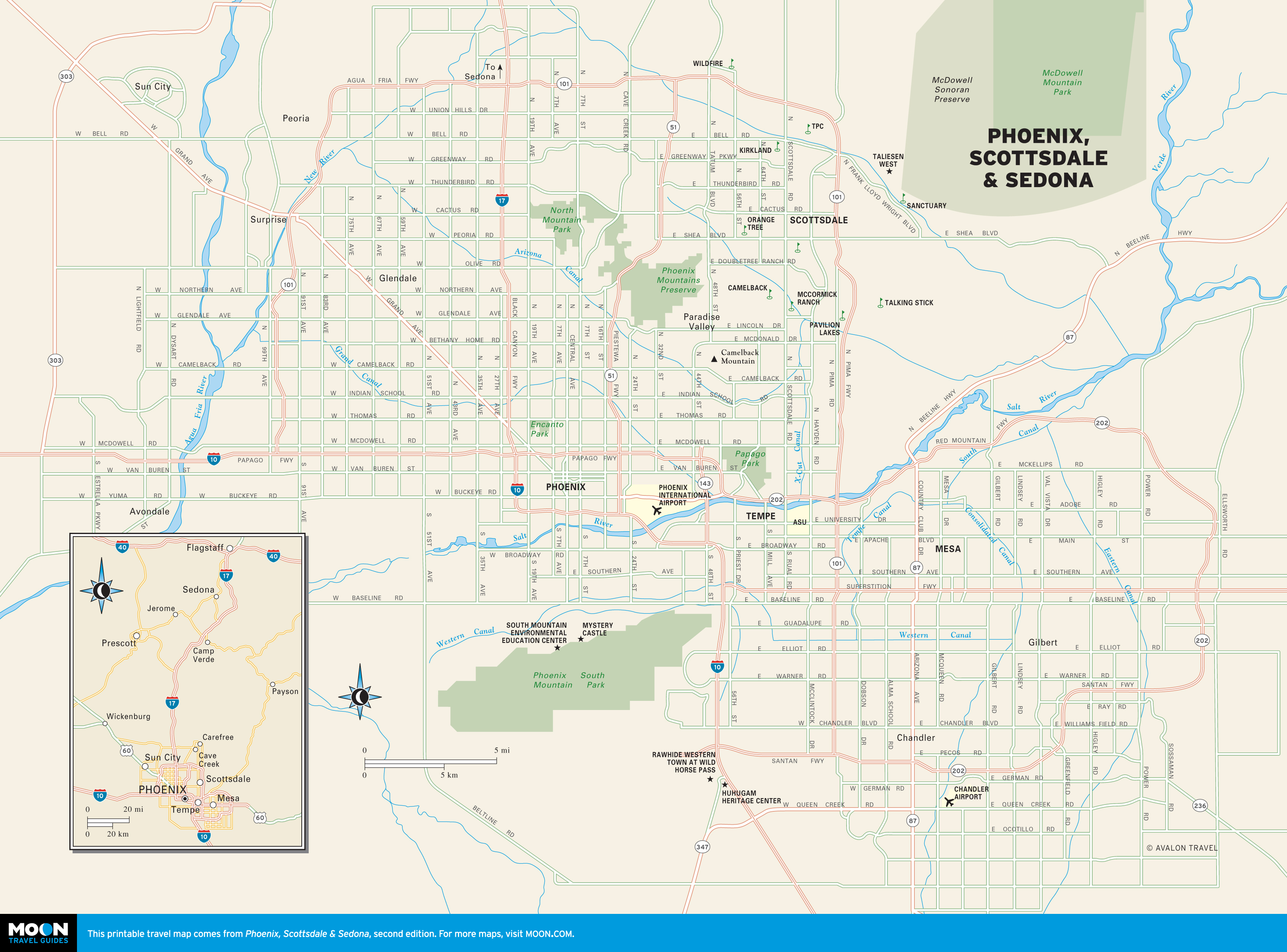
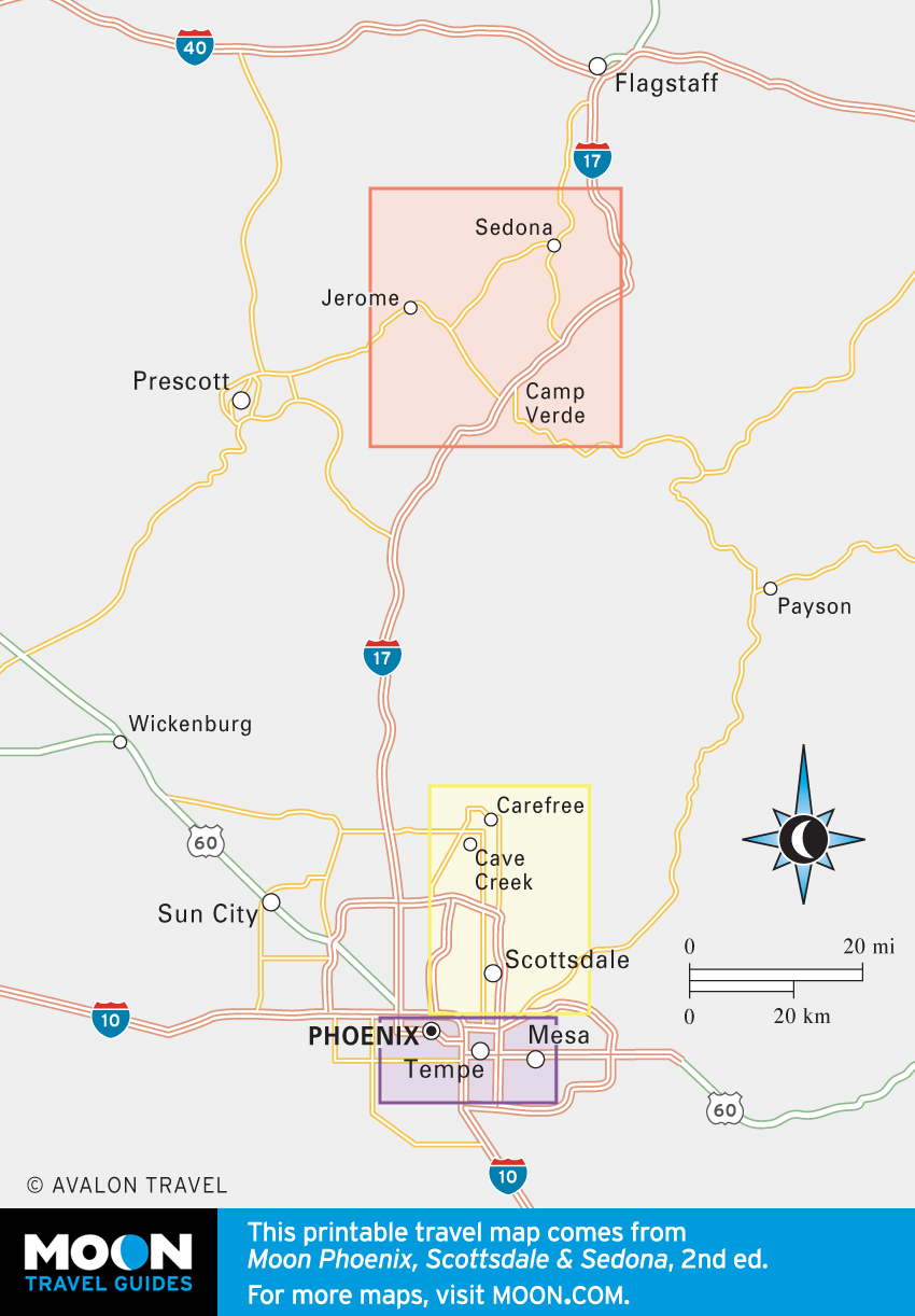
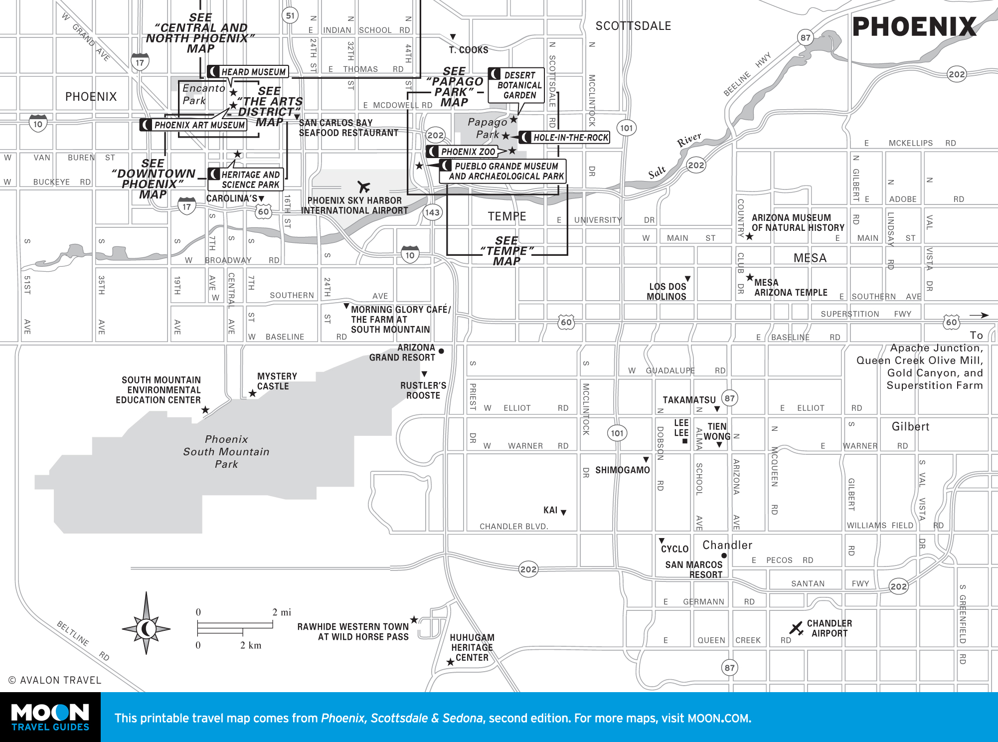
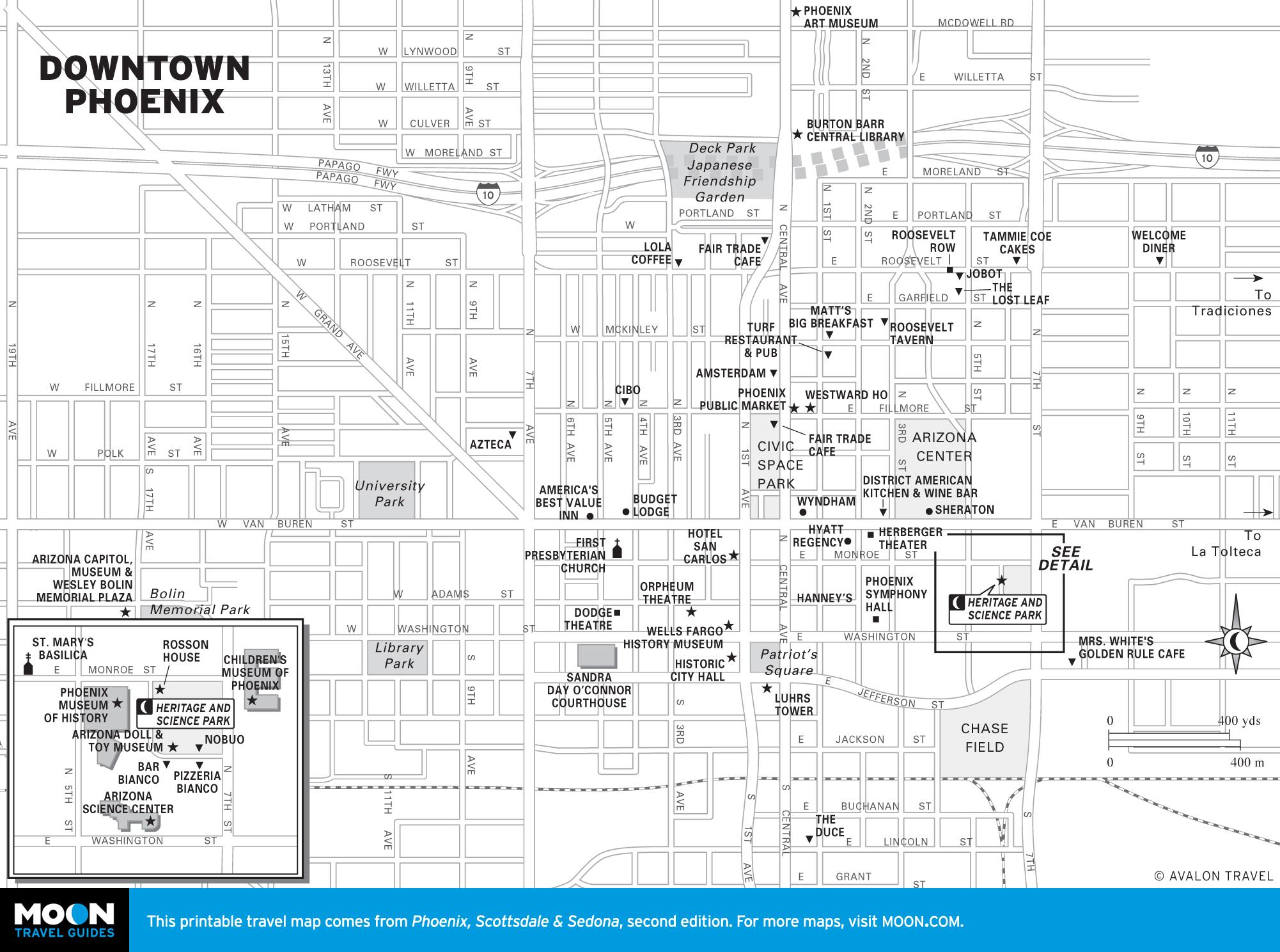
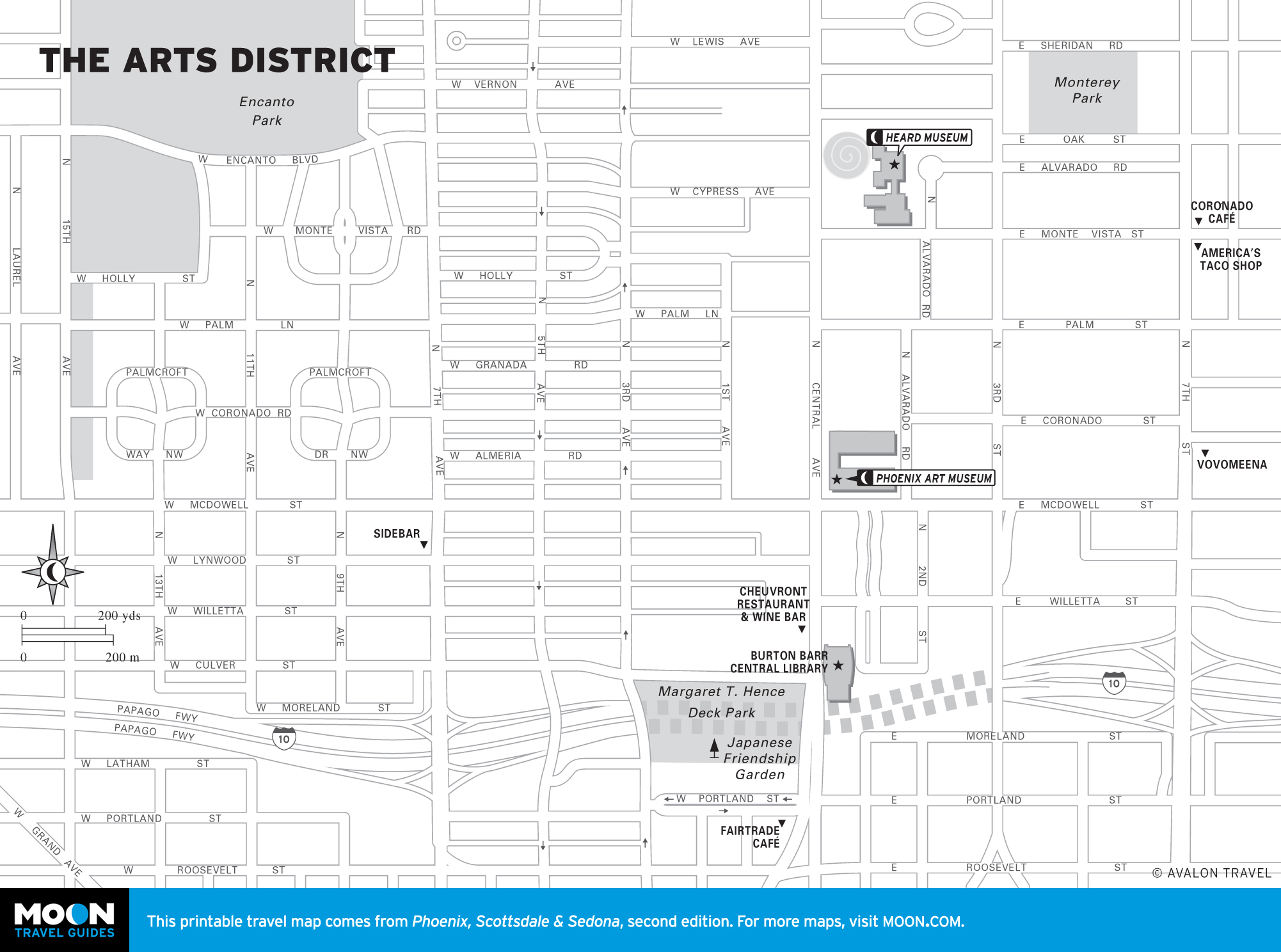
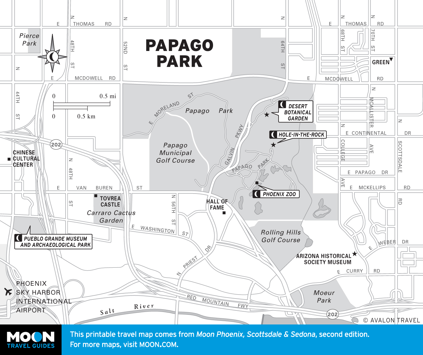
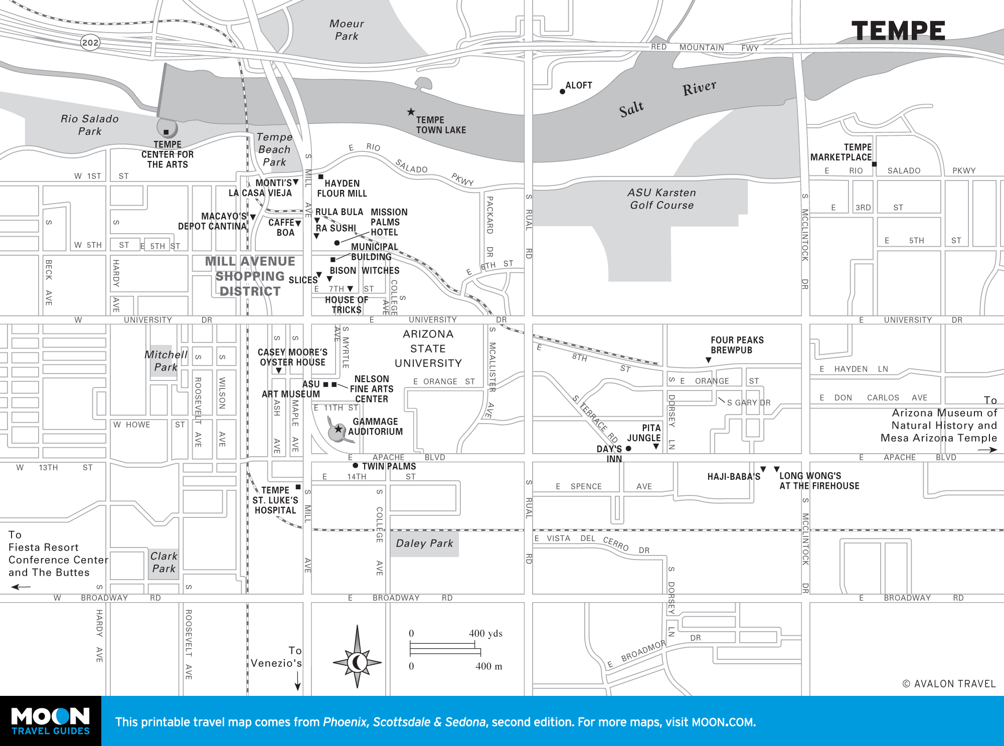
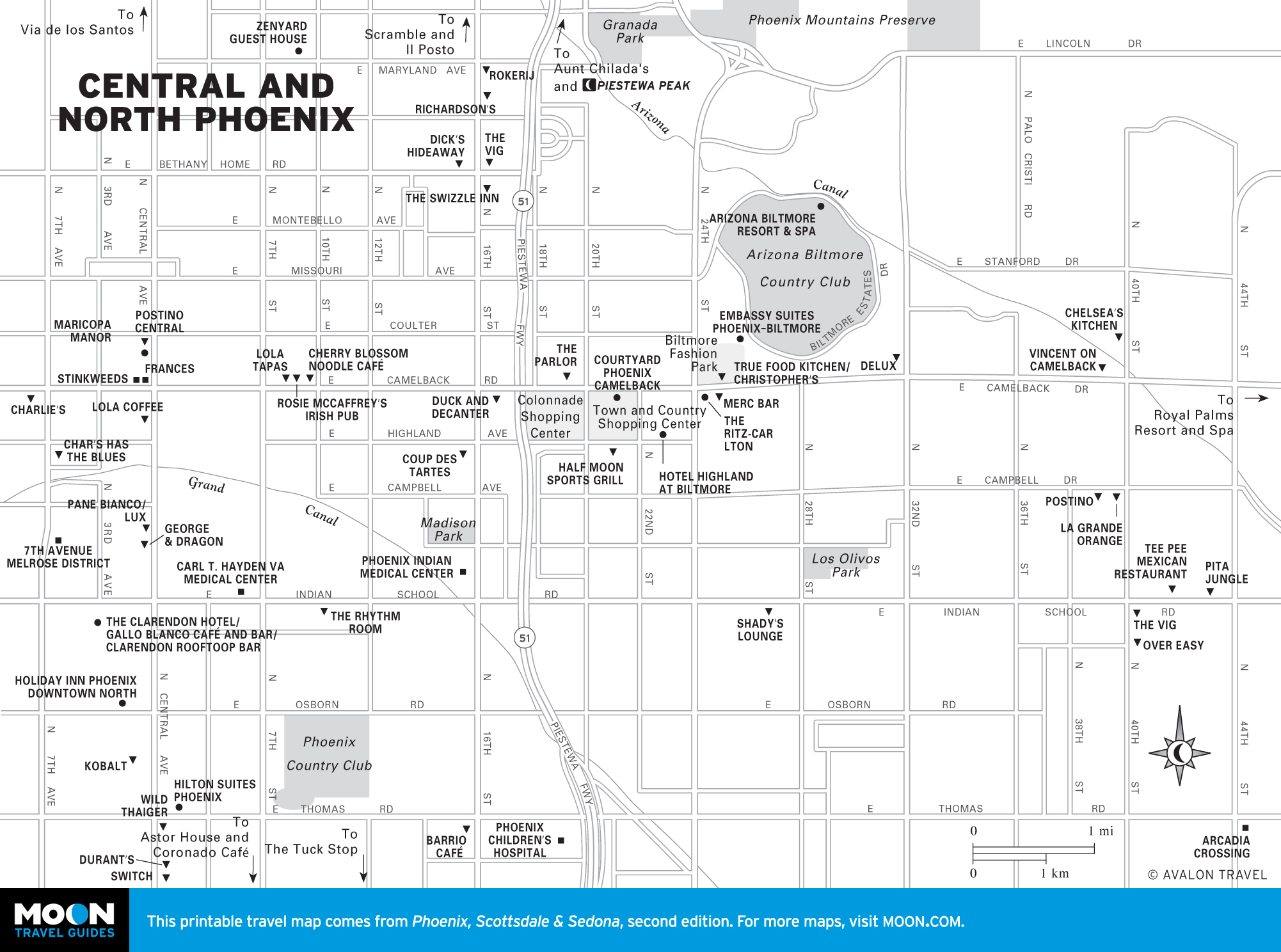
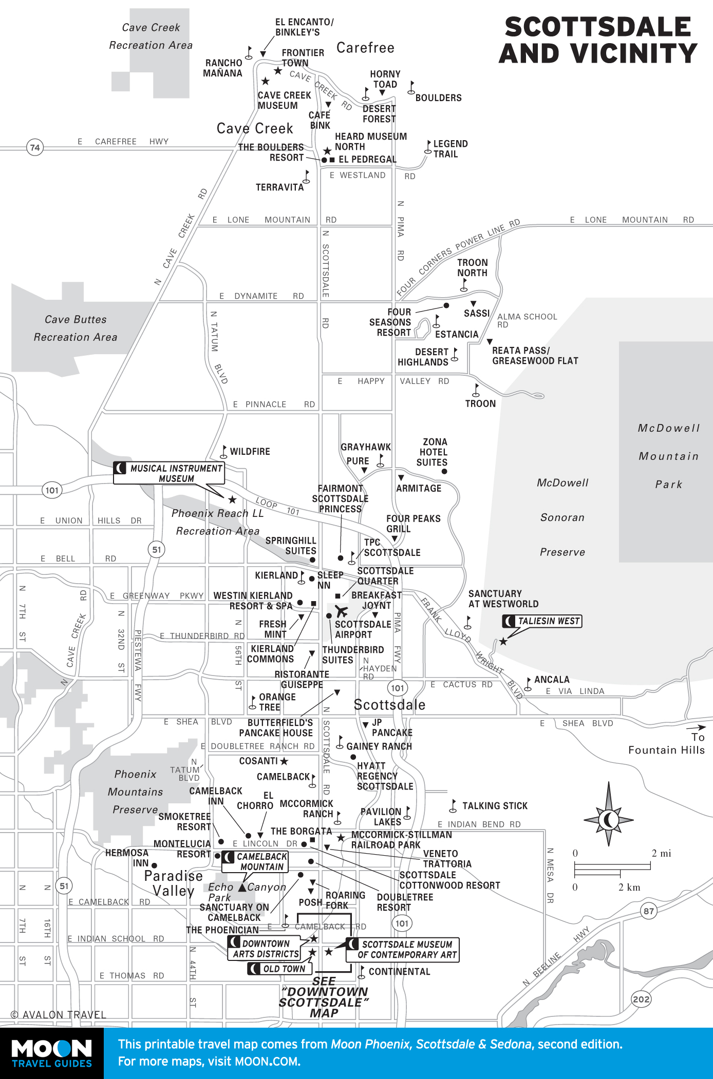
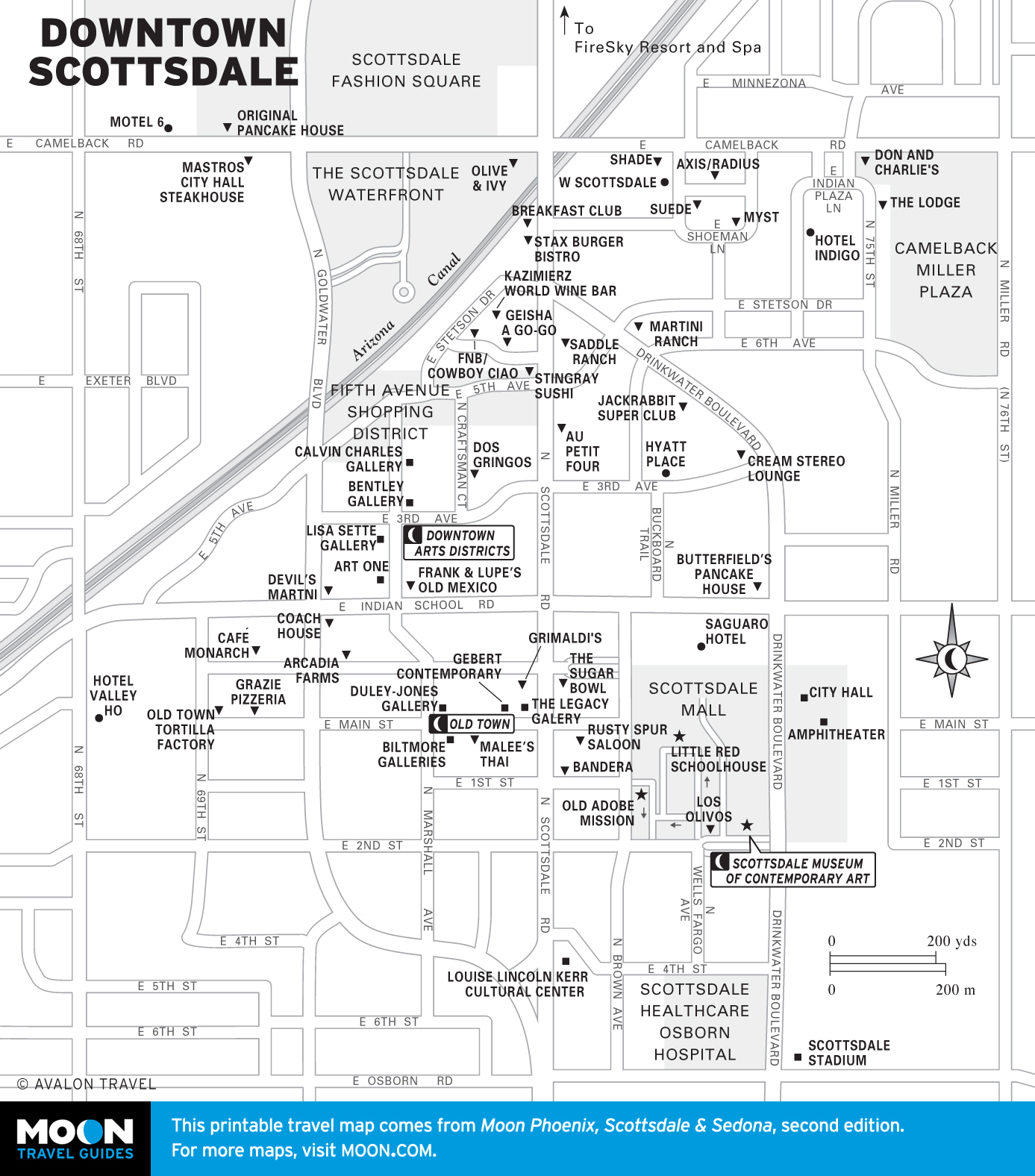
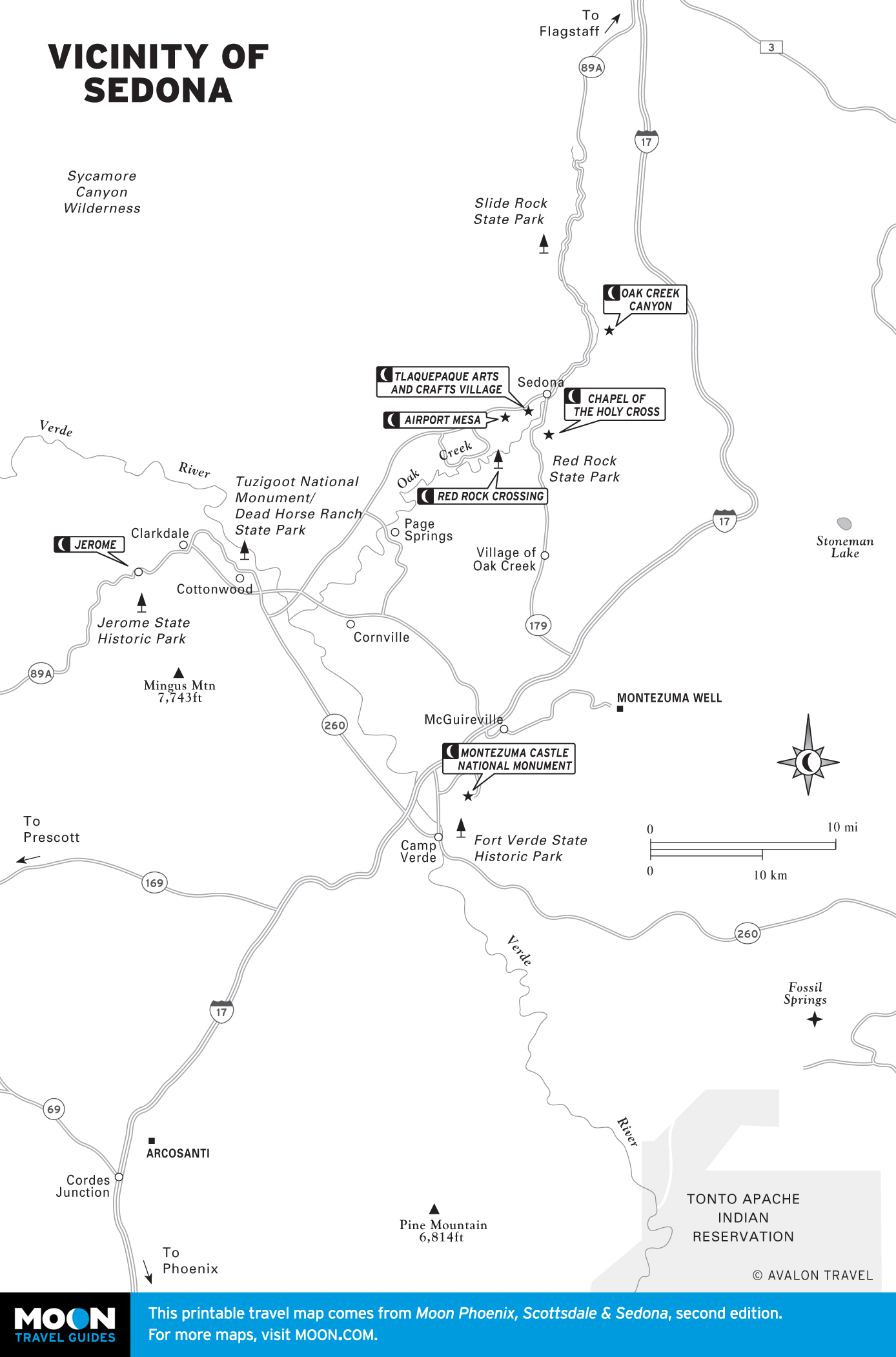
Travel Maps of the Valley of the Sun

Phoenix, Scottsdale, and surrounding communities—together known as the Valley of the Sun—make up one of the country’s fastest growing metro areas, enticing new residents with abundant sunshine, mountain vistas, and a resort lifestyle.

Travel map of Phoenix, Scottdale & Sedona, Arizona
Phoenix, Scottdale & Sedona
Travel maps of Phoenix, Scottsdale, and Sedona by region
Travel maps of Phoenix, Scottsdale, and Sedona by region.
Travel map of Phoenix, Arizona
Phoenix
Travel map of Downtown Phoenix, Arizona
Downtown Phoenix
Travel map of the Arts District in Phoenix, Arizona
The Arts District in Phoenix
Travel map of Papago Park in Phoenix, Arizona
Papago Park
Travel map of Tempe, Arizona
Tempe
Travel map of the Apache Trail Scenic Loop
Apache Trail Scenic Loop
Travel map of Central and North Phoenix, Arizona
Central and North Phoenix
Travel map of Scottsdale, Arizona and Vicinity
Scottsdale and Vicinity
Travel map of Downtown Scottsdale, Arizona
Downtown Scottsdale
Travel map of Sedona Arizona
Sedona
Travel map of the Vicinity of Sedona, Arizona
Vicinity of Sedona


Get more travel maps of Arizona in our regional travel guides:


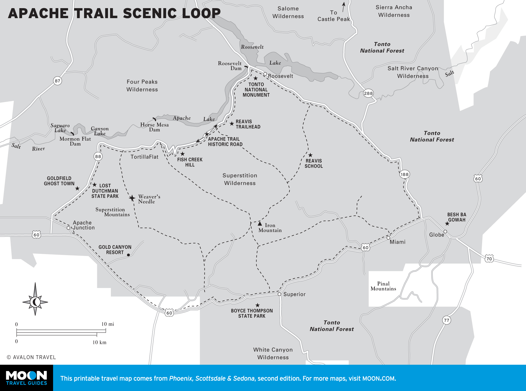
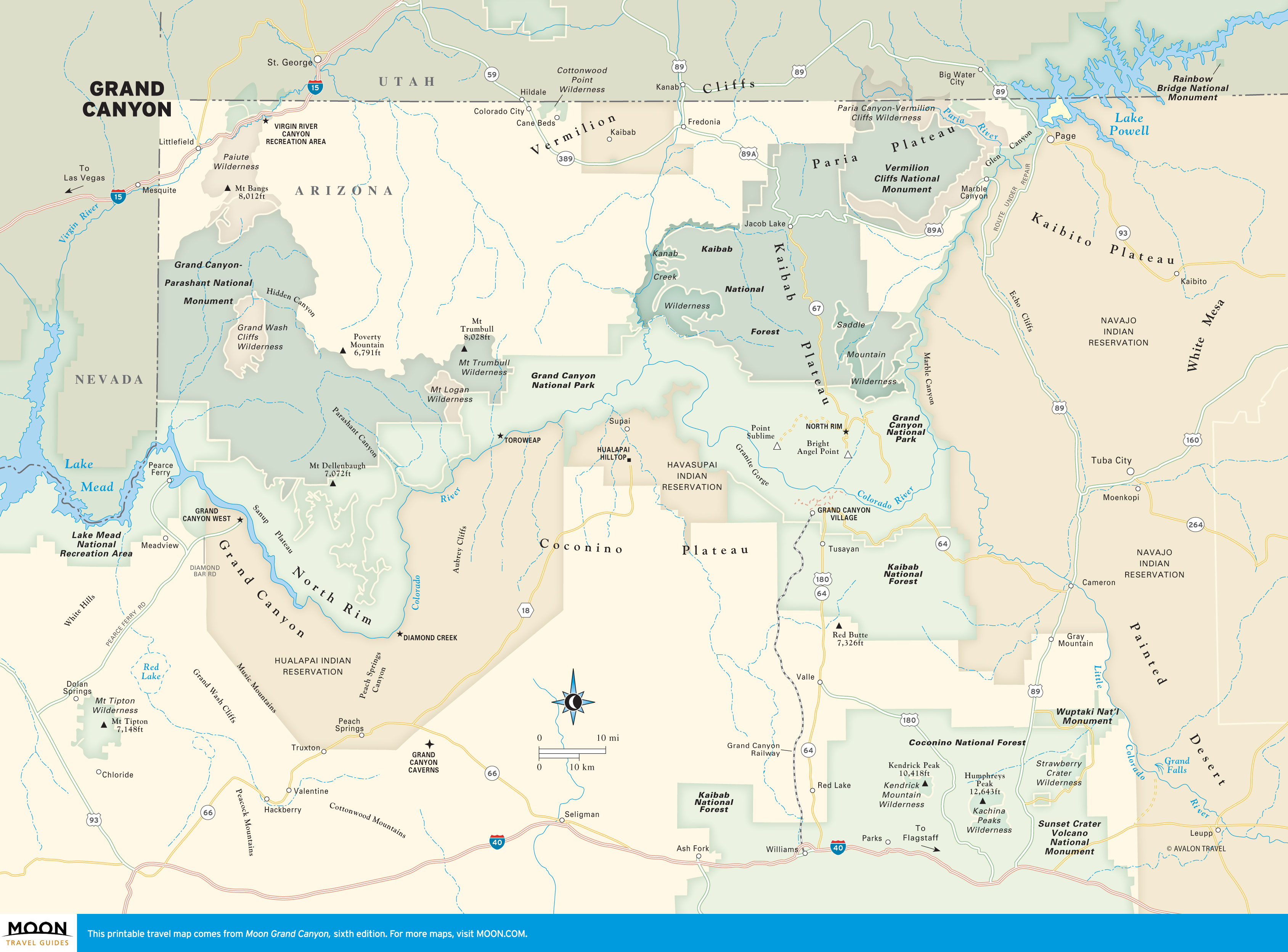
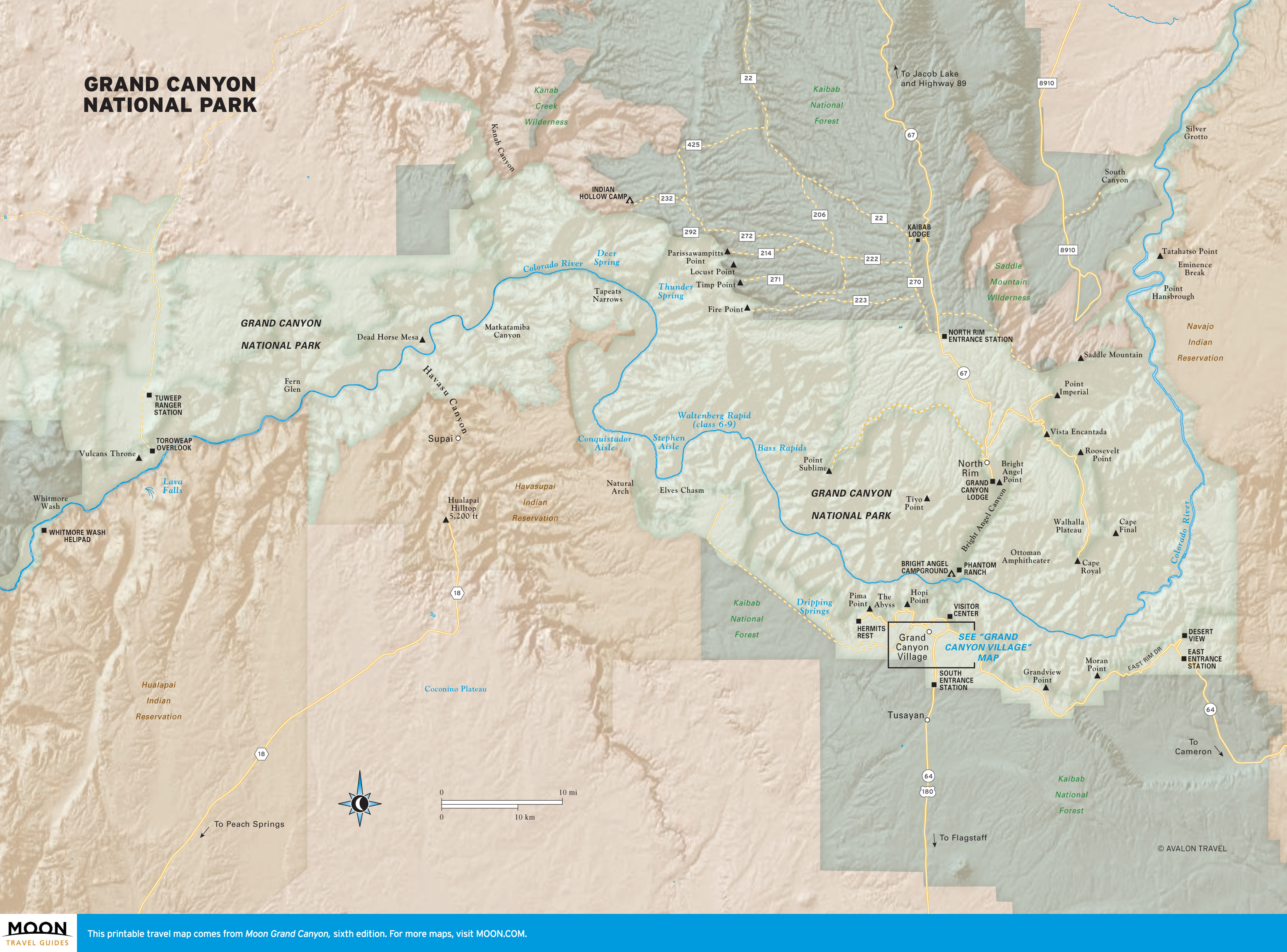
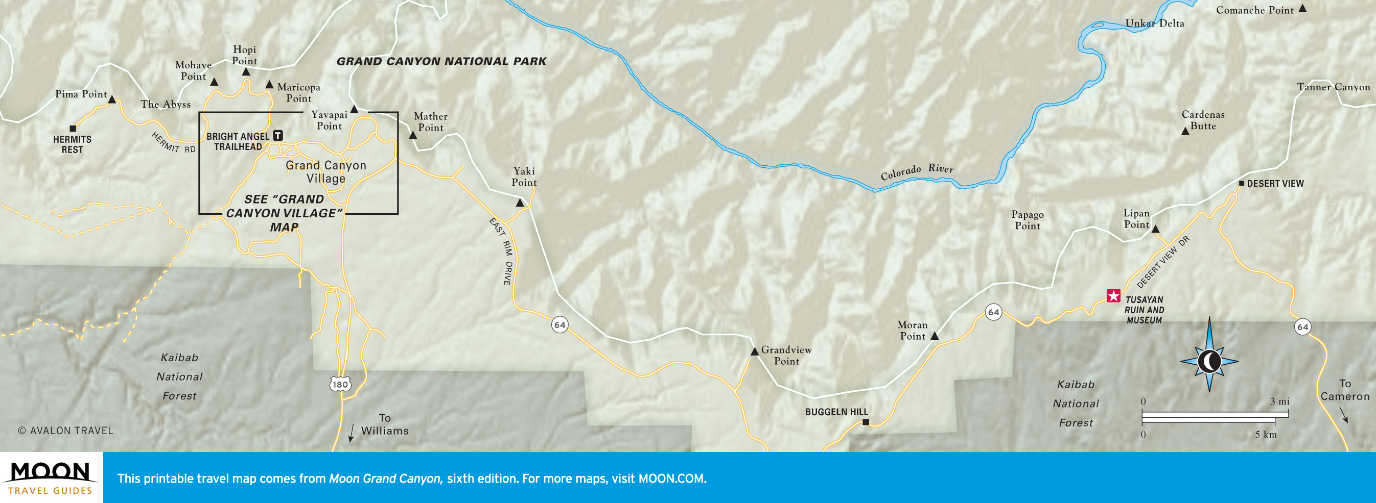
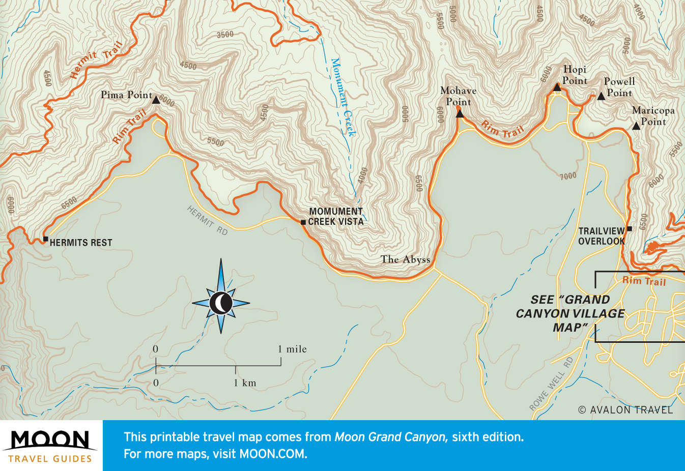
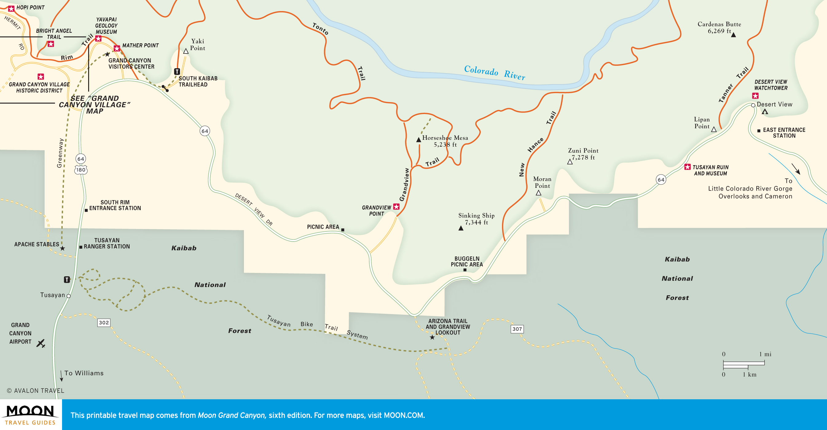
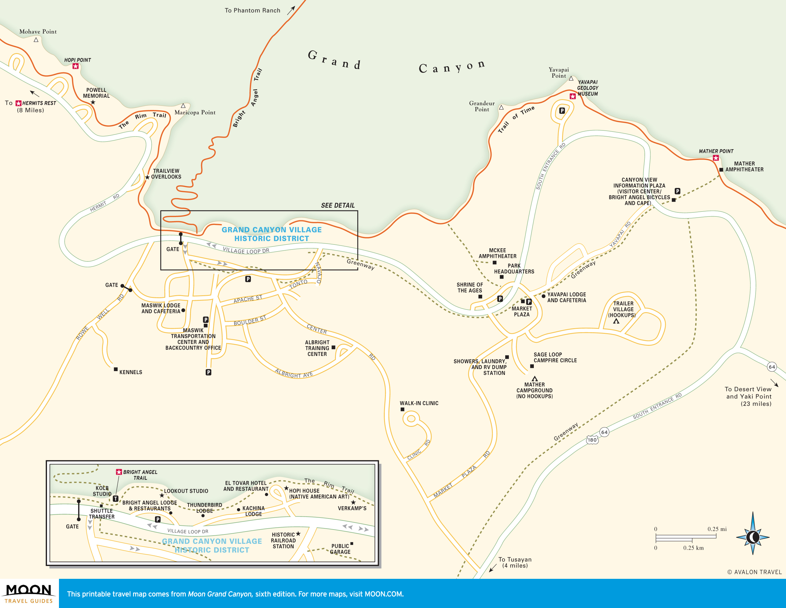
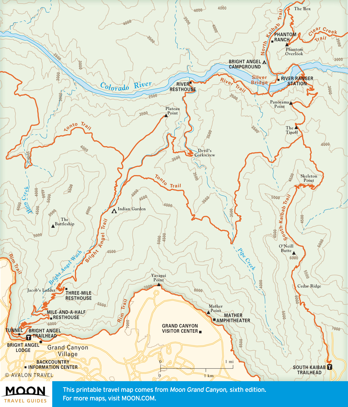
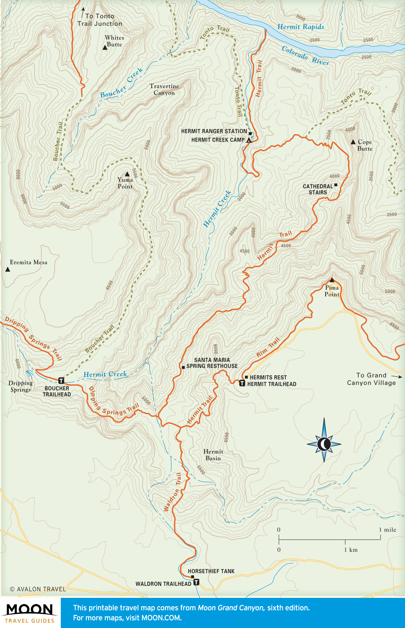
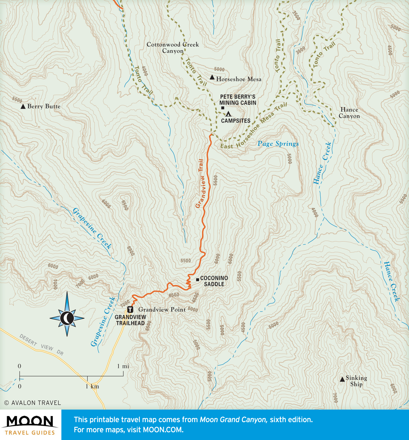
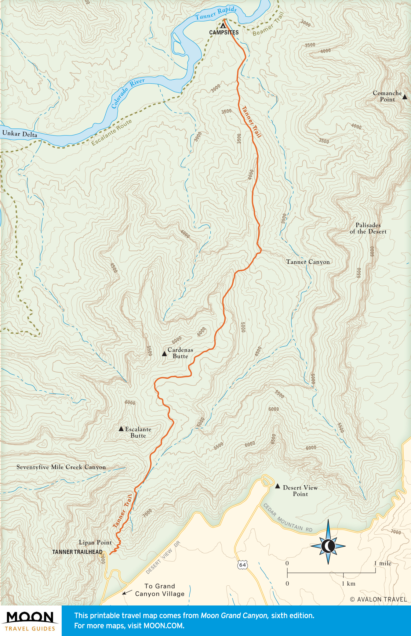
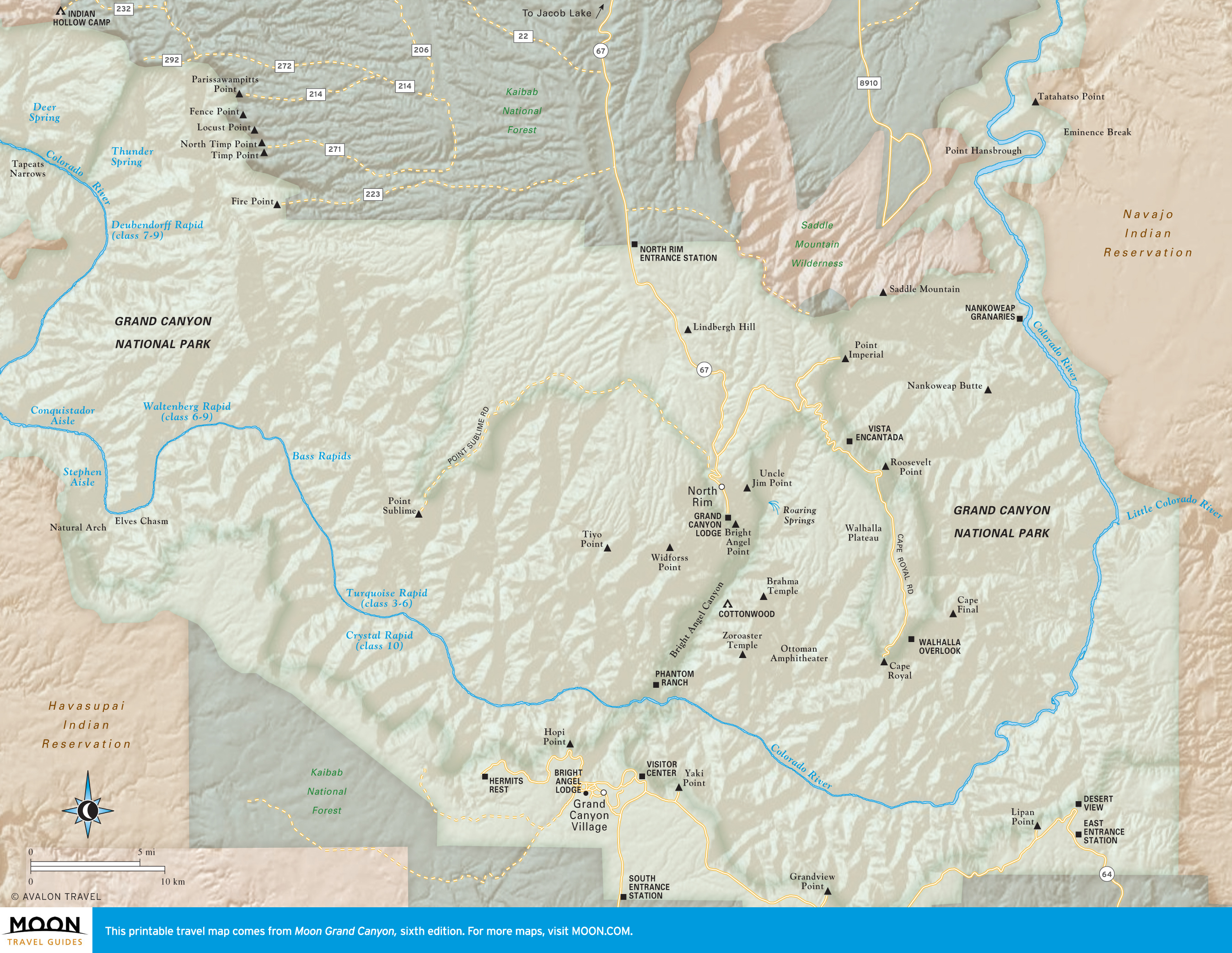
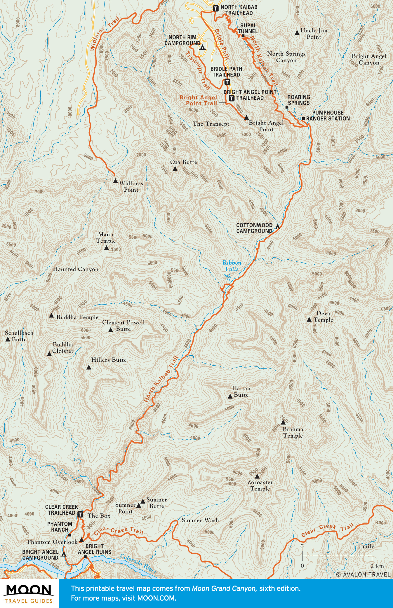
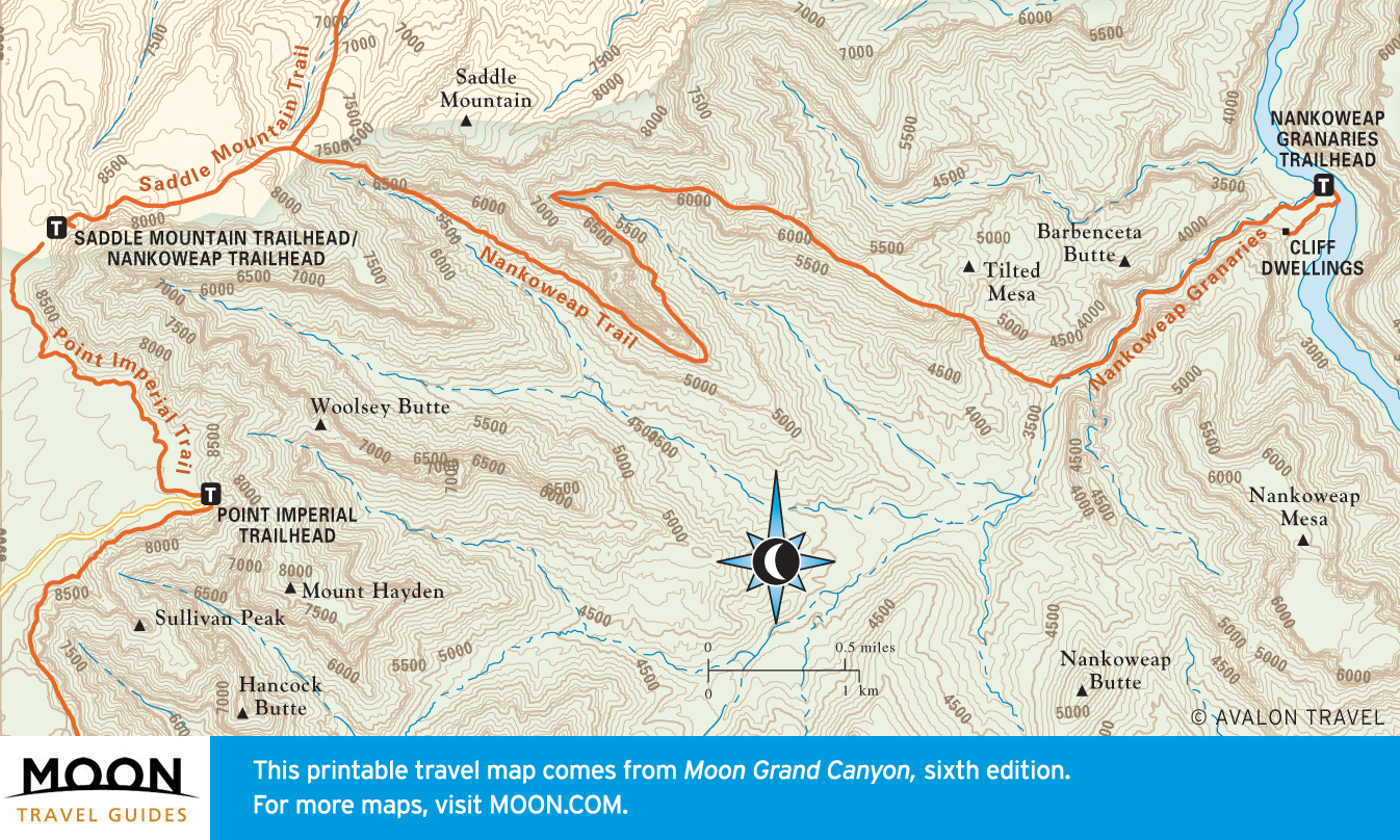
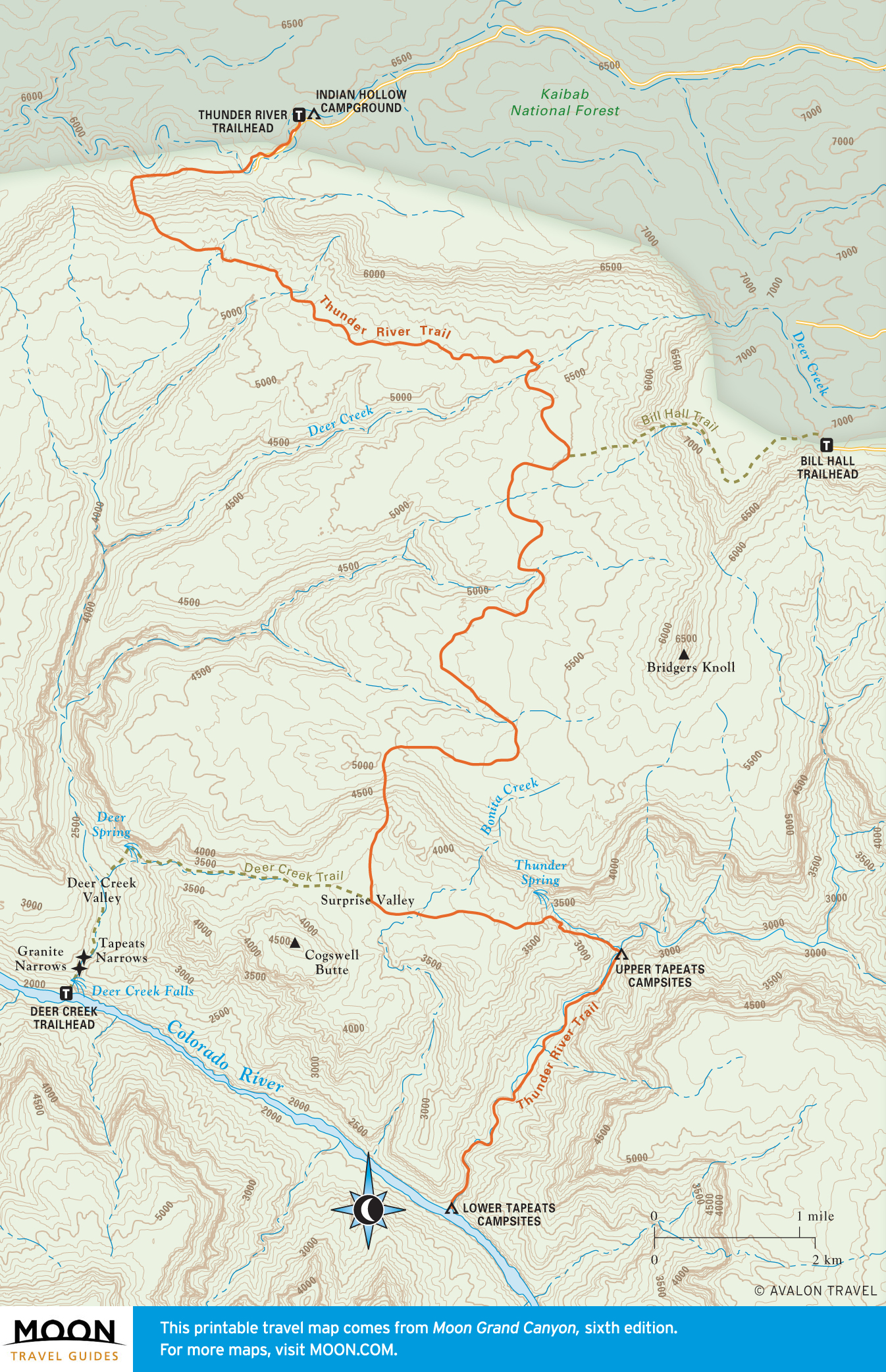
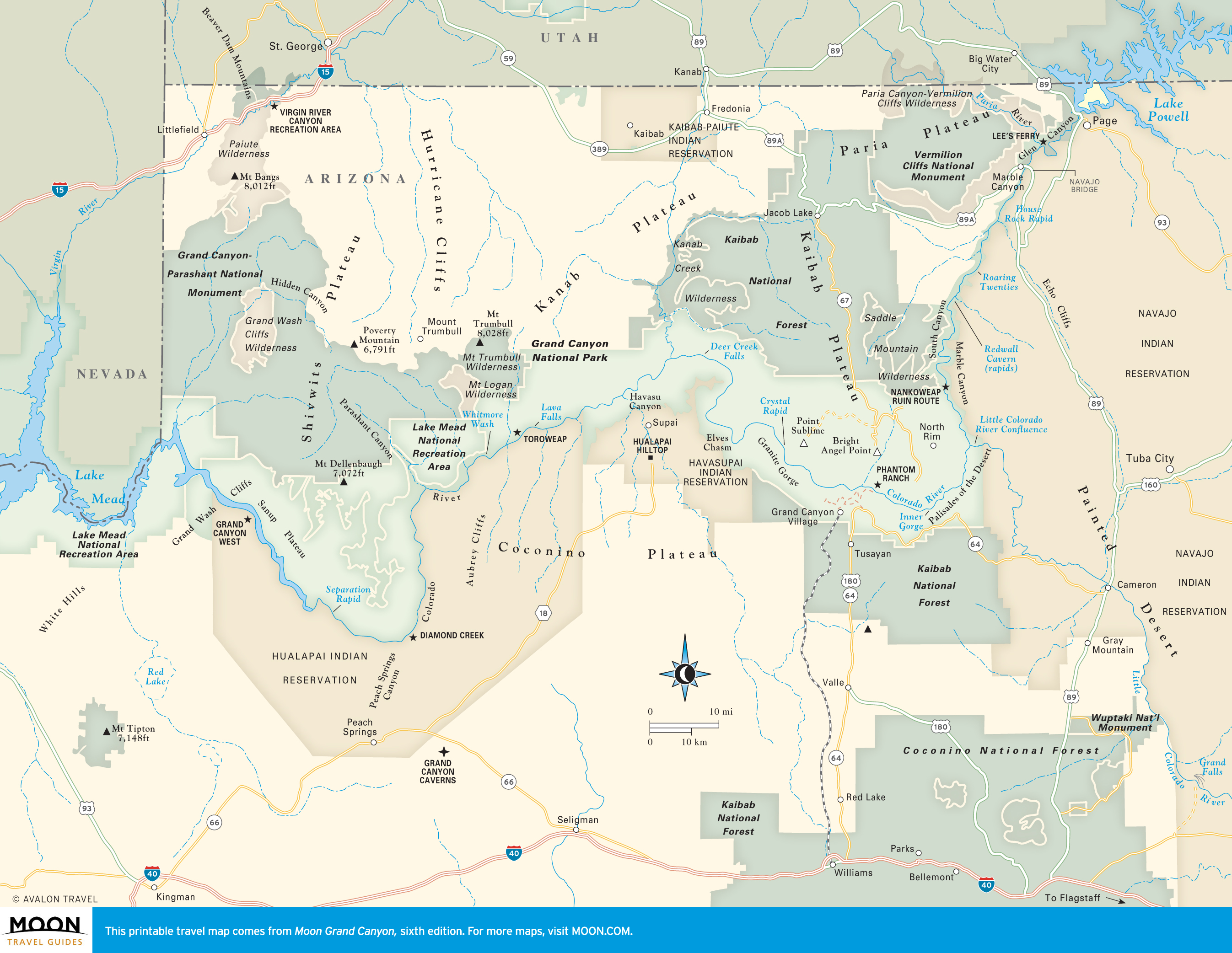
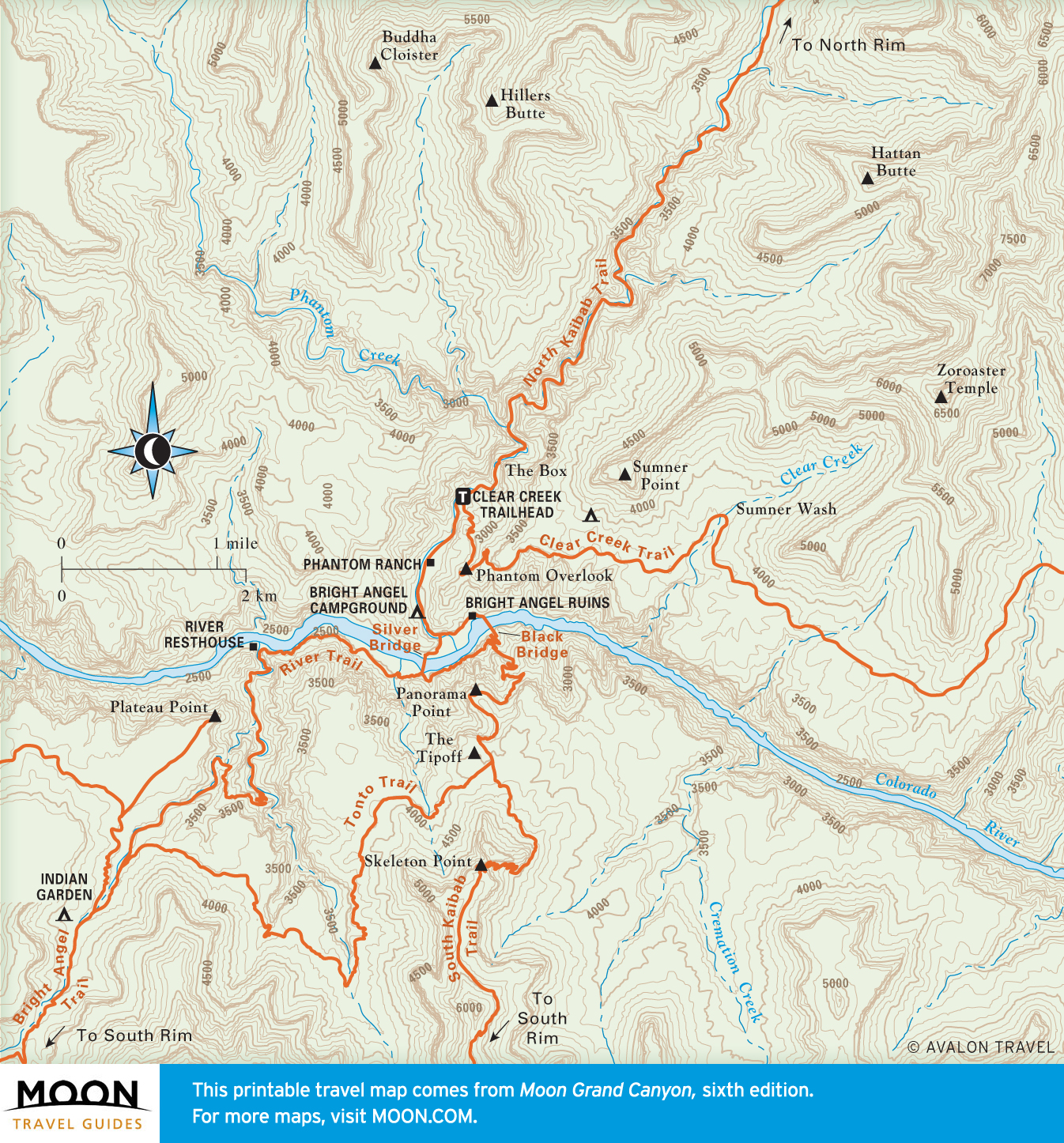
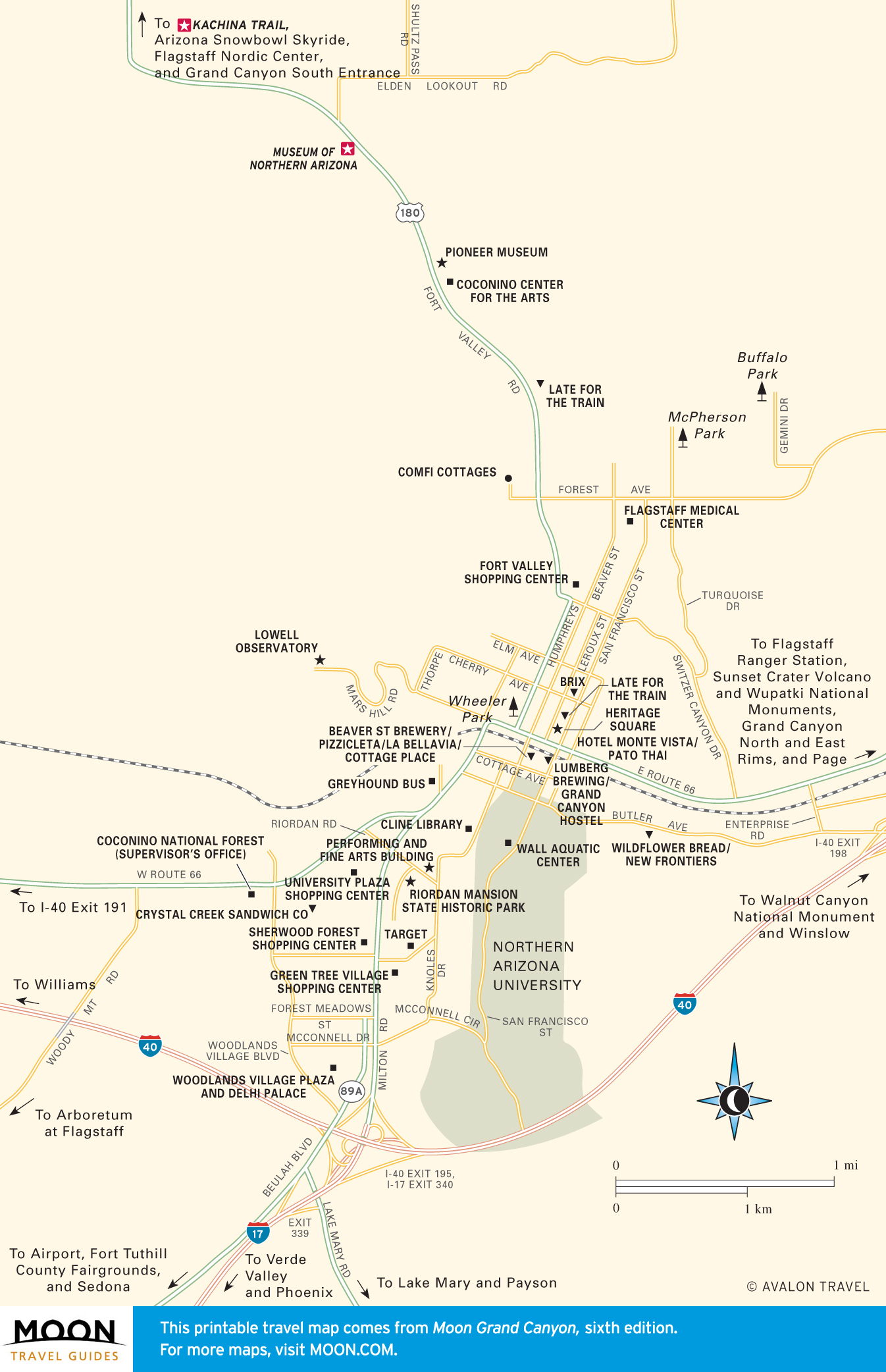
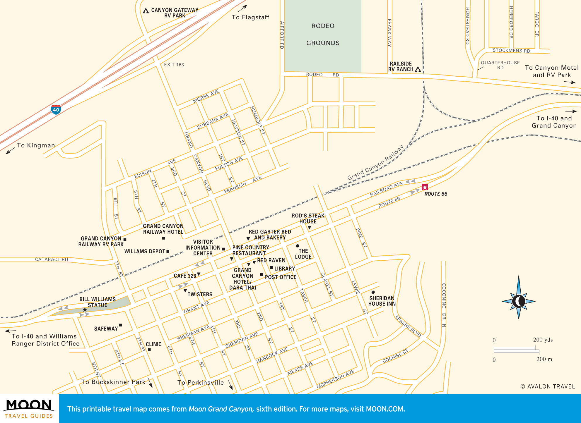
Travel Maps of the Grand Canyon

In 1903, Teddy Roosevelt urged every American to see Grand Canyon. Today, some five million visitors each year do, but the Grand Canyon you experience is yours alone.

Travel map of the Grand Canyon
Grand Canyon Overview
Travel map of Grand Canyon National park
Grand Canyon National Park
Travel map of the South Rim of the Grand Canyon
South Rim
Travel map of West Rim and Hermit Road in the Grand Canyon
West Rim and Hermit Road
Travel map of the East Rim and Desert View Drive in the Grand Canyon
East Rim and Desert View Drive
Travel map of Grand Canyon Village
Grand Canyon Village
Travel map of Bright Angel and South Kaibab Trails in the Grand Canyon
Bright Angel Trail
Travel map of Hermit Trail in the Grand Canyon
Hermit Trail
Travel map of the Grandview Trail in the Grand Canyon
Grandview Trail
Travel map of Tanner Trail in the Grand Canyon
Tanner Trail


Travel map of the North Rim of the Grand Canyon
North Rim
Travel map of Bright Angel Point and Walhalla Plateau in the Grand Canyon
Bright Angel Point
Travel map of Toroweap in the Grand Canyon
Toroweap
Travel map of the North Kaibab Trail in the Grand Canyon
North Kaibab Trail
Travel map of the Nankoweap Trail in the Grand Canyon
Nankoweap Trail
Travel map of the Thunder River Trail in the Grand Canyon
Thunder River Trail
Travel map of The Inner Canyon in the Grand Canyon
The Inner Canyon
Travel map of Phantom Ranch in the Grand Canyon
Phantom Ranch
Travel map of the Nankoweap Granaries in the Grand Canyon
Nankoweap Granaries


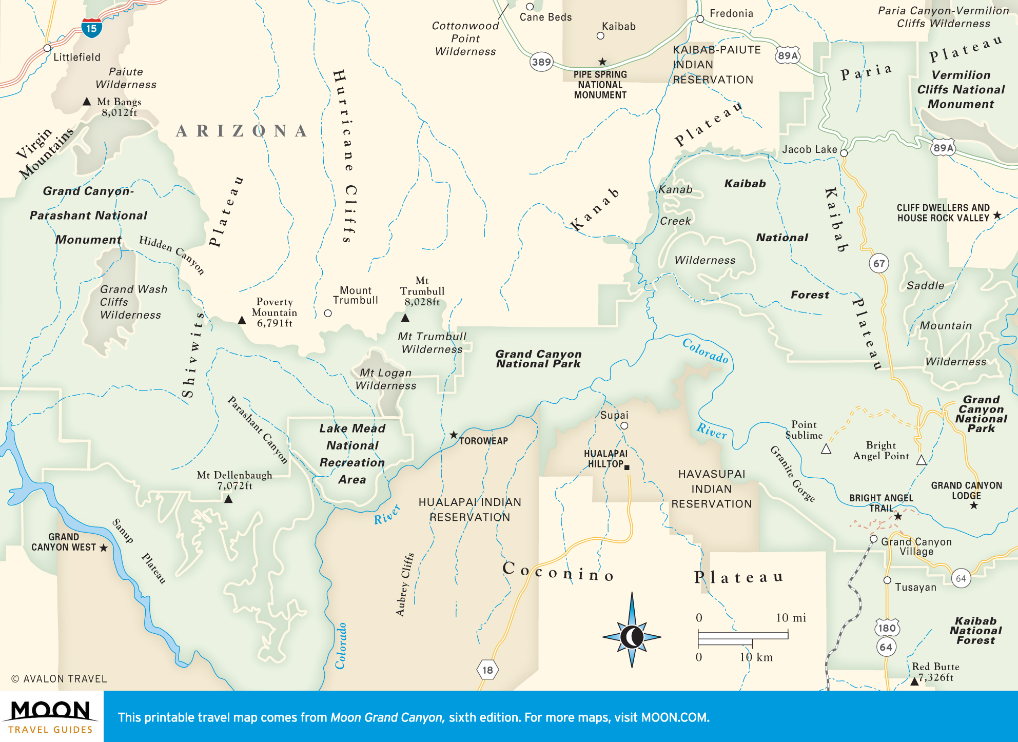
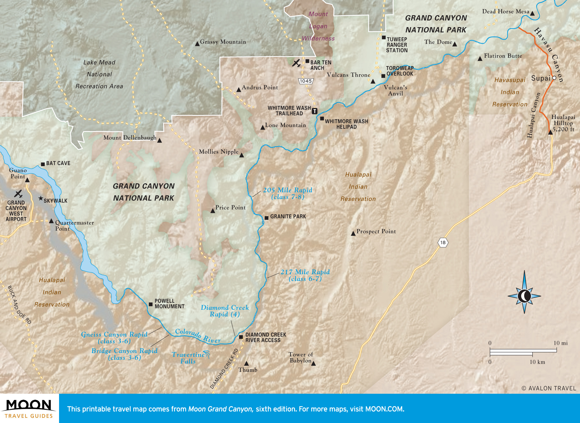
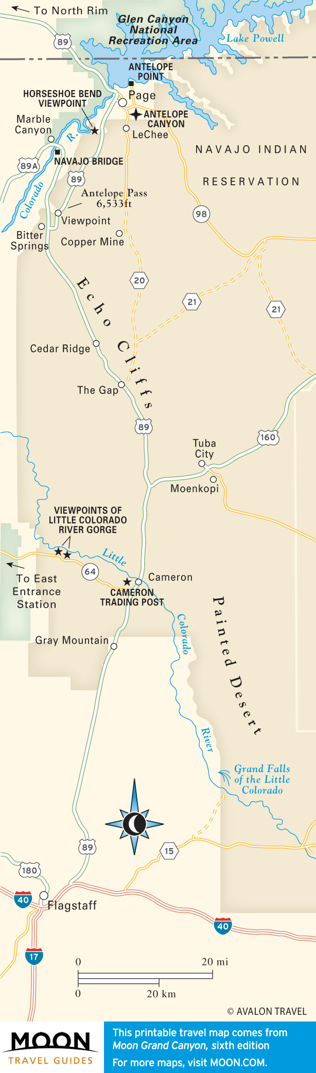
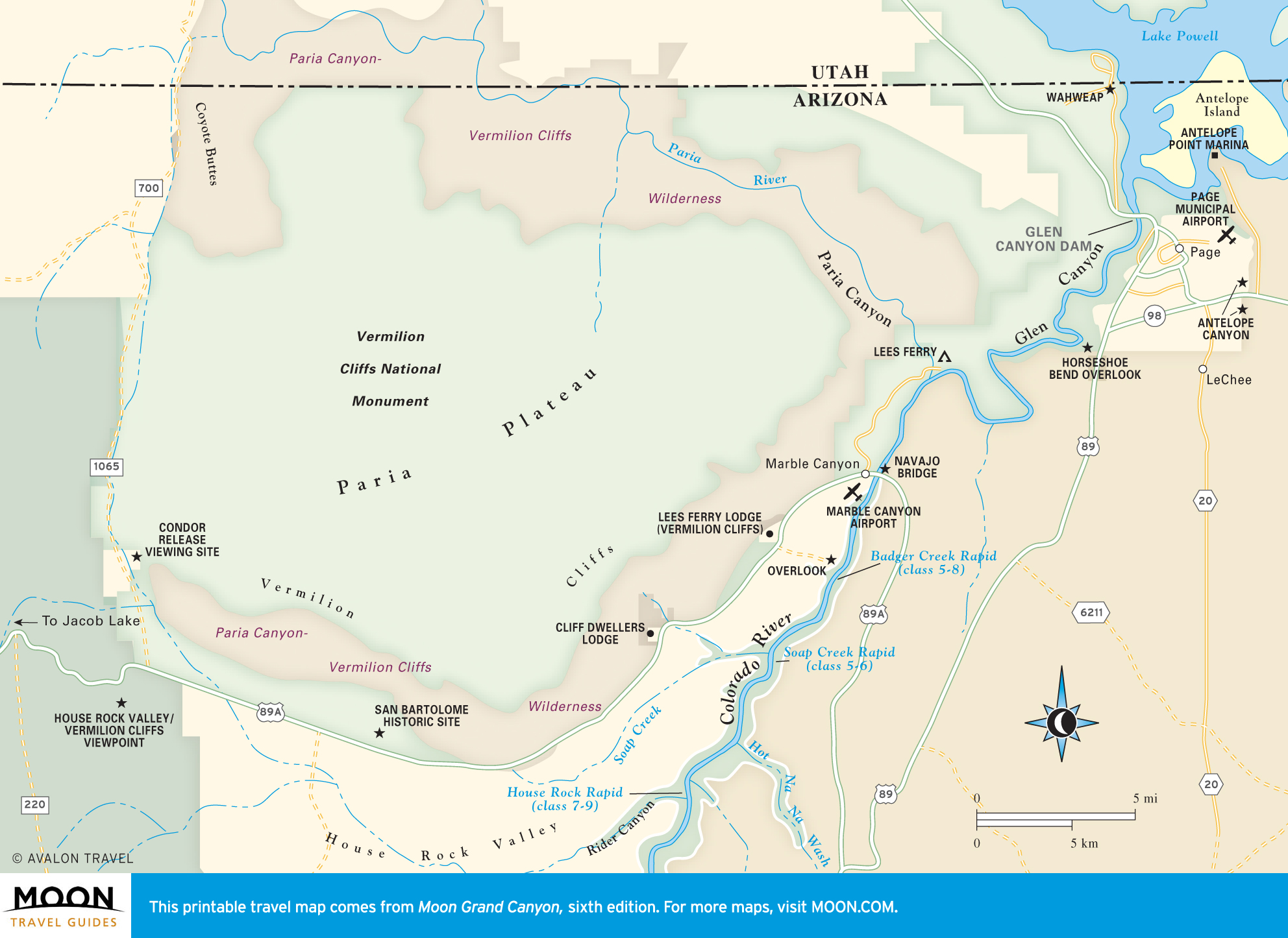
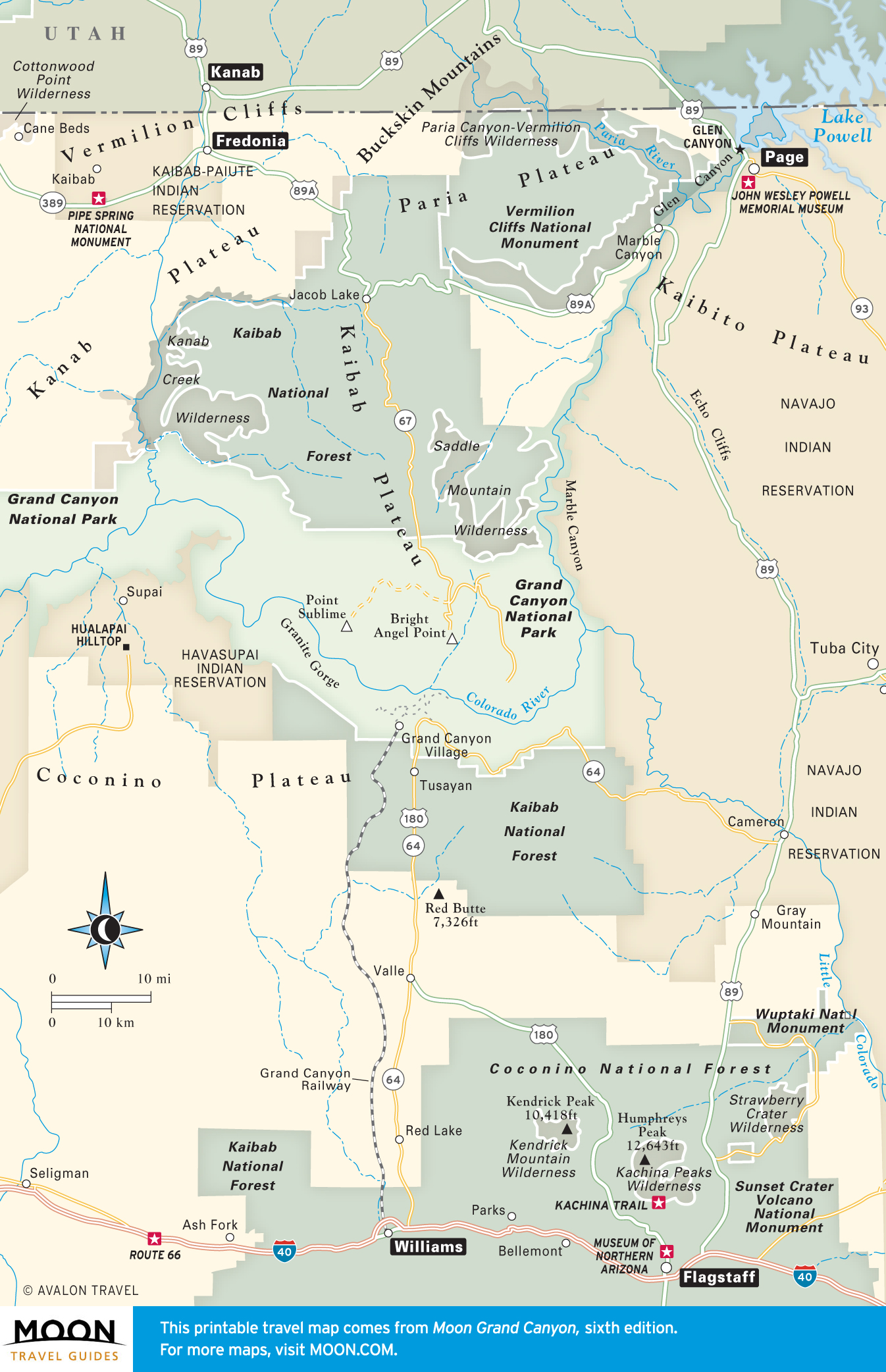
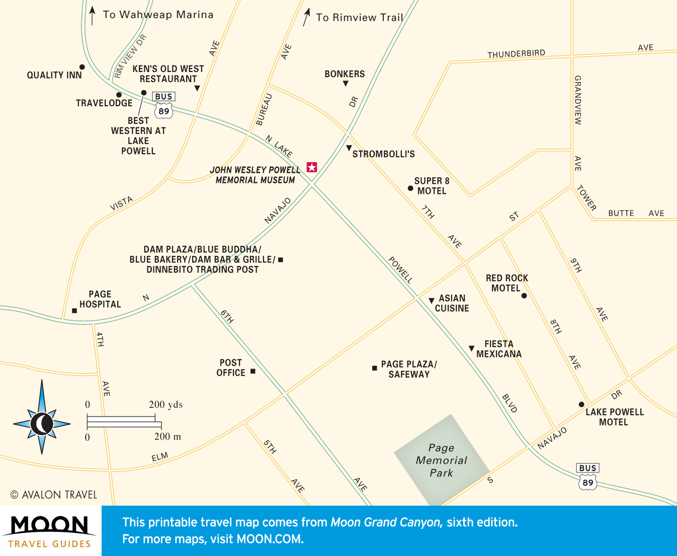
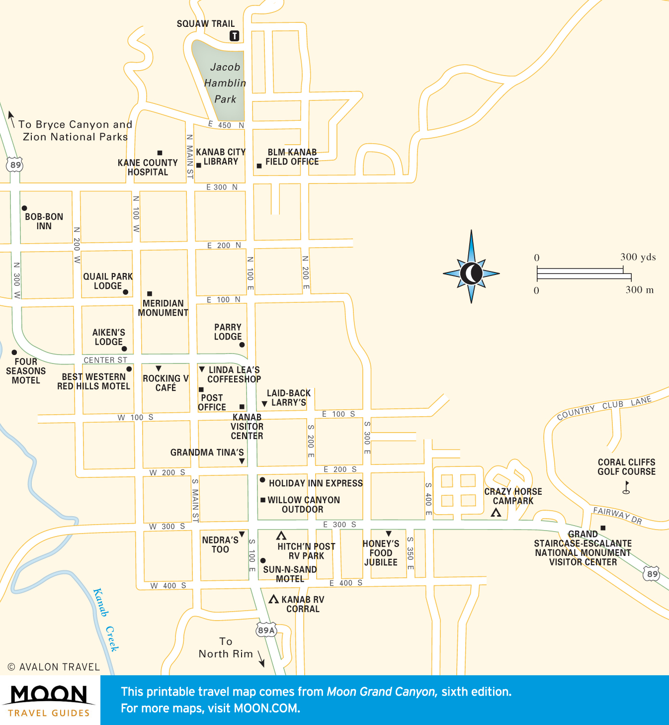
Travel Maps of Beyond the Boundaries of the Grand Canyon

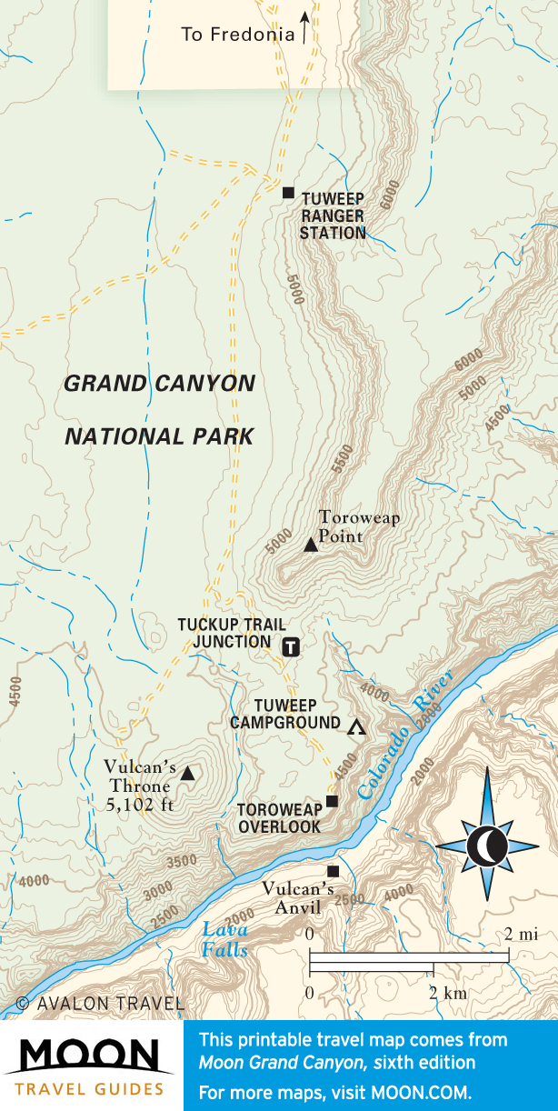
The rims and tributaries of Grand Canyon extend beyond national park boundaries into lands managed by the Forest Service and Bureau of Land Management or held by the Havasupai, Hualapai, and Navajo tribes. The Havasu Canyon, Grand Canyon Skywalk, historic Lees Ferry, and Marble Canyon overlooks all lie beyond the boundaries of the park but share the essence of Grand Canyon.

Travel map of Beyond the Boundaries of the Grand Canyon
Beyond the Boundaries of the Grand Canyon
Travel map of the Havasupai and Hualapai Reservations near the Grand Canyon
Havasupai and Hualapai Reservations
Travel map of Navajo Nation near the Grand Canyon
Navajo Nation
Travel map of Marble Canyon and Lees Ferry near the Grand Canyon
Marble Canyon and Lees Ferry
Travel map of Gateways to the Grand Canyon
Gateways to the Grand Canyon
Travel map of Flagstaff, Arizona
Flagstaff
Travel map of Williams, Arizona
Williams
Travel map of Downtown Page, Arizona
Downtown Page
Travel map of Kanab, Utah
Kanab, Utah


You are welcome to download and print these maps for non-commercial, non-infringing use, or, if you are an educator or student, for use in the classroom. Please take steps to ensure that Avalon Travel’s copyright information remains on any classroom handouts or in any other reasonable Fair Use instance. Copyright may be attributed properly with the statements: “© Avalon Travel” or “Copyright Avalon Travel.” For more information about copyright and usage please see our Copyright Policy.